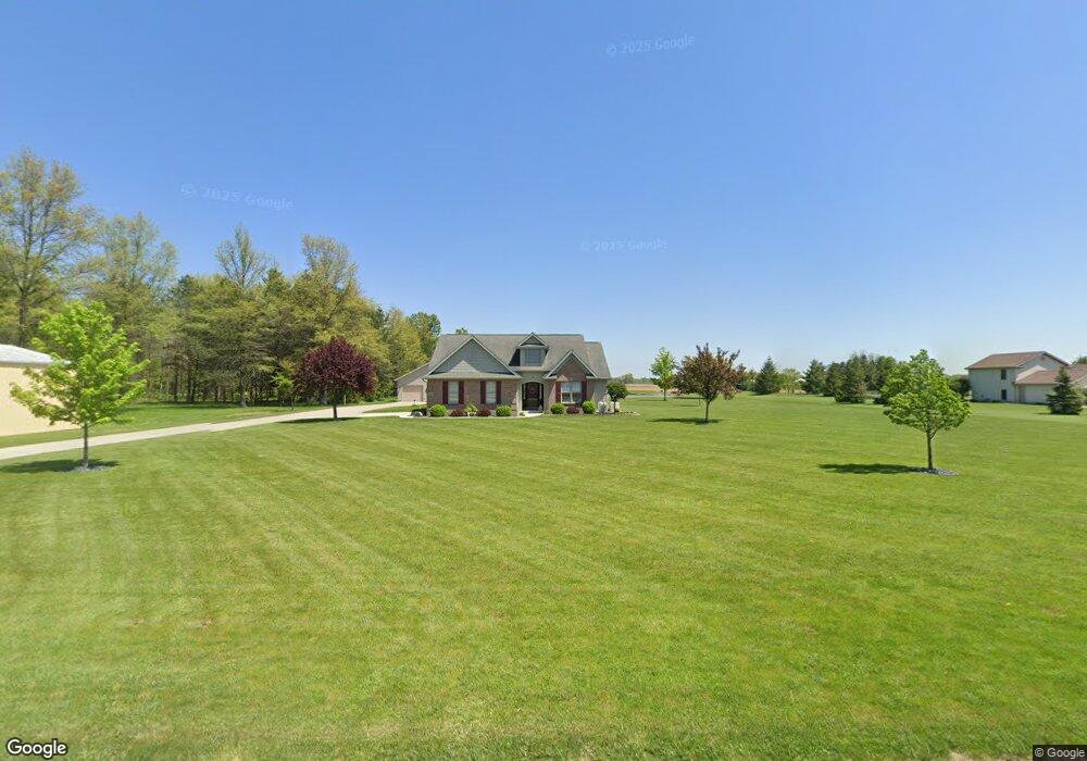
2112 Saint Marys Rd Delphos, OH 45833
Estimated Value: $237,000 - $355,000
3
Beds
2
Baths
1,650
Sq Ft
$191/Sq Ft
Est. Value
About This Home
This home is located at 2112 Saint Marys Rd, Delphos, OH 45833 and is currently estimated at $315,213, approximately $191 per square foot. 2112 Saint Marys Rd is a home located in Allen County with nearby schools including Spencerville Elementary School, Spencerville Middle School, and Spencerville High School.
Ownership History
Date
Name
Owned For
Owner Type
Purchase Details
Closed on
May 25, 2009
Sold by
Goergens Thomas F and Goergens Mary K
Bought by
Goergens Thomas F and Goergens Mary K
Current Estimated Value
Purchase Details
Closed on
Nov 10, 2008
Sold by
Secretary Of Veterans Affairs
Bought by
Goergens Thomas F and Goergens Mary K
Purchase Details
Closed on
Aug 21, 2008
Sold by
Mckinney Michael J and Mckinney Heather L
Bought by
Va
Purchase Details
Closed on
Dec 20, 2005
Sold by
Mckinney Michael J and Mckinney Heather L
Bought by
Bba Builders Inc
Create a Home Valuation Report for This Property
The Home Valuation Report is an in-depth analysis detailing your home's value as well as a comparison with similar homes in the area
Home Values in the Area
Average Home Value in this Area
Purchase History
| Date | Buyer | Sale Price | Title Company |
|---|---|---|---|
| Goergens Thomas F | -- | Tenure Title Agency | |
| Goergens Thomas F | -- | None Available | |
| Va | $130,000 | None Available | |
| Bba Builders Inc | -- | None Available |
Source: Public Records
Tax History Compared to Growth
Tax History
| Year | Tax Paid | Tax Assessment Tax Assessment Total Assessment is a certain percentage of the fair market value that is determined by local assessors to be the total taxable value of land and additions on the property. | Land | Improvement |
|---|---|---|---|---|
| 2024 | $3,057 | $97,830 | $14,910 | $82,920 |
| 2023 | $2,517 | $75,250 | $11,480 | $63,770 |
| 2022 | $2,642 | $75,250 | $11,480 | $63,770 |
| 2021 | $2,644 | $75,250 | $11,480 | $63,770 |
| 2020 | $2,412 | $66,960 | $11,170 | $55,790 |
| 2019 | $2,412 | $66,960 | $11,170 | $55,790 |
| 2018 | $2,453 | $66,960 | $11,170 | $55,790 |
| 2017 | $2,223 | $61,890 | $11,170 | $50,720 |
| 2016 | $2,190 | $61,890 | $11,170 | $50,720 |
| 2015 | $2,195 | $61,890 | $11,170 | $50,720 |
| 2014 | $2,195 | $62,480 | $11,060 | $51,420 |
| 2013 | $2,216 | $62,480 | $11,060 | $51,420 |
Source: Public Records
Map
Nearby Homes
- 14101 Allentown Rd
- 714 Briggs Ave Unit 1
- 620 N Broadway St
- 4455 N Kill Rd
- 425 N Main St
- 408 N Mulberry St
- 21302 Masters Rd
- 213 N Pearl St
- 316 E 4th St
- 417 W 4th St
- 601 Sunset Ave
- 421 W 4th St
- 433 W 4th St
- 115 Oakland Ave
- 123 Oakland Ave
- 1400 S Clay St Unit 17
- 420 S Canal St
- 510 S Broadway St
- 521 S Broadway St
- 827 S Washington St
- 2112 N Street Marys Rd
- 2074 Saint Marys Rd
- 2112 State Route
- 12082 Zion Church Rd
- 12750 Zion Church Rd
- 12265 Zion Church Rd
- 2222 Saint Marys Rd
- 2222 St Mary's Rd
- 2140 Saint Marys Rd
- 2140 N Street Marys Rd
- 11940 Zion Church Rd
- 2289 Saint Marys Rd
- 2324 Saint Marys Rd
- 2324 N Street Marys Rd
- 2373 Saint Marys Rd
- 2375 Saint Marys Rd
- 12250 Zion Church Rd
- 12260 Zion Church Rd