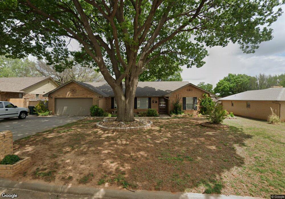
2112 Twin Dr Duncan, OK 73533
Estimated Value: $228,294 - $246,000
3
Beds
2
Baths
2,008
Sq Ft
$118/Sq Ft
Est. Value
About This Home
This home is located at 2112 Twin Dr, Duncan, OK 73533 and is currently estimated at $236,324, approximately $117 per square foot. 2112 Twin Dr is a home located in Stephens County with nearby schools including Plato Elementary School, Duncan Middle School, and Duncan High School.
Ownership History
Date
Name
Owned For
Owner Type
Purchase Details
Closed on
Oct 24, 2008
Sold by
Sanders Shannon D and Sanders Kara Suzanne
Bought by
Mercer Danny and Mercer Sheila
Current Estimated Value
Purchase Details
Closed on
Aug 18, 2005
Sold by
Schlein Terry L and Schlein Gina K
Bought by
Sanders Shannon D and Sanders Kara Suzanne
Home Financials for this Owner
Home Financials are based on the most recent Mortgage that was taken out on this home.
Original Mortgage
$99,000
Interest Rate
5.65%
Mortgage Type
New Conventional
Create a Home Valuation Report for This Property
The Home Valuation Report is an in-depth analysis detailing your home's value as well as a comparison with similar homes in the area
Home Values in the Area
Average Home Value in this Area
Purchase History
| Date | Buyer | Sale Price | Title Company |
|---|---|---|---|
| Mercer Danny | $134,500 | None Available | |
| Sanders Shannon D | $99,000 | None Available |
Source: Public Records
Mortgage History
| Date | Status | Borrower | Loan Amount |
|---|---|---|---|
| Previous Owner | Sanders Shannon D | $99,000 |
Source: Public Records
Tax History Compared to Growth
Tax History
| Year | Tax Paid | Tax Assessment Tax Assessment Total Assessment is a certain percentage of the fair market value that is determined by local assessors to be the total taxable value of land and additions on the property. | Land | Improvement |
|---|---|---|---|---|
| 2025 | $1,509 | $18,881 | $1,238 | $17,643 |
| 2024 | $1,476 | $18,331 | $1,238 | $17,093 |
| 2023 | $1,476 | $18,331 | $1,238 | $17,093 |
| 2022 | $1,384 | $17,797 | $1,238 | $16,559 |
| 2021 | $1,386 | $17,279 | $1,238 | $16,041 |
| 2020 | $1,320 | $16,287 | $1,238 | $15,049 |
| 2019 | $1,281 | $15,813 | $1,238 | $14,575 |
| 2018 | $1,278 | $15,353 | $1,238 | $14,115 |
| 2017 | $1,234 | $15,449 | $1,238 | $14,211 |
| 2016 | $1,183 | $14,912 | $1,238 | $13,674 |
| 2015 | $1,124 | $14,477 | $1,238 | $13,239 |
| 2014 | $1,124 | $14,056 | $1,238 | $12,818 |
Source: Public Records
Map
Nearby Homes
- 2201 W Club Rd
- 2110 W Club Rd
- 1706 Windsor Dr
- 1108 W Plato Rd Unit 29
- 1108 W Plato Rd Unit 1
- 2106 Carolin Dr
- 1108 1108 W Plato Unit 40
- 1108 1108 W Plato Unit 17
- 1601 1601 Pearl
- 1527 1527 N 13th
- 1927 High Meadow Dr
- 2518 Wildwood Place
- 0 Townsend St
- 2021 Overland Dr
- 1404 1404 Ne Aspen
- 1014 Oakview Dr
- 28 Canterbury Ln
- 1705 Foxboro Dr
- 2702 2702 Wildwood Place
- 30 Canterbury Ln