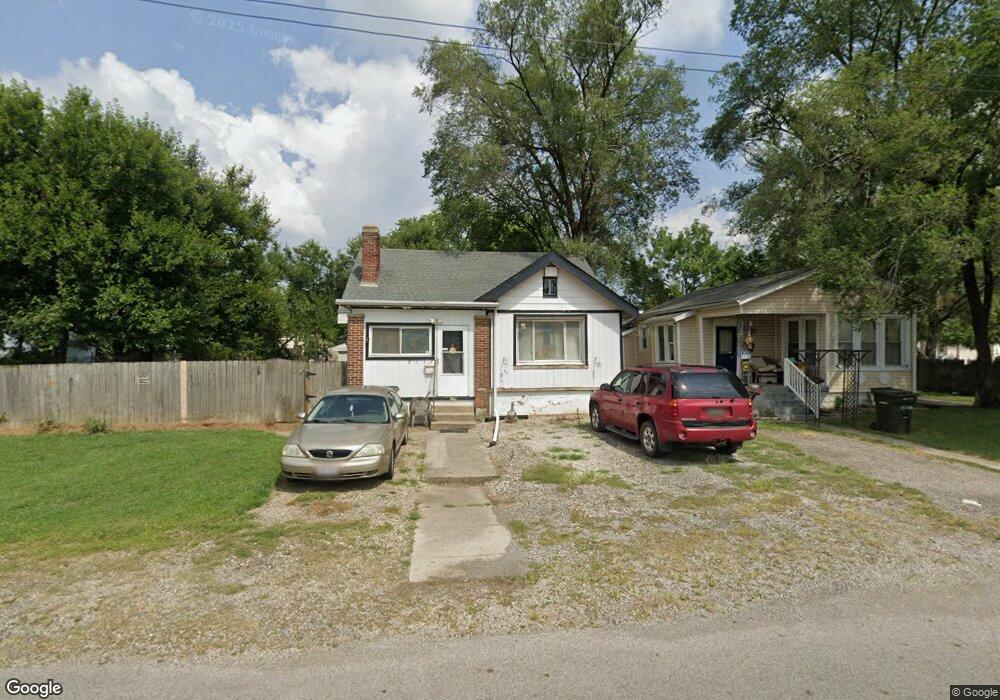
2112 Union Ave Columbus, OH 43223
South Hilltop NeighborhoodEstimated Value: $153,891 - $178,000
4
Beds
1
Bath
1,170
Sq Ft
$142/Sq Ft
Est. Value
About This Home
This home is located at 2112 Union Ave, Columbus, OH 43223 and is currently estimated at $166,473, approximately $142 per square foot. 2112 Union Ave is a home located in Franklin County with nearby schools including West Mound Elementary School, Hilltonia Middle School, and Briggs High School.
Ownership History
Date
Name
Owned For
Owner Type
Purchase Details
Closed on
May 8, 1997
Sold by
Corbin Rodger E and Corbin Roger
Bought by
Horvath James J and Fuller Debborah L
Current Estimated Value
Home Financials for this Owner
Home Financials are based on the most recent Mortgage that was taken out on this home.
Original Mortgage
$44,427
Outstanding Balance
$5,006
Interest Rate
8.17%
Mortgage Type
FHA
Estimated Equity
$161,467
Purchase Details
Closed on
Sep 23, 1996
Sold by
Logan Cathy and Logan Rita Kathleen
Bought by
Corbin Rodger E and Corbin Roger
Purchase Details
Closed on
Feb 25, 1992
Create a Home Valuation Report for This Property
The Home Valuation Report is an in-depth analysis detailing your home's value as well as a comparison with similar homes in the area
Home Values in the Area
Average Home Value in this Area
Purchase History
| Date | Buyer | Sale Price | Title Company |
|---|---|---|---|
| Horvath James J | $44,000 | Title First Agency Inc | |
| Corbin Rodger E | -- | Title First Agency Inc | |
| -- | -- | -- |
Source: Public Records
Mortgage History
| Date | Status | Borrower | Loan Amount |
|---|---|---|---|
| Open | Horvath James J | $44,427 |
Source: Public Records
Tax History
| Year | Tax Paid | Tax Assessment Tax Assessment Total Assessment is a certain percentage of the fair market value that is determined by local assessors to be the total taxable value of land and additions on the property. | Land | Improvement |
|---|---|---|---|---|
| 2025 | $1,775 | $39,550 | $7,490 | $32,060 |
| 2024 | $1,775 | $39,550 | $7,490 | $32,060 |
| 2023 | $1,752 | $39,550 | $7,490 | $32,060 |
| 2022 | $873 | $16,840 | $3,050 | $13,790 |
| 2021 | $875 | $16,840 | $3,050 | $13,790 |
| 2020 | $876 | $16,840 | $3,050 | $13,790 |
| 2019 | $841 | $13,860 | $2,520 | $11,340 |
| 2018 | $704 | $13,860 | $2,520 | $11,340 |
| 2017 | $310 | $13,860 | $2,520 | $11,340 |
| 2016 | $626 | $18,200 | $7,840 | $10,360 |
| 2015 | $568 | $18,200 | $7,840 | $10,360 |
| 2014 | $570 | $18,200 | $7,840 | $10,360 |
| 2013 | $376 | $21,385 | $9,205 | $12,180 |
Source: Public Records
Map
Nearby Homes
- 485 Belvidere Ave
- 530 Whitethorne Ave
- 510 Belvidere Ave
- 2023 Sullivant Ave Unit 2025
- 561 Belvidere Ave
- 2009 Sullivant Ave Unit 9
- 2188 Amherst Ave
- 329-331 Whitethorne Ave
- 611 Whitethorne Ave
- 479 Nashoba Ave
- 1953 Sullivant Ave
- 545-547 S Highland Ave Unit 545
- 265-267 Belvidere Ave
- 624 Wrexham Ave
- 1921 Sullivant Ave
- 538 S Wheatland Ave
- 2247 Safford Ave
- 249 Midland Ave
- 1543 Safford Ave
- 302 S Highland Ave Unit 306
- 2106 Union Ave
- 2122 Union Ave
- 0 Union St
- 451 Belvidere Ave
- 2115 Sullivant Ave
- 2119 Sullivant Ave Unit 119
- 478 Whitethorne Ave
- 467 Belvidere Ave
- 2119 Union Ave
- 470 Whitethorne Ave
- 474 Whitethorne Ave
- 2125 Sullivant Ave
- 464 Whitethorne Ave
- 2105 Sullivant Ave
- 2129 Sullivant Ave
- 2101 Sullivant Ave
- 477 Belvidere Ave
- 492 Butler Ave
- 2095 Sullivant Ave
- 495 Butler Ave
Your Personal Tour Guide
Ask me questions while you tour the home.