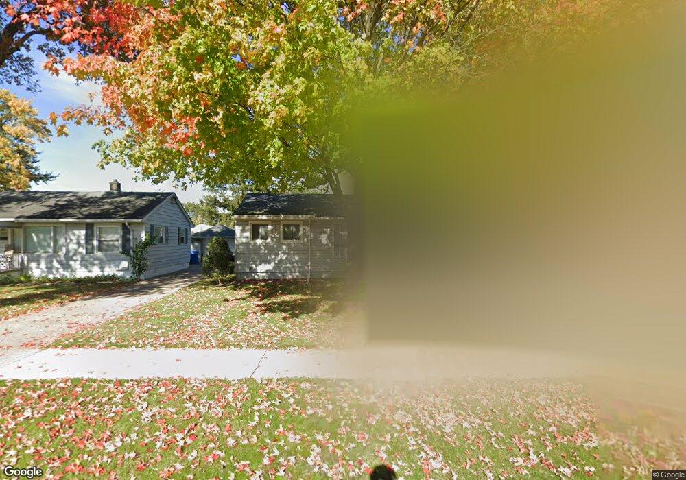
21120 Powers Ave Dearborn Heights, MI 48125
Estimated Value: $159,000 - $167,000
--
Bed
1
Bath
986
Sq Ft
$165/Sq Ft
Est. Value
About This Home
This home is located at 21120 Powers Ave, Dearborn Heights, MI 48125 and is currently estimated at $162,661, approximately $164 per square foot. 21120 Powers Ave is a home located in Wayne County with nearby schools including Polk Elementary School, Bedford School, and Pardee School.
Ownership History
Date
Name
Owned For
Owner Type
Purchase Details
Closed on
Jan 24, 2008
Sold by
Mason Barbara and Fields Sheri A
Bought by
Fields Sheri A
Current Estimated Value
Home Financials for this Owner
Home Financials are based on the most recent Mortgage that was taken out on this home.
Original Mortgage
$128,620
Outstanding Balance
$81,357
Interest Rate
6.2%
Mortgage Type
Stand Alone Refi Refinance Of Original Loan
Estimated Equity
$81,304
Purchase Details
Closed on
Apr 3, 2007
Sold by
Mason Barbara
Bought by
Mason Barbara
Purchase Details
Closed on
Jul 8, 2005
Sold by
Kizer Yolanda and Kizer Robert B
Bought by
Mason Barbara
Create a Home Valuation Report for This Property
The Home Valuation Report is an in-depth analysis detailing your home's value as well as a comparison with similar homes in the area
Home Values in the Area
Average Home Value in this Area
Purchase History
| Date | Buyer | Sale Price | Title Company |
|---|---|---|---|
| Fields Sheri A | -- | Embassy Title Agency | |
| Mason Barbara | -- | Embassy Title Agency | |
| Mason Barbara | -- | Michigan Title Insurance Age | |
| Mason Barbara | $119,000 | Multiple |
Source: Public Records
Mortgage History
| Date | Status | Borrower | Loan Amount |
|---|---|---|---|
| Open | Fields Sheri A | $128,620 |
Source: Public Records
Tax History Compared to Growth
Tax History
| Year | Tax Paid | Tax Assessment Tax Assessment Total Assessment is a certain percentage of the fair market value that is determined by local assessors to be the total taxable value of land and additions on the property. | Land | Improvement |
|---|---|---|---|---|
| 2025 | $1,286 | $74,800 | $0 | $0 |
| 2024 | $1,286 | $66,800 | $0 | $0 |
| 2023 | $1,215 | $58,800 | $0 | $0 |
| 2022 | $1,686 | $50,700 | $0 | $0 |
| 2021 | $1,687 | $43,800 | $0 | $0 |
| 2019 | $1,639 | $37,300 | $0 | $0 |
| 2018 | $1,101 | $31,200 | $0 | $0 |
| 2017 | $991 | $30,300 | $0 | $0 |
| 2016 | $1,560 | $29,600 | $0 | $0 |
| 2015 | $2,790 | $27,900 | $0 | $0 |
| 2013 | $2,860 | $29,800 | $0 | $0 |
| 2010 | -- | $38,000 | $0 | $0 |
Source: Public Records
Map
Nearby Homes
- 21302 Powers Ave
- 4913 Campbell St
- 21334 Powers Ave
- 21543 Powers Ave
- 4644 Gertrude St
- 5381 Merrick St
- 5373 Katherine St
- 5621 Merrick St
- Vacant Clippert St
- 5648 Hipp St
- 5660 Hipp St
- 4620 Katherine St
- 4507 Katherine St
- 5873 Merrick St
- 20425 Powers Ave
- 4401 Katherine St
- 4455 Hipp St
- 4420 Katherine St
- 5455 Mayfair St
- 6056 Clippert St
- 21112 Powers Ave
- 21128 Powers Ave
- 21140 Powers Ave
- 5132 Gertrude St
- 5009 Campbell St
- 5001 Campbell St
- 21129 Powers Ave
- 21121 Powers Ave
- 21139 Powers Ave
- 21113 Powers Ave
- 4993 Campbell St
- 21145 Powers Ave
- 21101 Powers Ave
- 5108 Gertrude St
- 4985 Campbell St
- 5145 Gertrude St
- 21201 Powers Ave
- 21040 Powers Ave
- 5330 Gertrude St
- 5133 Gertrude St