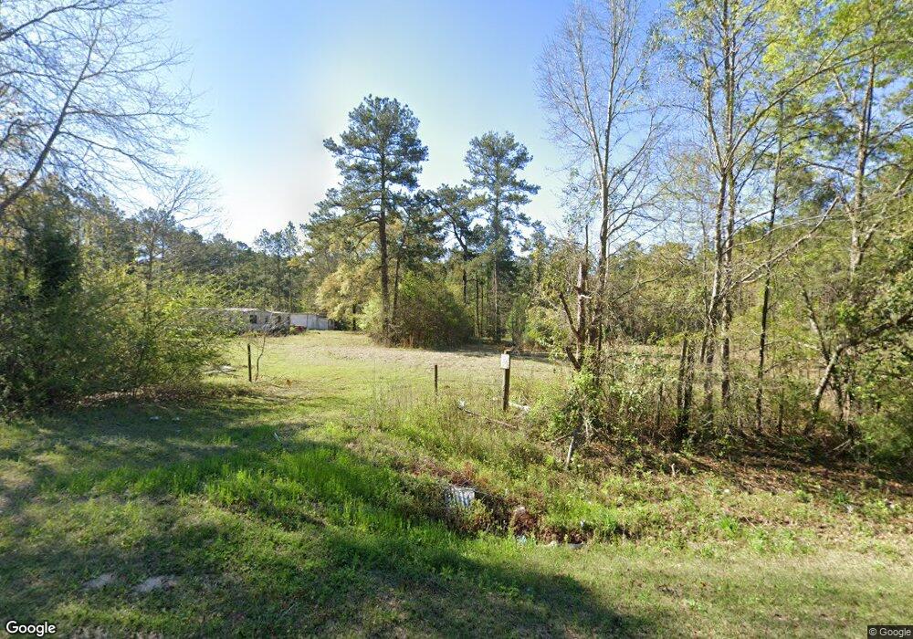
Estimated Value: $121,787 - $185,000
--
Bed
1
Bath
959
Sq Ft
$155/Sq Ft
Est. Value
About This Home
This home is located at 2113 Collins Rd, Cairo, GA 39828 and is currently estimated at $148,447, approximately $154 per square foot. 2113 Collins Rd is a home located in Grady County with nearby schools including Cairo High School.
Ownership History
Date
Name
Owned For
Owner Type
Purchase Details
Closed on
Sep 15, 2008
Bought by
Beckett Sharon
Current Estimated Value
Purchase Details
Closed on
May 8, 2008
Sold by
Vaughn Evelyn
Bought by
Beckett Sharon
Purchase Details
Closed on
Nov 17, 2005
Sold by
Addsion John L
Bought by
Vaughan Willis and Vaughan Evelyn
Home Financials for this Owner
Home Financials are based on the most recent Mortgage that was taken out on this home.
Original Mortgage
$63,000
Interest Rate
6.04%
Mortgage Type
New Conventional
Purchase Details
Closed on
Sep 30, 1997
Sold by
Norton Clayton L
Bought by
Addison John L
Purchase Details
Closed on
Sep 9, 1989
Sold by
Scarbrough James
Bought by
Norton Clayton L
Purchase Details
Closed on
Jul 19, 1983
Bought by
Scarbrough James
Create a Home Valuation Report for This Property
The Home Valuation Report is an in-depth analysis detailing your home's value as well as a comparison with similar homes in the area
Home Values in the Area
Average Home Value in this Area
Purchase History
| Date | Buyer | Sale Price | Title Company |
|---|---|---|---|
| Beckett Sharon | -- | -- | |
| Beckett Sharon | -- | -- | |
| Vaughan Willis | $70,000 | -- | |
| Addison John L | $52,500 | -- | |
| Norton Clayton L | $40,000 | -- | |
| Scarbrough James | -- | -- |
Source: Public Records
Mortgage History
| Date | Status | Borrower | Loan Amount |
|---|---|---|---|
| Previous Owner | Vaughan Willis | $63,000 |
Source: Public Records
Tax History Compared to Growth
Tax History
| Year | Tax Paid | Tax Assessment Tax Assessment Total Assessment is a certain percentage of the fair market value that is determined by local assessors to be the total taxable value of land and additions on the property. | Land | Improvement |
|---|---|---|---|---|
| 2024 | $1,371 | $44,571 | $22,426 | $22,145 |
| 2023 | $74 | $24,783 | $10,526 | $14,257 |
| 2022 | $763 | $24,783 | $10,526 | $14,257 |
| 2021 | $765 | $24,783 | $10,526 | $14,257 |
| 2020 | $768 | $24,783 | $10,526 | $14,257 |
| 2019 | $768 | $24,783 | $10,526 | $14,257 |
| 2018 | $721 | $24,783 | $10,526 | $14,257 |
| 2017 | $686 | $24,783 | $10,526 | $14,257 |
| 2016 | $635 | $22,812 | $10,526 | $12,286 |
| 2015 | $628 | $22,812 | $10,526 | $12,286 |
| 2014 | -- | $22,812 | $10,526 | $12,286 |
| 2013 | -- | $29,006 | $18,180 | $10,826 |
Source: Public Records
Map
Nearby Homes
- 1385 Martin Luther King Junior Ave
- 490 13th St SW
- 000 1st Ave SW
- 1137 Summerfield
- 786 Madison Ln
- 425 8th St SW
- 0 Upper Hawthorne Trail
- 320 8th St SW
- 1389 Lake Front Dr
- 117 6th St SW
- 1296 McQuaig St NW
- 1006 Syrup Mill Creek Ln
- 1006 Syrup Mill Creek
- 1002 Syrup Mill Creek
- Lot 1 Crine Blvd
- 1500 15th Ave NW
- 460 2nd St SW
- 117 Pine Cir SW
- 112 Pine Cir SW
- 000 Hwy 111 South 20 59 Acres
- 135 Azalea Ln
- 2078 Collins Rd
- 154 Azalea Ln
- 2163 Collins Rd
- 170 Azalea Ln
- 2061 Collins Rd
- 1516 Upper Hawthorne Trail
- 1514 Upper Hawthorne Trail
- 1512 Upper Hawthorne Trail
- 165 Azalea Ln
- 184 Azalea Ln
- 2257 Collins Rd
- 2273 Collins Rd
- 205 Azalea Ln
- 2240 Collins Rd
- 1958 Collins Rd
- 190 Perrys Rd
- 1009 Vereen Bell Rd
- 408 Wight Rd
- 967 Vereen Bell Rd
