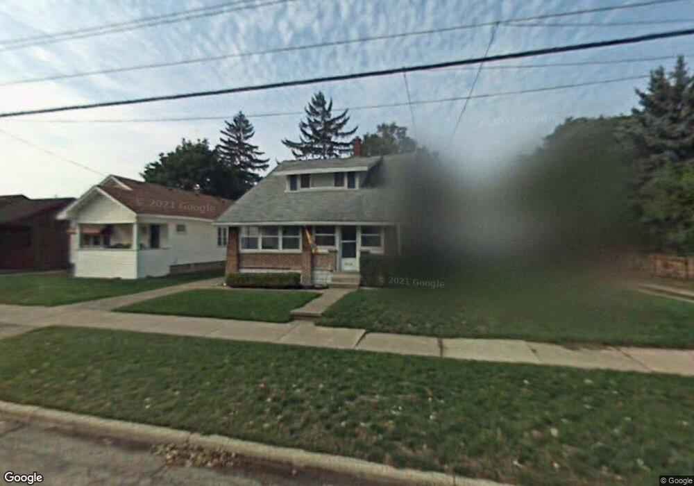
2113 Emerald Ave NE Grand Rapids, MI 49505
Creston NeighborhoodEstimated Value: $265,983 - $304,000
--
Bed
1
Bath
1,253
Sq Ft
$229/Sq Ft
Est. Value
About This Home
This home is located at 2113 Emerald Ave NE, Grand Rapids, MI 49505 and is currently estimated at $287,496, approximately $229 per square foot. 2113 Emerald Ave NE is a home located in Kent County with nearby schools including Riverside Middle School, Union High School, and All Saints Academy - Lower Campus.
Ownership History
Date
Name
Owned For
Owner Type
Purchase Details
Closed on
Jun 14, 2024
Sold by
Bosowski Debra A and Simington Debra A
Bought by
Simington Debra A and Bosowski Debra A
Current Estimated Value
Purchase Details
Closed on
Jul 10, 1991
Bought by
Simington Michael H Bosowski Debra and Simington Michael H Debra Anne
Purchase Details
Closed on
Nov 18, 1986
Sold by
Bosowski Debra
Bought by
Simington Debra Anne and Simington Michael H Debra Anne
Purchase Details
Closed on
Jun 20, 1986
Purchase Details
Closed on
Jun 17, 1986
Create a Home Valuation Report for This Property
The Home Valuation Report is an in-depth analysis detailing your home's value as well as a comparison with similar homes in the area
Home Values in the Area
Average Home Value in this Area
Purchase History
| Date | Buyer | Sale Price | Title Company |
|---|---|---|---|
| Simington Debra A | -- | None Listed On Document | |
| Simington Michael H Bosowski Debra | $44,000 | -- | |
| Simington Michael H | $44,000 | -- | |
| Simington Debra Anne | -- | -- | |
| -- | $100 | -- | |
| -- | $44,000 | -- |
Source: Public Records
Tax History Compared to Growth
Tax History
| Year | Tax Paid | Tax Assessment Tax Assessment Total Assessment is a certain percentage of the fair market value that is determined by local assessors to be the total taxable value of land and additions on the property. | Land | Improvement |
|---|---|---|---|---|
| 2025 | $1,499 | $125,800 | $0 | $0 |
| 2024 | $1,499 | $112,500 | $0 | $0 |
| 2023 | $1,499 | $103,600 | $0 | $0 |
| 2022 | $1,507 | $87,800 | $0 | $0 |
| 2021 | $1,474 | $71,800 | $0 | $0 |
| 2020 | $1,409 | $66,900 | $0 | $0 |
| 2019 | $1,425 | $63,700 | $0 | $0 |
| 2018 | $1,425 | $59,300 | $0 | $0 |
| 2017 | $1,387 | $50,200 | $0 | $0 |
| 2016 | $1,404 | $46,400 | $0 | $0 |
| 2015 | $1,306 | $46,400 | $0 | $0 |
| 2013 | -- | $38,400 | $0 | $0 |
Source: Public Records
Map
Nearby Homes
- 921 Eleanor St NE
- 778 Eleanor St NE
- 738 Graceland St NE
- 2038 Melita Ave NE
- 1848 Emerald Ave NE
- 612 Woodridge St NE
- 861 Aberdeen St NE
- 1825 Meadowfield Dr NE
- 1757 Westlane Dr NE
- 2019 Plainfield Ave NE
- 465 Kenwood St NE
- 2100 Dawson Ave NE
- 1824 Herrick Ave NE
- 2030 Sinclair Ave NE
- 1119 Kentwood Dr NE
- 1335 Knapp St NE
- 2027 Joan Ave NE
- 2471 Union Ave NE
- 321 Knapp St NE
- 1237 Dale Ct NE
- 2115 Emerald Ave NE
- 2109 Emerald Ave NE
- 2117 Emerald Ave NE
- 845 Graceland St NE
- 843 Graceland St NE
- 2125 Emerald Ave NE
- 2110 Duiker Ave NE
- 2114 Duiker Ave NE
- 2106 Duiker Ave NE
- 837 Graceland St NE
- 2129 Emerald Ave NE
- 901 Graceland St NE
- 833 Graceland St NE
- 2114 Emerald Ave NE
- 2110 Emerald Ave NE
- 2133 Emerald Ave NE
- 2128 Duiker Ave NE
- 2120 Emerald Ave NE
- 907 Graceland St NE
- 2124 Emerald Ave NE