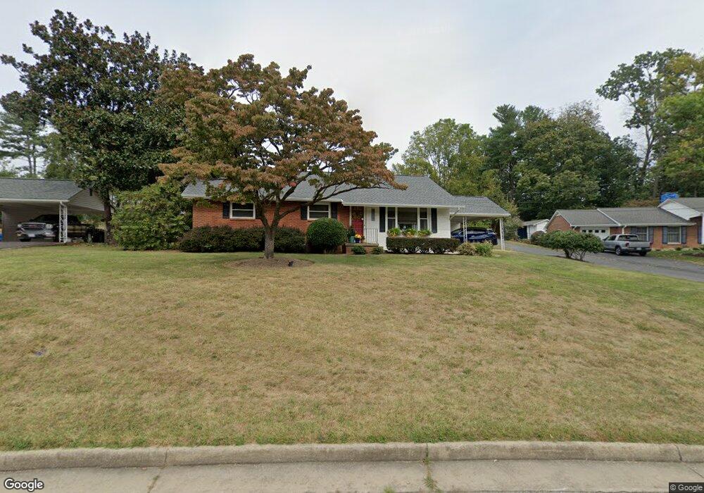
2113 Forest Dr Waynesboro, VA 22980
Estimated Value: $311,000 - $344,000
3
Beds
2
Baths
1,450
Sq Ft
$227/Sq Ft
Est. Value
About This Home
This home is located at 2113 Forest Dr, Waynesboro, VA 22980 and is currently estimated at $329,146, approximately $226 per square foot. 2113 Forest Dr is a home located in Waynesboro City with nearby schools including Westwood Hills Elementary School, Kate Collins Middle School, and Waynesboro High School.
Ownership History
Date
Name
Owned For
Owner Type
Purchase Details
Closed on
Sep 5, 2022
Sold by
Carter Roger E
Bought by
Carter Anthony Wayne and Carter Candra T
Current Estimated Value
Purchase Details
Closed on
Aug 26, 2010
Sold by
Davis James S
Bought by
Carter Roger E
Create a Home Valuation Report for This Property
The Home Valuation Report is an in-depth analysis detailing your home's value as well as a comparison with similar homes in the area
Home Values in the Area
Average Home Value in this Area
Purchase History
| Date | Buyer | Sale Price | Title Company |
|---|---|---|---|
| Carter Anthony Wayne | -- | -- | |
| Carter Roger E | $166,000 | -- |
Source: Public Records
Tax History Compared to Growth
Tax History
| Year | Tax Paid | Tax Assessment Tax Assessment Total Assessment is a certain percentage of the fair market value that is determined by local assessors to be the total taxable value of land and additions on the property. | Land | Improvement |
|---|---|---|---|---|
| 2025 | $2,578 | $314,400 | $50,000 | $264,400 |
| 2024 | $2,074 | $269,400 | $47,500 | $221,900 |
| 2023 | $2,074 | $269,400 | $47,500 | $221,900 |
| 2022 | $1,818 | $202,000 | $47,500 | $154,500 |
| 2021 | $1,800 | $200,000 | $47,500 | $152,500 |
| 2020 | $1,688 | $187,600 | $47,500 | $140,100 |
| 2019 | $1,688 | $187,600 | $47,500 | $140,100 |
| 2018 | $1,498 | $166,400 | $47,500 | $118,900 |
| 2017 | $1,448 | $166,400 | $47,500 | $118,900 |
| 2016 | $1,318 | $164,800 | $47,500 | $117,300 |
| 2015 | $1,318 | $164,800 | $47,500 | $117,300 |
| 2014 | -- | $161,000 | $47,500 | $113,500 |
| 2013 | -- | $0 | $0 | $0 |
Source: Public Records
Map
Nearby Homes
- 2224 Mount Vernon St
- 636 Rosser Ave
- PENWELL Plan at Kira Heights
- SALEM Plan at Kira Heights
- NEUVILLE Plan at Kira Heights
- 2500 Forest Dr
- 2418 Mount Vernon St
- 2509 Belvue Rd Unit 18
- 2509 Belvue Rd
- 656 Edwardian Ln
- 2524 Belvue Rd
- 407 Crompton Rd
- 1073 Pendleton Dr
- 812 Meadowbrook Rd
- 1229 Rosser Ave
- 529 S Linden Ave
- 1637 Mulberry St
- 208 Sunbird Ln
- 2404 Village Dr
- 840 Hawthorne Ln
- 2121 Forest Dr
- 2107 Forest Dr
- 2129 Forest Dr
- 2108 Cortland St
- 2116 Cortland St
- 2124 Cortland St
- 2112 Cortland St
- 2100 Forest Dr
- 413 S Ellison Ln
- 2101 Forest Dr
- 2120 Forest Dr
- 425 S Ellison Ln
- 2130 Cortland St
- 2137 Forest Dr
- 401 S Ellison Ln
- Lot 7 Forest Dr
- Lot 16 Forest Dr
- Lot 7 Forest Dr Unit 911 Address TBD
- 2128 Forest Dr
- 437 S Ellison Ln