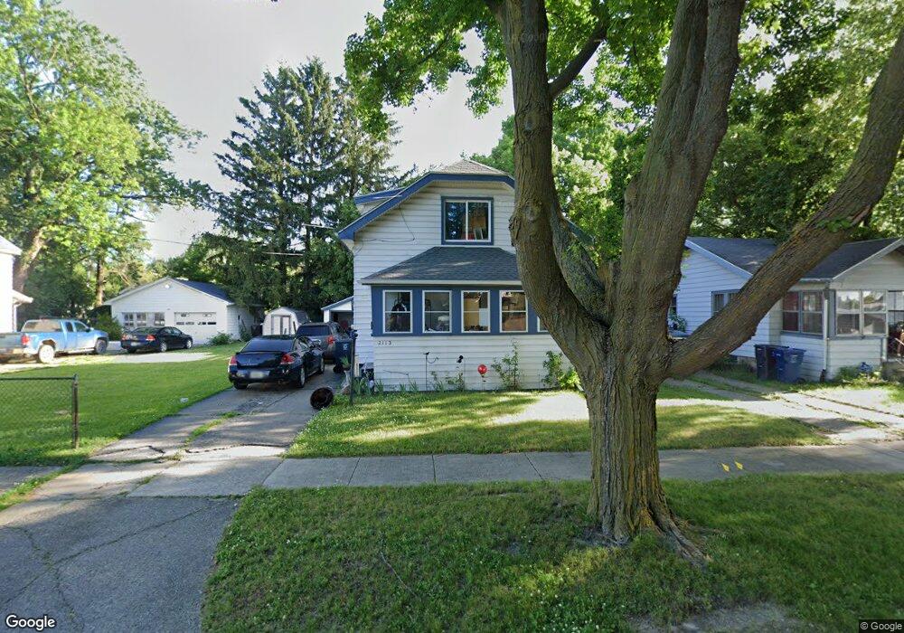
2113 Kansas Ave Flint, MI 48506
Eastside NeighborhoodEstimated Value: $33,000 - $55,000
2
Beds
1
Bath
924
Sq Ft
$48/Sq Ft
Est. Value
About This Home
This home is located at 2113 Kansas Ave, Flint, MI 48506 and is currently estimated at $44,455, approximately $48 per square foot. 2113 Kansas Ave is a home located in Genesee County with nearby schools including Potter School, Flint Cultural Center Academy, and WAY Academy of Flint.
Ownership History
Date
Name
Owned For
Owner Type
Purchase Details
Closed on
Oct 26, 2017
Sold by
County Land Bank Authority
Bought by
Townsend Juliana
Current Estimated Value
Purchase Details
Closed on
Feb 3, 2015
Sold by
The Genesee County Land Bank Authority
Bought by
Townsend Juliane
Purchase Details
Closed on
Dec 22, 2014
Sold by
Genesee County Treasurer
Bought by
Genesee County Land Bank
Purchase Details
Closed on
Apr 18, 2008
Sold by
Ray Douglas and Ray Mary
Bought by
Melton James and Melton Susan
Purchase Details
Closed on
Aug 20, 2003
Sold by
Sobota Daniel
Bought by
Ray Doug
Purchase Details
Closed on
May 13, 2002
Sold by
Sobota Daniel
Bought by
Ray Doug
Home Financials for this Owner
Home Financials are based on the most recent Mortgage that was taken out on this home.
Original Mortgage
$7,000
Interest Rate
8%
Mortgage Type
Seller Take Back
Create a Home Valuation Report for This Property
The Home Valuation Report is an in-depth analysis detailing your home's value as well as a comparison with similar homes in the area
Home Values in the Area
Average Home Value in this Area
Purchase History
| Date | Buyer | Sale Price | Title Company |
|---|---|---|---|
| Townsend Juliana | $3,000 | None Available | |
| Townsend Juliane | $3,000 | None Available | |
| Genesee County Land Bank | -- | None Available | |
| Melton James | -- | None Available | |
| Ray Doug | $22,000 | -- | |
| Ray Doug | $22,000 | -- |
Source: Public Records
Mortgage History
| Date | Status | Borrower | Loan Amount |
|---|---|---|---|
| Previous Owner | Ray Doug | $7,000 | |
| Closed | Townsend Juliane | $0 |
Source: Public Records
Tax History Compared to Growth
Tax History
| Year | Tax Paid | Tax Assessment Tax Assessment Total Assessment is a certain percentage of the fair market value that is determined by local assessors to be the total taxable value of land and additions on the property. | Land | Improvement |
|---|---|---|---|---|
| 2025 | $622 | $14,400 | $0 | $0 |
| 2024 | $576 | $13,400 | $0 | $0 |
| 2023 | $573 | $11,300 | $0 | $0 |
| 2022 | $0 | $9,100 | $0 | $0 |
| 2021 | $587 | $7,300 | $0 | $0 |
| 2020 | $543 | $7,100 | $0 | $0 |
| 2019 | $537 | $5,700 | $0 | $0 |
| 2018 | $577 | $6,900 | $0 | $0 |
| 2017 | $596 | $0 | $0 | $0 |
| 2016 | $596 | $0 | $0 | $0 |
| 2015 | -- | $0 | $0 | $0 |
| 2014 | -- | $0 | $0 | $0 |
| 2012 | -- | $10,100 | $0 | $0 |
Source: Public Records
Map
Nearby Homes
- 2301 Missouri Ave
- 1501 Arlington Ave
- 1318 Cronk Ave
- 2426 Missouri Ave
- 1510 N Vernon Ave
- 2605 Nebraska Ave
- 301 Chandler St
- 1622 Arlington Ave
- 2610 Pennsylvania Ave
- 1644 Pennsylvania Ave
- 406 S Lynch St
- 1605 Kearsley Park Blvd
- 524 S Lynch St
- 605 S Lynch St
- 2131 Windemere Ave
- 2202 Windemere Ave
- 2208 Windemere Ave
- 622 Chalmers St
- 1445 Kearsley Park Kearsley Park
- 1623 Montclair Ave
- 2117 Kansas Ave
- 2105 Kansas Ave
- 2121 Kansas Ave
- 2114 Nebraska Ave
- 2108 Nebraska Ave
- 2116 Nebraska Ave
- 2101 Kansas Ave
- 2125 Kansas Ave
- 2104 Nebraska Ave
- 2021 Kansas Ave
- 2100 Nebraska Ave
- 2129 Kansas Ave
- 2126 Nebraska Ave
- 2020 Nebraska Ave
- 2017 Kansas Ave
- 2016 Nebraska Ave
- 2100 Kansas Ave
- 2013 Kansas Ave
- 2020 Kansas Ave
- 2012 Nebraska Ave