Estimated Value: $72,000 - $133,000
3
Beds
1
Bath
960
Sq Ft
$112/Sq Ft
Est. Value
About This Home
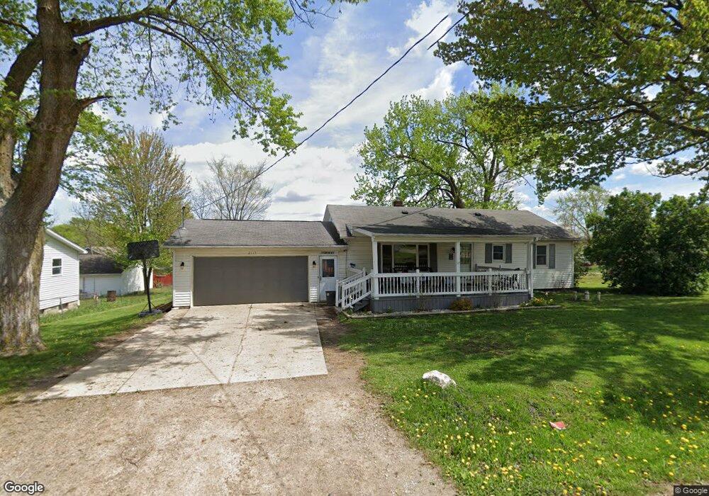
This home is located at 2113 Monaco St Unit Bldg-Unit, Flint, MI 48532 and is currently estimated at $107,676, approximately $112 per square foot. 2113 Monaco St Unit Bldg-Unit is a home located in Genesee County with nearby schools including Carman-Ainsworth High School, Genesee STEM Academy, and St. Paul Lutheran School.
Ownership History
Date
Name
Owned For
Owner Type
Purchase Details
Closed on
Oct 20, 2025
Sold by
Abeare Aaron Jeffery
Bought by
Abeare Aaron and Abeare Amber L
Current Estimated Value
Home Financials for this Owner
Home Financials are based on the most recent Mortgage that was taken out on this home.
Original Mortgage
$92,700
Outstanding Balance
$92,700
Interest Rate
5.5%
Mortgage Type
Balloon
Estimated Equity
$14,976
Purchase Details
Closed on
Jan 26, 2018
Sold by
Wells Fargo Bank National Association
Bought by
Abeare Aaron Jeffery
Purchase Details
Closed on
Aug 30, 2017
Sold by
The Estate Of Marcus V Bexton
Bought by
Wells Fargo Bank Na
Purchase Details
Closed on
Jun 21, 2017
Sold by
Bexton Marcus V and Bexton Irene E
Bought by
Wells Fargo Bank Na
Create a Home Valuation Report for This Property
The Home Valuation Report is an in-depth analysis detailing your home's value as well as a comparison with similar homes in the area
Home Values in the Area
Average Home Value in this Area
Purchase History
| Date | Buyer | Sale Price | Title Company |
|---|---|---|---|
| Abeare Aaron | -- | Michigan Trusted Title | |
| Abeare Aaron Jeffery | $36,500 | None Available | |
| Wells Fargo Bank Na | $89,725 | None Available | |
| Wells Fargo Bank Na | $89,725 | None Available |
Source: Public Records
Mortgage History
| Date | Status | Borrower | Loan Amount |
|---|---|---|---|
| Open | Abeare Aaron | $92,700 |
Source: Public Records
Tax History
| Year | Tax Paid | Tax Assessment Tax Assessment Total Assessment is a certain percentage of the fair market value that is determined by local assessors to be the total taxable value of land and additions on the property. | Land | Improvement |
|---|---|---|---|---|
| 2025 | $1,848 | $48,000 | $0 | $0 |
| 2024 | $1,019 | $42,600 | $0 | $0 |
| 2023 | $934 | $34,900 | $0 | $0 |
| 2022 | $742 | $31,800 | $0 | $0 |
| 2021 | $1,112 | $29,600 | $0 | $0 |
| 2020 | $821 | $25,500 | $0 | $0 |
| 2019 | $814 | $21,800 | $0 | $0 |
| 2018 | $1,513 | $25,600 | $0 | $0 |
| 2017 | $1,990 | $25,600 | $0 | $0 |
| 2016 | $1,510 | $23,000 | $0 | $0 |
| 2015 | $861 | $22,400 | $0 | $0 |
| 2014 | $511 | $21,400 | $0 | $0 |
| 2012 | -- | $25,300 | $25,300 | $0 |
Source: Public Records
Map
Nearby Homes
- 2033 Eberly Rd
- 18.41 Taft Rd
- 1512 Crescent Lane Dr Lot#46
- 10 Acres T A Mansour Blvd
- 4474 Corunna Rd
- 4199 Sheraton Dr
- 4480 Corunna Rd
- 1455 S Linden Rd
- 0 Charter Dr Unit 50153638
- 3277 Whitney Ave
- 2521 White Oak Place
- 3365 Ridgecliffe Dr
- 3.9 Acres W Court St
- 4335 Lennon Rd
- VL Clairmont St
- 2 Charter Dr
- 3088 Curtis Dr
- 5151 Brobeck St
- 4490 W Lennon Rd
- 1137 S Graham Rd
Your Personal Tour Guide
Ask me questions while you tour the home.