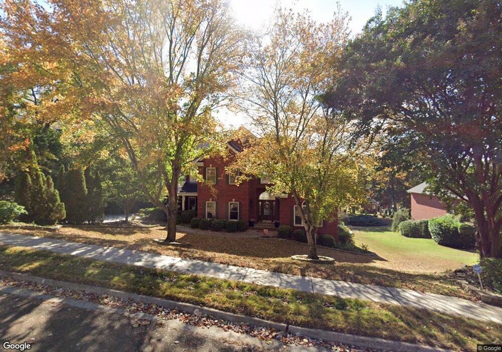
2113 Smoketree Trail NE Huntsville, AL 35811
Chapman Heights NeighborhoodEstimated Value: $658,000 - $710,000
4
Beds
4
Baths
3,645
Sq Ft
$185/Sq Ft
Est. Value
About This Home
This home is located at 2113 Smoketree Trail NE, Huntsville, AL 35811 and is currently estimated at $675,705, approximately $185 per square foot. 2113 Smoketree Trail NE is a home located in Madison County with nearby schools including Chapman Elementary School, Chapman Middle School, and Lee High School.
Ownership History
Date
Name
Owned For
Owner Type
Purchase Details
Closed on
May 26, 2010
Sold by
Johnson Joseph Micael and Johnson Emily W
Bought by
Bledsoe Richard K and Bledsoe Nancy L
Current Estimated Value
Home Financials for this Owner
Home Financials are based on the most recent Mortgage that was taken out on this home.
Original Mortgage
$258,000
Outstanding Balance
$173,336
Interest Rate
5.02%
Mortgage Type
New Conventional
Estimated Equity
$502,369
Create a Home Valuation Report for This Property
The Home Valuation Report is an in-depth analysis detailing your home's value as well as a comparison with similar homes in the area
Home Values in the Area
Average Home Value in this Area
Purchase History
| Date | Buyer | Sale Price | Title Company |
|---|---|---|---|
| Bledsoe Richard K | -- | -- |
Source: Public Records
Mortgage History
| Date | Status | Borrower | Loan Amount |
|---|---|---|---|
| Open | Bledsoe Richard K | $258,000 |
Source: Public Records
Tax History Compared to Growth
Tax History
| Year | Tax Paid | Tax Assessment Tax Assessment Total Assessment is a certain percentage of the fair market value that is determined by local assessors to be the total taxable value of land and additions on the property. | Land | Improvement |
|---|---|---|---|---|
| 2024 | $3,591 | $61,620 | $5,560 | $56,060 |
| 2023 | $3,526 | $58,740 | $5,560 | $53,180 |
| 2022 | $3,137 | $54,920 | $5,000 | $49,920 |
| 2021 | $2,788 | $48,900 | $5,000 | $43,900 |
| 2020 | $2,757 | $48,340 | $4,450 | $43,890 |
| 2019 | $2,675 | $46,930 | $4,450 | $42,480 |
| 2018 | $2,546 | $44,720 | $0 | $0 |
| 2017 | $2,383 | $41,920 | $0 | $0 |
| 2016 | $2,383 | $41,920 | $0 | $0 |
| 2015 | $2,383 | $41,920 | $0 | $0 |
| 2014 | $2,274 | $40,040 | $0 | $0 |
Source: Public Records
Map
Nearby Homes
- 2112 Smoketree Trail NE
- 2119 Smoketree Trail NE
- 2909 Saddletree Blvd NE
- 2909 Smoketree Cir NE
- 2107 Greenslope Trail NE
- 4015 High Mountain Rd NE
- 2105 Greenslope Trail NE
- 2109 Raincreek Trail NE
- 4025 High Mountain Rd NE
- 8.6 Acres High Mountain Rd NE
- 1900 Randy Ct NE
- 0 Hawks Way NE Unit 35 21372427
- 35.5 Acres Hawks Way NE
- 19 Acres Hawks Way NE
- 4005 Hawks Way NE
- Lot 114 Hawks Way NE
- 64 Acres Hawks Way NE
- 2505 Gaboury Ln NE
- 4000 Hawks Way NE
- 2012 Haynes Ave NE
- 0 Forest Chapel Cir NE Unit 1036534
- 0 Forest Chapel Cir NE Unit 1072095
- 0 Forest Chapel Cir NE
- 0 Forest Chapel Cir NE Unit 1771374
- 2111 Smoketree Trail NE
- 2115 Smoketree Trail NE
- 2114 Smoketree Trail NE
- 0 Smoketree Trail Unit 1104198
- 0 Smoketree Trail Unit 1820655
- 0 Smoketree Trail Unit 1800733
- 2118 Smoketree Trail NE
- 2109 Smoketree Trail NE
- 2116 Smoketree Trail NE
- 2103 Smoketree Trail NE
- 2903 Smoketree Cir NE
- 1 Smoketree Trail NE
- 2120 Greenslope Trail NE
- 2118 Greenslope Trail NE
- 2122 Greenslope Trail NE
- 2900 Smoketree Cir NE