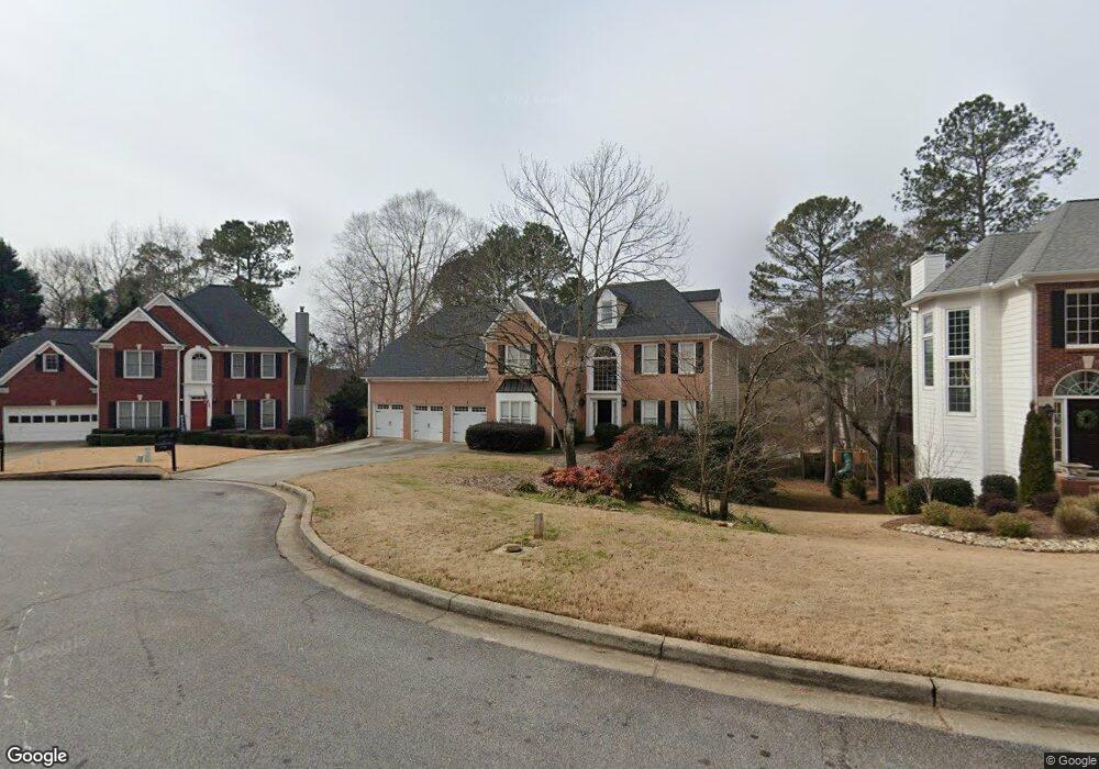
2114 Cape Liberty Dr Suwanee, GA 30024
Estimated Value: $548,000 - $620,000
5
Beds
4
Baths
4,172
Sq Ft
$140/Sq Ft
Est. Value
About This Home
This home is located at 2114 Cape Liberty Dr, Suwanee, GA 30024 and is currently estimated at $584,782, approximately $140 per square foot. 2114 Cape Liberty Dr is a home located in Gwinnett County with nearby schools including Walnut Grove Elementary School, Creekland Middle School, and Collins Hill High School.
Ownership History
Date
Name
Owned For
Owner Type
Purchase Details
Closed on
Apr 24, 2020
Sold by
Ring Christopher
Bought by
Ring Christopher
Current Estimated Value
Home Financials for this Owner
Home Financials are based on the most recent Mortgage that was taken out on this home.
Original Mortgage
$325,200
Outstanding Balance
$288,011
Interest Rate
3.5%
Mortgage Type
New Conventional
Estimated Equity
$296,771
Purchase Details
Closed on
Mar 15, 2011
Sold by
Federal Home Loan Mortgage Corporation
Bought by
Ring Christopher and Ring Thomas
Home Financials for this Owner
Home Financials are based on the most recent Mortgage that was taken out on this home.
Original Mortgage
$159,984
Interest Rate
4.75%
Mortgage Type
FHA
Purchase Details
Closed on
Mar 2, 2010
Sold by
Wells Fargo Bk Na
Bought by
Federal Home Loan Mortgage Corporation
Purchase Details
Closed on
Nov 19, 2001
Sold by
Pedersen Wallace R and Pedersen Bridgette
Bought by
Pedersen Wallace R and Pedersen Bridgette L
Home Financials for this Owner
Home Financials are based on the most recent Mortgage that was taken out on this home.
Original Mortgage
$238,000
Interest Rate
7.08%
Mortgage Type
New Conventional
Purchase Details
Closed on
Oct 12, 2000
Sold by
Baker Pamela P
Bought by
Pedersen Wallace R and Pedersen Brigitte
Home Financials for this Owner
Home Financials are based on the most recent Mortgage that was taken out on this home.
Original Mortgage
$238,500
Interest Rate
7.96%
Mortgage Type
New Conventional
Purchase Details
Closed on
Sep 4, 2000
Sold by
Baker Michael S
Bought by
Baker Pamela P
Home Financials for this Owner
Home Financials are based on the most recent Mortgage that was taken out on this home.
Original Mortgage
$238,500
Interest Rate
7.96%
Mortgage Type
New Conventional
Purchase Details
Closed on
Mar 5, 1993
Sold by
Hedgewood Prop
Bought by
Baker Margaret R Michael
Home Financials for this Owner
Home Financials are based on the most recent Mortgage that was taken out on this home.
Original Mortgage
$54,000
Interest Rate
7.88%
Create a Home Valuation Report for This Property
The Home Valuation Report is an in-depth analysis detailing your home's value as well as a comparison with similar homes in the area
Home Values in the Area
Average Home Value in this Area
Purchase History
| Date | Buyer | Sale Price | Title Company |
|---|---|---|---|
| Ring Christopher | -- | -- | |
| Ring Christopher | $176,000 | -- | |
| Federal Home Loan Mortgage Corporation | -- | -- | |
| Wells Fargo Bk Na | $260,449 | -- | |
| Pedersen Wallace R | -- | -- | |
| Pedersen Wallace R | $238,500 | -- | |
| Baker Pamela P | -- | -- | |
| Baker Margaret R Michael | $186,300 | -- |
Source: Public Records
Mortgage History
| Date | Status | Borrower | Loan Amount |
|---|---|---|---|
| Open | Ring Christopher | $325,200 | |
| Previous Owner | Ring Christopher | $159,984 | |
| Previous Owner | Pedersen Wallace R | $238,000 | |
| Previous Owner | Pedersen Wallace R | $238,500 | |
| Previous Owner | Baker Margaret R Michael | $54,000 |
Source: Public Records
Tax History
| Year | Tax Paid | Tax Assessment Tax Assessment Total Assessment is a certain percentage of the fair market value that is determined by local assessors to be the total taxable value of land and additions on the property. | Land | Improvement |
|---|---|---|---|---|
| 2025 | $6,701 | $256,040 | $28,000 | $228,040 |
| 2024 | $6,362 | $231,240 | $38,400 | $192,840 |
| 2023 | $6,362 | $240,080 | $41,600 | $198,480 |
| 2022 | $5,839 | $207,240 | $37,200 | $170,040 |
| 2021 | $4,813 | $153,560 | $26,800 | $126,760 |
| 2020 | $4,849 | $153,560 | $26,800 | $126,760 |
| 2019 | $4,537 | $144,960 | $24,640 | $120,320 |
| 2018 | $4,299 | $133,560 | $24,640 | $108,920 |
| 2016 | $3,475 | $94,720 | $18,000 | $76,720 |
| 2015 | $3,511 | $94,720 | $18,000 | $76,720 |
| 2014 | -- | $94,720 | $18,000 | $76,720 |
Source: Public Records
Map
Nearby Homes
- 2164 Cape Liberty Dr
- 2094 Cape Liberty Dr Unit 4
- 2152 Merrymount Dr Unit 6
- 2012 Little River Dr Unit 1
- 2347 Merrymount Dr
- 2165 Wildwood Lake Dr
- 2251 Lake Haven Way
- 2382 Merrymount Dr Unit 2
- 30 Karen Camile Dr
- 2067 York River Way
- 1985 Tyler Trace
- 2001 Stone Forest Dr
- 2275 Shore View Way
- 1832 Shores Ridge Ct
- 291 Shore Dr
- 2272 Stag Run
- 2390 Walnut Grove Way
- 2035 Wildcat Cliffs Way Unit 1
- 441 Shore Dr
- 310 Allatoona Rd
- 2124 Cape Liberty Dr
- 2104 Cape Liberty Dr Unit 4
- 2187 Merrymount Dr Unit 5
- 2197 Merrymount Dr Unit 5
- 2134 Cape Liberty Dr
- 2177 Merrymount Dr Unit 6
- 2207 Merrymount Dr
- 2113 Cape Liberty Dr Unit 4
- 2123 Cape Liberty Dr
- 2103 Cape Liberty Dr Unit 4
- 2217 Merrymount Dr
- 2144 Cape Liberty Dr
- 275 Merrymount Ct
- 2133 Cape Liberty Dr
- 265 Merrymount Ct
- 2227 Merrymount Dr
- 2154 Cape Liberty Dr Unit 4
- 2143 Cape Liberty Dr
- 2157 Merrymount Dr
- 2192 Merrymount Dr
Your Personal Tour Guide
Ask me questions while you tour the home.