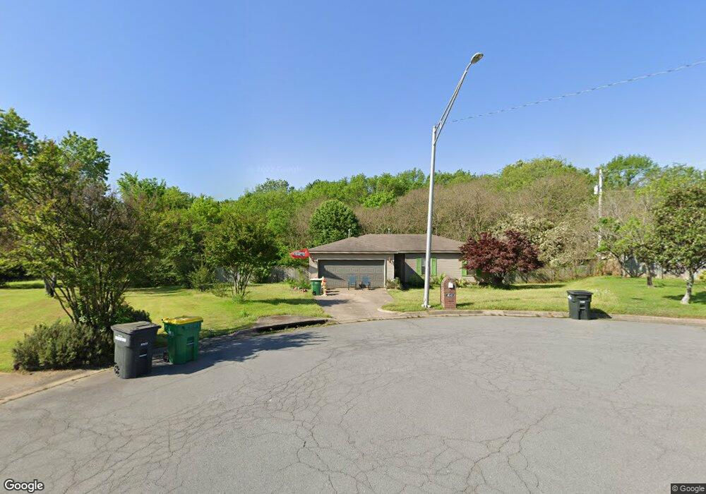
2114 E Lee Ave Unit B Sherwood, AR 72120
Estimated Value: $154,002 - $192,000
--
Bed
1
Bath
1,792
Sq Ft
$100/Sq Ft
Est. Value
About This Home
This home is located at 2114 E Lee Ave Unit B, Sherwood, AR 72120 and is currently estimated at $179,751, approximately $100 per square foot. 2114 E Lee Ave Unit B is a home located in Pulaski County with nearby schools including Sherwood Elementary School, Sylvan Hills Middle School, and Sylvan Hills High School.
Ownership History
Date
Name
Owned For
Owner Type
Purchase Details
Closed on
Jan 23, 2020
Sold by
Huffmaster Phillip Wayne and Huffmaster Phillip
Bought by
Huffmaster Phillip Wayne and Huffmaster Shirley Louise
Current Estimated Value
Purchase Details
Closed on
May 8, 2017
Sold by
Huffmaster Katherine and Huffmaster John David
Bought by
Huffmaster Phillip
Create a Home Valuation Report for This Property
The Home Valuation Report is an in-depth analysis detailing your home's value as well as a comparison with similar homes in the area
Home Values in the Area
Average Home Value in this Area
Purchase History
| Date | Buyer | Sale Price | Title Company |
|---|---|---|---|
| Huffmaster Phillip Wayne | -- | None Available | |
| Huffmaster Phillip | -- | None Available |
Source: Public Records
Tax History Compared to Growth
Tax History
| Year | Tax Paid | Tax Assessment Tax Assessment Total Assessment is a certain percentage of the fair market value that is determined by local assessors to be the total taxable value of land and additions on the property. | Land | Improvement |
|---|---|---|---|---|
| 2025 | $542 | $24,702 | $1,144 | $23,558 |
| 2024 | $542 | $24,702 | $1,144 | $23,558 |
| 2023 | $542 | $24,702 | $1,144 | $23,558 |
| 2022 | $695 | $24,702 | $1,144 | $23,558 |
| 2021 | $645 | $16,680 | $1,100 | $15,580 |
| 2020 | $265 | $16,680 | $1,100 | $15,580 |
| 2019 | $265 | $16,680 | $1,100 | $15,580 |
| 2018 | $290 | $16,680 | $1,100 | $15,580 |
| 2017 | $285 | $16,680 | $1,100 | $15,580 |
| 2016 | $257 | $21,570 | $5,750 | $15,820 |
| 2015 | $501 | $9,863 | $5,750 | $4,113 |
| 2014 | $501 | $9,863 | $5,750 | $4,113 |
Source: Public Records
Map
Nearby Homes
- 1926 E Lee Ave
- 1501 Stafford Rd
- 1423 Stafford Rd
- +/- 21.56 Acres Stafford Rd
- 1800 Palomino Dr
- 1419 Stafford Rd
- 1415 Stafford Rd
- 2204 E Lee Ave
- 2206 E Lee Ave
- 626 Newcastle Dr
- 622 Newcastle Dr
- 618 & 620 Newcastle Dr
- 1301 Stafford Rd
- 619 Newcastle Dr
- 1300 Stafford Rd
- 615 Brierly Dr
- 615 & 617 Brierly Dr
- 8000 Pinto Trail
- +/- 8.16 Acres Windchime Ave
- 609 Newcastle Dr
- 2114 E Lee Ave
- 4441 Matthew Ct
- 4431 Matthew Ct
- 4440 Matthew Ct
- 7918 Bronco Ln
- 7922 Bronco Ln
- 7924 Bronco Ln
- 7916 Bronco Ln
- 8000 Bronco Ln
- 7914 Bronco Ln
- 0 Bronco Ln
- 8004 Bronco Ln
- 4430 Matthew Ct
- 1621 Manor Dr
- 8008 Bronco Ln
- 4411 Matthew Ct
- 4420 Matthew Ct
- 0 Matthew Ct Unit 20031375
- 0 Matthew Ct Unit 18001818
- 7910 Bronco Ln