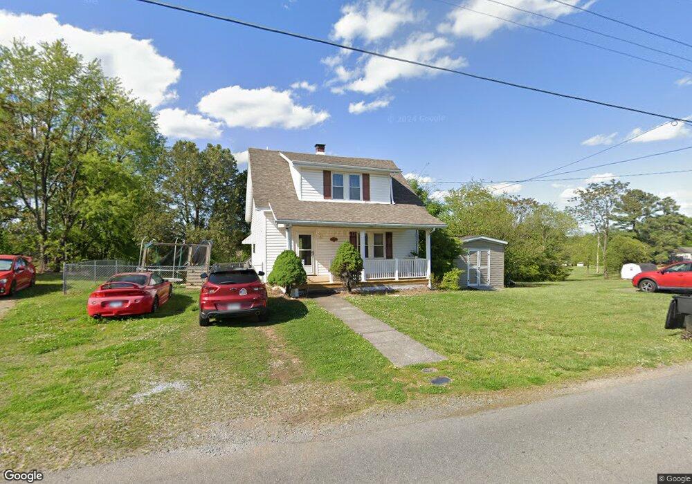
2114 Mayfield Dr Roanoke, VA 24014
Estimated Value: $213,000 - $270,000
3
Beds
2
Baths
1,207
Sq Ft
$198/Sq Ft
Est. Value
About This Home
This home is located at 2114 Mayfield Dr, Roanoke, VA 24014 and is currently estimated at $238,505, approximately $197 per square foot. 2114 Mayfield Dr is a home located in Roanoke County with nearby schools including Mt. Pleasant Elementary School, William Byrd Middle School, and William Byrd High School.
Ownership History
Date
Name
Owned For
Owner Type
Purchase Details
Closed on
Mar 8, 2012
Sold by
Adams Sue J and Ware Sue J
Bought by
Jeffers Michael Todd
Current Estimated Value
Home Financials for this Owner
Home Financials are based on the most recent Mortgage that was taken out on this home.
Original Mortgage
$117,346
Interest Rate
3.88%
Mortgage Type
New Conventional
Create a Home Valuation Report for This Property
The Home Valuation Report is an in-depth analysis detailing your home's value as well as a comparison with similar homes in the area
Purchase History
| Date | Buyer | Sale Price | Title Company |
|---|---|---|---|
| Jeffers Michael Todd | -- | None Available |
Source: Public Records
Mortgage History
| Date | Status | Borrower | Loan Amount |
|---|---|---|---|
| Previous Owner | Jeffers Michael Todd | $117,346 |
Source: Public Records
Tax History
| Year | Tax Paid | Tax Assessment Tax Assessment Total Assessment is a certain percentage of the fair market value that is determined by local assessors to be the total taxable value of land and additions on the property. | Land | Improvement |
|---|---|---|---|---|
| 2025 | $1,810 | $175,700 | $33,800 | $141,900 |
| 2024 | $1,733 | $166,600 | $33,800 | $132,800 |
| 2023 | $1,665 | $157,100 | $33,800 | $123,300 |
| 2022 | $1,437 | $131,800 | $27,000 | $104,800 |
| 2021 | $1,273 | $116,800 | $23,300 | $93,500 |
| 2020 | $1,268 | $116,300 | $23,300 | $93,000 |
| 2019 | $1,185 | $108,700 | $20,600 | $88,100 |
| 2018 | $1,159 | $107,100 | $20,600 | $86,500 |
| 2017 | $1,159 | $106,300 | $20,600 | $85,700 |
| 2016 | $1,161 | $106,500 | $20,600 | $85,900 |
| 2015 | $1,163 | $106,700 | $20,600 | $86,100 |
| 2014 | $1,139 | $104,500 | $20,600 | $83,900 |
Source: Public Records
Map
Nearby Homes
- 1701 Mayfield Dr
- 3416 Mount Pleasant Blvd
- 3036 Woodway Rd
- 3480 Mount Pleasant Blvd
- 1631 Eanes Rd
- 2725 Garden City Blvd SE
- 2721 Garden City Blvd SE
- 0 Garden City Blvd SE
- 1576 Rosewalk Ln
- 1374 Gillette Ave SE
- 3520 Ballyhack Trail
- 1126 Gearhart Rd SE
- 3540 Ballyhack Trail
- 951 Hartsook Blvd SE
- 3592 Ballyhack Trail
- 3559 Ballyhack Trail
- 3517 Ballyhack Trail
- 3537 Ballyhack Trail
- 3527 Ballyhack Trail
- 3630 Ballyhack Trail
- 2026 Mayfield Dr
- 0 Mayfield Dr
- 2105 Mayfield Dr
- 2124 Mayfield Dr
- 3251 Bushdale Rd
- 2025 Mayfield Dr
- 2125 Mayfield Dr
- 2204 Mayfield Dr
- 2013 Mayfield Dr
- 2201 Mayfield Dr
- 2212 Mayfield Dr
- 2006 Mayfield Dr
- 3143 Bushdale Rd
- 3509 Bushdale Rd
- 2304 Mayfield Dr
- 2213 Mayfield Dr
- 3330 Alcoa Rd
- 3513 Bushdale Rd
- 2303 Mayfield Dr
- 3328 Bushdale Rd
Your Personal Tour Guide
Ask me questions while you tour the home.