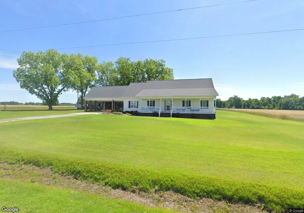
2114 Nor Am Rd Fremont, NC 27830
Estimated Value: $344,000 - $396,000
3
Beds
4
Baths
2,395
Sq Ft
$155/Sq Ft
Est. Value
About This Home
This home is located at 2114 Nor Am Rd, Fremont, NC 27830 and is currently estimated at $371,534, approximately $155 per square foot. 2114 Nor Am Rd is a home located in Wayne County with nearby schools including Northwest Elementary School, Norwayne Middle School, and Charles B. Aycock High School.
Ownership History
Date
Name
Owned For
Owner Type
Purchase Details
Closed on
Oct 25, 2006
Sold by
Hooks & Co Llc
Bought by
Spell Libby Lutrell and Spell Miriam Williams
Current Estimated Value
Home Financials for this Owner
Home Financials are based on the most recent Mortgage that was taken out on this home.
Original Mortgage
$88,136
Outstanding Balance
$52,389
Interest Rate
6.39%
Mortgage Type
Future Advance Clause Open End Mortgage
Estimated Equity
$319,145
Purchase Details
Closed on
May 1, 2001
Create a Home Valuation Report for This Property
The Home Valuation Report is an in-depth analysis detailing your home's value as well as a comparison with similar homes in the area
Home Values in the Area
Average Home Value in this Area
Purchase History
| Date | Buyer | Sale Price | Title Company |
|---|---|---|---|
| Spell Libby Lutrell | $12,000 | None Availabel | |
| -- | $23,000 | -- |
Source: Public Records
Mortgage History
| Date | Status | Borrower | Loan Amount |
|---|---|---|---|
| Open | Spell Libby Lutrell | $88,136 |
Source: Public Records
Tax History Compared to Growth
Tax History
| Year | Tax Paid | Tax Assessment Tax Assessment Total Assessment is a certain percentage of the fair market value that is determined by local assessors to be the total taxable value of land and additions on the property. | Land | Improvement |
|---|---|---|---|---|
| 2025 | $2,039 | $383,900 | $35,820 | $348,080 |
| 2024 | $2,039 | $235,300 | $23,600 | $211,700 |
| 2023 | $1,957 | $235,300 | $23,600 | $211,700 |
| 2022 | $1,957 | $235,300 | $23,600 | $211,700 |
| 2021 | $1,874 | $235,300 | $23,600 | $211,700 |
| 2020 | $1,771 | $235,300 | $23,600 | $211,700 |
| 2018 | $1,693 | $224,730 | $21,220 | $203,510 |
| 2017 | $1,693 | $224,730 | $21,220 | $203,510 |
| 2016 | $1,693 | $224,730 | $21,220 | $203,510 |
| 2015 | $1,697 | $224,730 | $21,220 | $203,510 |
| 2014 | $1,700 | $224,730 | $21,220 | $203,510 |
Source: Public Records
Map
Nearby Homes
- 219 Willowbrook Dr
- 215 Willowbrook Dr
- 205 Sweeten Branch Dr
- 204 Country Pointe Rd
- 368 Hooks Rd
- 207 King James Way
- 3948 N Carolina 581
- 129 Ralph Dr
- 133 Ralph Dr
- 120 Ralph Dr
- 122 Ralph Dr
- 126 Ralph Dr
- 3986 N Carolina 581
- 3988 N Carolina 581
- 201 Talton Farm Dr
- 101 Talton Estates Dr
- 4010 N Carolina 581
- 209 Rae Dr
- 217 Rae Dr
- 2229 Nor Am Rd
- 1067 Union Grove Church Rd
- 1093 Union Grove Church Rd
- 1058 Union Grove Church Rd
- 1155 Union Grove Church Rd
- 2079 Nor Am Rd
- 1168 Union Grove Church Rd
- 1954 Nor Am Rd
- 1184 Union Grove Church Rd
- 000 Union Grove Church Rd
- 1075 Union Grove Church Rd
- 1205 Union Grove Church Rd
- 1938 Nor Am Rd
- 1216 Union Grove Church Rd
- 847 Union Grove Church Rd
- 1236 Union Grove Church Rd
- 309 Willowbrook Dr
- 1259 Union Grove Church Rd
- 207 Brookside Way
- 311 Willowbrook Dr