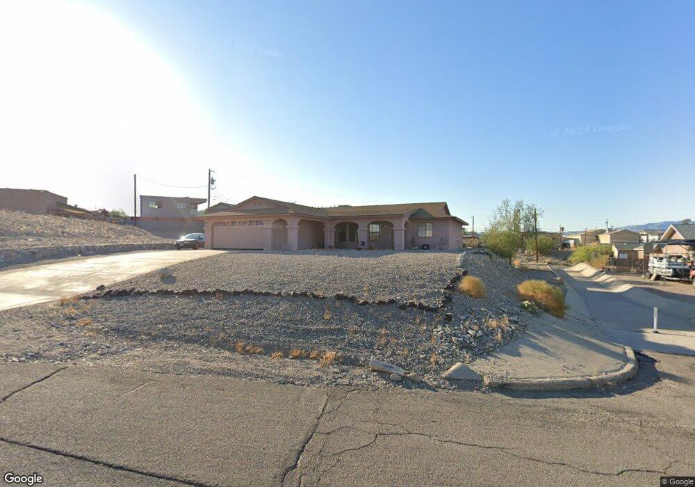
2114 Polaris Dr Lake Havasu City, AZ 86403
Estimated Value: $386,000 - $613,000
--
Bed
1
Bath
1,650
Sq Ft
$279/Sq Ft
Est. Value
About This Home
This home is located at 2114 Polaris Dr, Lake Havasu City, AZ 86403 and is currently estimated at $460,132, approximately $278 per square foot. 2114 Polaris Dr is a home located in Mohave County with nearby schools including Smoketree Elementary School, Thunderbolt Middle School, and Lake Havasu High School.
Ownership History
Date
Name
Owned For
Owner Type
Purchase Details
Closed on
Jun 17, 2004
Sold by
Bischof Gary
Bought by
Bischof Thayme
Current Estimated Value
Home Financials for this Owner
Home Financials are based on the most recent Mortgage that was taken out on this home.
Original Mortgage
$148,160
Outstanding Balance
$73,734
Interest Rate
6.27%
Mortgage Type
Purchase Money Mortgage
Estimated Equity
$386,398
Create a Home Valuation Report for This Property
The Home Valuation Report is an in-depth analysis detailing your home's value as well as a comparison with similar homes in the area
Home Values in the Area
Average Home Value in this Area
Purchase History
| Date | Buyer | Sale Price | Title Company |
|---|---|---|---|
| Bischof Thayme | -- | First American Title Ins Co | |
| Bischof Thayme | $185,200 | First American Title Ins Co |
Source: Public Records
Mortgage History
| Date | Status | Borrower | Loan Amount |
|---|---|---|---|
| Open | Bischof Thayme | $148,160 |
Source: Public Records
Tax History Compared to Growth
Tax History
| Year | Tax Paid | Tax Assessment Tax Assessment Total Assessment is a certain percentage of the fair market value that is determined by local assessors to be the total taxable value of land and additions on the property. | Land | Improvement |
|---|---|---|---|---|
| 2026 | $576 | -- | -- | -- |
| 2025 | $1,167 | $35,917 | $0 | $0 |
| 2024 | $1,167 | $39,514 | $0 | $0 |
| 2023 | $1,167 | $33,679 | $0 | $0 |
| 2022 | $1,124 | $25,321 | $0 | $0 |
| 2021 | $1,308 | $23,724 | $0 | $0 |
| 2019 | $1,245 | $19,699 | $0 | $0 |
| 2018 | $1,205 | $17,888 | $0 | $0 |
| 2017 | $1,406 | $16,863 | $0 | $0 |
| 2016 | $1,276 | $14,671 | $0 | $0 |
| 2015 | $1,223 | $12,568 | $0 | $0 |
Source: Public Records
Map
Nearby Homes
- 583 Robin Ln
- 640 Acoma Blvd N
- 1790 Rainbow Ave S
- 2200 Clarke Dr
- 532 Acoma Blvd N
- 1986 Bahama Ave
- 1960 Pirate Ln
- 2021 Industrial
- 675 Knobhill Ln
- 2301 Sahara Dr
- 2311 Rainbow Ave N
- 320 Chipeta Ln
- 2270 Constellation Dr
- 2295 Cosnina Dr
- 2305 Cosnina Dr
- 2100 Chaparral Dr
- 2349 Clarke Dr
- 2075 Palo Verde Blvd S
- 1930 Bahama Ave
- 2067 Palo Verde Blvd S
- 2110 Polaris Dr
- 591 Acoma Blvd N
- 583 Robin Ln
- 2100 Polaris Dr
- 581 Robin Ln
- 585 Acoma Blvd N
- 595 Acoma Blvd N
- 595 Acoma Blvd N
- 2111 Polaris Dr
- 2090 Polaris Dr
- 2101 Polaris Dr
- 599 Acoma Blvd N
- 2091 Polaris Dr
- 2108 Rainbow Ave N
- 2080 Polaris Dr
- 2108 Rainbow Ave N
- 592 Acoma Blvd N
- 586 Acoma Blvd N
- 2100 Rainbow Ave N
- 579 Robin Ln