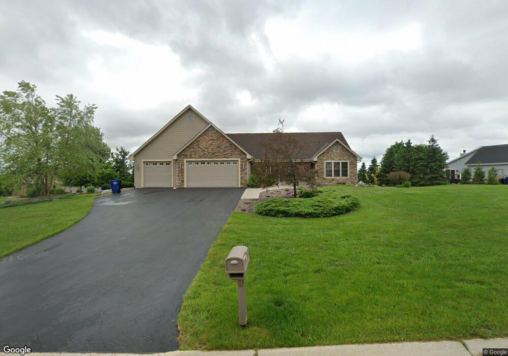
2115 Grandview Dr Slinger, WI 53086
Estimated Value: $642,387 - $710,000
3
Beds
2
Baths
2,430
Sq Ft
$276/Sq Ft
Est. Value
About This Home
This home is located at 2115 Grandview Dr, Slinger, WI 53086 and is currently estimated at $670,597, approximately $275 per square foot. 2115 Grandview Dr is a home located in Washington County with nearby schools including Slinger High School and St Peter Elementary School.
Ownership History
Date
Name
Owned For
Owner Type
Purchase Details
Closed on
May 15, 2019
Sold by
Powell John R and Powell Mindy L
Bought by
Stork Robert H and Stork Stacey R
Current Estimated Value
Home Financials for this Owner
Home Financials are based on the most recent Mortgage that was taken out on this home.
Original Mortgage
$382,500
Outstanding Balance
$334,922
Interest Rate
4%
Mortgage Type
New Conventional
Estimated Equity
$335,675
Purchase Details
Closed on
Apr 10, 2007
Sold by
Neuville Louis H
Bought by
Powell John R and Powell Mindy L
Home Financials for this Owner
Home Financials are based on the most recent Mortgage that was taken out on this home.
Original Mortgage
$59,500
Interest Rate
5.5%
Mortgage Type
Adjustable Rate Mortgage/ARM
Create a Home Valuation Report for This Property
The Home Valuation Report is an in-depth analysis detailing your home's value as well as a comparison with similar homes in the area
Home Values in the Area
Average Home Value in this Area
Purchase History
| Date | Buyer | Sale Price | Title Company |
|---|---|---|---|
| Stork Robert H | $425,000 | Frontier Ttl & Closing Svcs | |
| Powell John R | $79,500 | None Available |
Source: Public Records
Mortgage History
| Date | Status | Borrower | Loan Amount |
|---|---|---|---|
| Open | Stork Robert H | $382,500 | |
| Previous Owner | Powell John R | $59,500 |
Source: Public Records
Tax History Compared to Growth
Tax History
| Year | Tax Paid | Tax Assessment Tax Assessment Total Assessment is a certain percentage of the fair market value that is determined by local assessors to be the total taxable value of land and additions on the property. | Land | Improvement |
|---|---|---|---|---|
| 2024 | $6,688 | $587,500 | $101,400 | $486,100 |
| 2023 | $6,215 | $460,900 | $78,000 | $382,900 |
| 2022 | $6,361 | $460,900 | $78,000 | $382,900 |
| 2021 | $6,079 | $460,900 | $78,000 | $382,900 |
| 2020 | $6,014 | $401,000 | $72,500 | $328,500 |
| 2019 | $5,945 | $401,000 | $72,500 | $328,500 |
| 2018 | $5,889 | $401,000 | $72,500 | $328,500 |
| 2017 | $5,581 | $363,700 | $69,000 | $294,700 |
| 2016 | $5,305 | $312,800 | $69,000 | $243,800 |
| 2015 | $5,536 | $312,800 | $69,000 | $243,800 |
| 2014 | $5,536 | $312,800 | $69,000 | $243,800 |
| 2013 | $5,919 | $331,000 | $76,000 | $255,000 |
Source: Public Records
Map
Nearby Homes
- 1900 Hillside Rd
- 2300 Sherman Rd
- 4229 Sherman Rd
- 3790 Sherman Rd
- 3555 Hillside Rd
- 3053 Bogey Ln
- 4455 Club Dr
- 4434 Foxboro Ct
- Madison II Plan at Cedar Creek Estates
- Prairiefield II Plan at Cedar Creek Estates
- McKinley I Plan at Cedar Creek Estates
- The Walnut Plan at Cedar Creek Estates
- The Juneberry Plan at Cedar Creek Estates
- Savannah Plan at Cedar Creek Estates
- Hampton Ridge Plan at Cedar Creek Estates
- Jefferson I Plan at Cedar Creek Estates
- Wakefield Plan at Cedar Creek Estates
- 497 Limestone Ln
- Breckenridge I Plan at Cedar Creek Estates
- Hampton Bay Plan at Cedar Creek Estates
- 2050 Highland Ct
- 2125 Grandview Dr
- 2095 Grandview Dr
- 2100 Grandview Dr
- 2020 Highland Ct
- 2025 Highland Ct
- 2025 Highland Ct Unit 2025
- 2085 Grandview Dr
- 2000 Highland Ct
- 1950 Hillside Rd
- 1975 Highland Ct
- 2077 Grandview Dr
- 2080 Grandview Dr
- 1950 Highland Ct
- 1925 Highland Ct
- 3179 Hillside Rd
- 2075 Grandview Dr
- 1900 Highland Ct
- 3145 Hillside Rd
- 2005 Grandview Dr