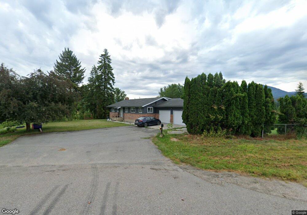
2115 Highway 395 S Unit B Chewelah, WA 99109
Estimated Value: $479,000 - $520,092
3
Beds
3
Baths
1,392
Sq Ft
$365/Sq Ft
Est. Value
About This Home
This home is located at 2115 Highway 395 S Unit B, Chewelah, WA 99109 and is currently estimated at $508,273, approximately $365 per square foot. 2115 Highway 395 S Unit B is a home located in Stevens County with nearby schools including Gess Elementary School and Jenkins Junior/Senior High School.
Ownership History
Date
Name
Owned For
Owner Type
Purchase Details
Closed on
Nov 29, 2021
Sold by
Daniels Marilyn A
Bought by
Noel Michael S and Noel Stacy G
Current Estimated Value
Home Financials for this Owner
Home Financials are based on the most recent Mortgage that was taken out on this home.
Original Mortgage
$360,000
Outstanding Balance
$330,839
Interest Rate
3.05%
Mortgage Type
New Conventional
Estimated Equity
$177,434
Purchase Details
Closed on
Mar 22, 2005
Sold by
Holmes Timothy A and Holmes Pamela D
Bought by
Daniels Marilyn A
Home Financials for this Owner
Home Financials are based on the most recent Mortgage that was taken out on this home.
Original Mortgage
$80,000
Interest Rate
5.53%
Mortgage Type
Purchase Money Mortgage
Create a Home Valuation Report for This Property
The Home Valuation Report is an in-depth analysis detailing your home's value as well as a comparison with similar homes in the area
Home Values in the Area
Average Home Value in this Area
Purchase History
| Date | Buyer | Sale Price | Title Company |
|---|---|---|---|
| Noel Michael S | $400,000 | Stevens County Title Company | |
| Daniels Marilyn A | $230,000 | Stevens County Title Co |
Source: Public Records
Mortgage History
| Date | Status | Borrower | Loan Amount |
|---|---|---|---|
| Open | Noel Michael S | $360,000 | |
| Previous Owner | Daniels Marilyn A | $80,000 |
Source: Public Records
Tax History Compared to Growth
Tax History
| Year | Tax Paid | Tax Assessment Tax Assessment Total Assessment is a certain percentage of the fair market value that is determined by local assessors to be the total taxable value of land and additions on the property. | Land | Improvement |
|---|---|---|---|---|
| 2024 | $3,366 | $451,186 | $65,313 | $385,873 |
| 2023 | $3,031 | $393,428 | $40,000 | $353,428 |
| 2022 | $3,061 | $367,756 | $40,000 | $327,756 |
| 2021 | $2,343 | $250,603 | $40,000 | $210,603 |
| 2020 | $2,401 | $250,603 | $40,000 | $210,603 |
| 2019 | $2,182 | $245,684 | $40,000 | $205,684 |
| 2018 | $1,549 | $228,698 | $40,000 | $188,698 |
| 2017 | $1,569 | $226,590 | $40,000 | $186,590 |
| 2016 | $2,067 | $226,590 | $40,000 | $186,590 |
| 2015 | $1,635 | $226,590 | $40,000 | $186,590 |
| 2013 | -- | $226,590 | $40,000 | $186,590 |
Source: Public Records
Map
Nearby Homes
- 000 Pinebrook Dr
- XXX Pinebrook Dr
- 813 Tamarack Ln
- 902 N West St
- 2082 Kramer Rd
- 708 N Ridge St
- 604 N West St
- 906 Valley Ave
- 206 W Jenkins Ave
- 604 N 3rd St W
- 1006 W Clay Ave
- 1005 N 3rd St E
- 104 -106 N Ridge St
- 104 -106 N Ridge St
- 104 & 106 N Ridge St
- 104 N Ridge St
- 2367 Morse Way
- 101/915 W West Main Ave
- 604 N 3rd St E
- 903 W King Ave
- 2115 Hwy 395 S
- 2115 Highway 395 S
- 2115 Hwy 395 B Rd
- 2114 Highway 395 S
- 2125 Highway 395 S
- XXX N Hwy 395 Hwy
- 1617 U S 395
- 0 U S 395
- C-LOT 6 U S 395
- B-LOT 5 U S 395
- A-LOT 4 U S 395
- 1763 M U S 395
- 2105 Highway 395 S
- 1505 Pinebrook Dr
- 2139 Highway 395 S
- XXX Huckleberry Dr
- 309 Maven Way
- Lot #4 Maven Way
- 1508 N Pinebrook Dr
- 1509 N Pinebrook Dr