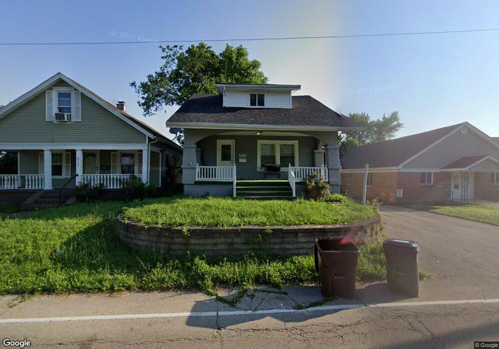
2115 Keenan Ave Dayton, OH 45414
Northridge NeighborhoodEstimated Value: $120,000 - $151,000
3
Beds
2
Baths
1,332
Sq Ft
$104/Sq Ft
Est. Value
About This Home
This home is located at 2115 Keenan Ave, Dayton, OH 45414 and is currently estimated at $138,453, approximately $103 per square foot. 2115 Keenan Ave is a home located in Montgomery County with nearby schools including Northridge High School, Horizon Science Academy-Dayton Elementary School, and Deca Prep.
Ownership History
Date
Name
Owned For
Owner Type
Purchase Details
Closed on
Jan 21, 2022
Sold by
D & Coby Holdings Llc
Bought by
Runyon Samantha Nicole
Current Estimated Value
Home Financials for this Owner
Home Financials are based on the most recent Mortgage that was taken out on this home.
Original Mortgage
$117,727
Outstanding Balance
$109,123
Interest Rate
3.56%
Mortgage Type
FHA
Estimated Equity
$29,330
Purchase Details
Closed on
Dec 23, 2020
Sold by
Jenkins Theodore L and Jenkins Patricia A
Bought by
D & Coby Holdings Llc
Purchase Details
Closed on
May 15, 2018
Sold by
Jenkins Theodore L and Jenkins Patricia A
Bought by
Jenkins Theodore L and Jenkins Patricia A
Create a Home Valuation Report for This Property
The Home Valuation Report is an in-depth analysis detailing your home's value as well as a comparison with similar homes in the area
Home Values in the Area
Average Home Value in this Area
Purchase History
| Date | Buyer | Sale Price | Title Company |
|---|---|---|---|
| Runyon Samantha Nicole | $11,333 | Law Office Of Joseph C Lucas L | |
| D & Coby Holdings Llc | $16,600 | None Available | |
| Jenkins Theodore L | -- | None Available |
Source: Public Records
Mortgage History
| Date | Status | Borrower | Loan Amount |
|---|---|---|---|
| Open | Runyon Samantha Nicole | $117,727 | |
| Closed | Runyon Samantha Nicole | $5,995 |
Source: Public Records
Tax History Compared to Growth
Tax History
| Year | Tax Paid | Tax Assessment Tax Assessment Total Assessment is a certain percentage of the fair market value that is determined by local assessors to be the total taxable value of land and additions on the property. | Land | Improvement |
|---|---|---|---|---|
| 2024 | $2,198 | $27,100 | $3,790 | $23,310 |
| 2023 | $2,198 | $27,100 | $3,790 | $23,310 |
| 2022 | $1,414 | $12,920 | $2,710 | $10,210 |
| 2021 | $1,395 | $12,920 | $2,710 | $10,210 |
| 2020 | $1,413 | $12,920 | $2,710 | $10,210 |
| 2019 | $725 | $13,040 | $2,710 | $10,330 |
| 2018 | $743 | $13,040 | $2,710 | $10,330 |
| 2017 | $741 | $13,040 | $2,710 | $10,330 |
| 2016 | $631 | $12,360 | $2,710 | $9,650 |
| 2015 | $587 | $12,360 | $2,710 | $9,650 |
| 2014 | $587 | $12,360 | $2,710 | $9,650 |
| 2012 | -- | $14,170 | $3,750 | $10,420 |
Source: Public Records
Map
Nearby Homes
- 2124 Lodell Ave
- 2059 Neff Rd
- 3865 Hillmont Ave
- 2233 Ottello Ave
- 2320 Ottello Ave
- 2417 Neff Rd
- 1640 Pinecrest Dr
- 4400 Canyon Rd
- 2424 Ottello Ave
- 2585 Coronette Ave
- 3394 Lodge Ave Unit 3384
- 4404 Ross Ave
- 2171 Argray Dr
- 32 Stafford Ave
- 2216 Rector Ave
- 3815 Old Riverside Dr
- 1742 Eric Dr
- 4071 Old Riverside Dr
- 632 Redwood Ave
- 2412 Neva Dr
- 2111 Keenan Ave
- 2119 Keenan Ave
- 4402 Kenneth Ave
- 4414 Kenneth Ave
- 2112 Lodell Ave
- 2126 Keenan Ave
- 2116 Lodell Ave
- 2116 Keenan Ave
- 2120 Lodell Ave
- 2108 Lodell Ave
- 4422 Kenneth Ave
- 2025 Auburndale Ave
- 2035 Auburndale Ave
- 2029 Auburndale Ave
- 4401 Kenneth Ave
- 2136 Lodell Ave
- 4405 Kenneth Ave
- 2039 Auburndale Ave
- 2132 Lodell Ave
- 2015 Auburndale Ave