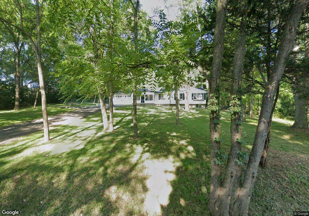
2115 Lamb Rd Carroll, OH 43112
Bloom NeighborhoodEstimated Value: $362,000 - $463,000
2
Beds
4
Baths
1,324
Sq Ft
$311/Sq Ft
Est. Value
About This Home
This home is located at 2115 Lamb Rd, Carroll, OH 43112 and is currently estimated at $411,328, approximately $310 per square foot. 2115 Lamb Rd is a home located in Fairfield County with nearby schools including Bloom Carroll Primary School, Bloom Carroll Intermediate School, and Bloom-Carroll Middle School.
Ownership History
Date
Name
Owned For
Owner Type
Purchase Details
Closed on
Aug 8, 2024
Sold by
Schottenstein Craig K
Bought by
Skinner Drew Michael and Neu Alexandra Carlisle
Current Estimated Value
Home Financials for this Owner
Home Financials are based on the most recent Mortgage that was taken out on this home.
Original Mortgage
$392,850
Outstanding Balance
$386,699
Interest Rate
6.95%
Mortgage Type
Credit Line Revolving
Estimated Equity
$24,629
Purchase Details
Closed on
Jul 24, 2024
Sold by
Schottenstein Craig K
Bought by
Skinner Drew Michael and Neu Alexandra Carlisle
Home Financials for this Owner
Home Financials are based on the most recent Mortgage that was taken out on this home.
Original Mortgage
$392,850
Outstanding Balance
$386,699
Interest Rate
6.95%
Mortgage Type
Credit Line Revolving
Estimated Equity
$24,629
Purchase Details
Closed on
Jun 9, 2023
Sold by
Moore Albert L
Bought by
Schottenstein Craig K
Purchase Details
Closed on
Jun 7, 2023
Sold by
Albert L Moore Family Trust
Bought by
Moore Albert L
Purchase Details
Closed on
Dec 3, 2021
Sold by
Horsley Terry Trowbridge and Jordan Michael
Bought by
Moore Albert L and The Albert L Moore Family Trus
Create a Home Valuation Report for This Property
The Home Valuation Report is an in-depth analysis detailing your home's value as well as a comparison with similar homes in the area
Home Values in the Area
Average Home Value in this Area
Purchase History
| Date | Buyer | Sale Price | Title Company |
|---|---|---|---|
| Skinner Drew Michael | $405,000 | None Listed On Document | |
| Skinner Drew Michael | $405,000 | None Listed On Document | |
| Schottenstein Craig K | -- | None Listed On Document | |
| Moore Albert L | -- | None Listed On Document | |
| Moore Albert L | $220,000 | None Available |
Source: Public Records
Mortgage History
| Date | Status | Borrower | Loan Amount |
|---|---|---|---|
| Open | Skinner Drew Michael | $392,850 | |
| Closed | Skinner Drew Michael | $392,850 |
Source: Public Records
Tax History
| Year | Tax Paid | Tax Assessment Tax Assessment Total Assessment is a certain percentage of the fair market value that is determined by local assessors to be the total taxable value of land and additions on the property. | Land | Improvement |
|---|---|---|---|---|
| 2025 | $7,362 | $121,160 | $43,230 | $77,930 |
| 2024 | $7,362 | $89,340 | $26,250 | $63,090 |
| 2023 | $3,410 | $78,700 | $26,250 | $52,450 |
| 2022 | $3,436 | $78,700 | $26,250 | $52,450 |
| 2021 | $2,713 | $57,390 | $21,000 | $36,390 |
| 2020 | $2,318 | $57,390 | $21,000 | $36,390 |
| 2019 | $2,333 | $57,390 | $21,000 | $36,390 |
| 2018 | $2,088 | $45,540 | $17,640 | $27,900 |
| 2017 | $1,968 | $52,810 | $16,800 | $36,010 |
| 2016 | $1,939 | $52,810 | $16,800 | $36,010 |
| 2015 | $1,853 | $49,690 | $16,800 | $32,890 |
| 2014 | $1,778 | $49,690 | $16,800 | $32,890 |
| 2013 | $1,778 | $49,690 | $16,800 | $32,890 |
Source: Public Records
Map
Nearby Homes
- 5715 Coonpath Rd NW
- 7195 Alspach Rd NW
- 3540 Carroll-Southern Rd NW
- 3510 Kauffman Rd NW
- 2155 Carroll-Southern Rd NW
- 10 Mount Zion Rd NW
- 4400 Kauffman Rd NW
- 3355 Old Columbus Rd NW
- 50 Market St
- 52 W Canal St
- 55 Betz Rd SW
- 7835 E Ohio State Ln NW
- 6920 Winchester Rd NW
- 7545 Royalton Rd SW
- 681 Mount Zion Rd SW
- 3076 Lithopolis Rd NW
- 8245 Royalton Rd SW
- 8322 Benson Rd
- 8667 Mount Union Ct NW
- 2445 Columbus Lancaster Rd NW Unit lot 274
- 2115 Lamb Rd
- 2020 Lamb Rd NW
- 2020 Lamb Rd
- 1975 Lamb Rd NW
- 6081 Plummer Rd
- 1975 Lamb Rd
- 6125 Plummer Rd
- 0 Lamb Rd NW Unit 2303250
- 0 Lamb Rd NW Unit Lot 4 2239264
- 0 Lamb Rd NW Unit Lot 2 2239251
- 0 Lamb Rd NW Unit Lot 3 2239260
- 0 Lamb Rd NW Unit L-1
- 1899 Lamb Rd
- 6205 Plummer Rd
- 0 Plummer Rd NW Unit Lot 5
- 6320 Plummer Rd
- 1829 Lamb Rd
- 1765 Lamb Rd
- 2350 Lamb Rd
- 6375 Plummer Rd
Your Personal Tour Guide
Ask me questions while you tour the home.