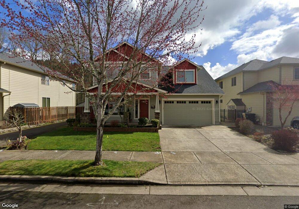
2115 Mayfly St Lebanon, OR 97355
Estimated Value: $506,951 - $543,000
4
Beds
3
Baths
2,346
Sq Ft
$224/Sq Ft
Est. Value
About This Home
This home is located at 2115 Mayfly St, Lebanon, OR 97355 and is currently estimated at $524,976, approximately $223 per square foot. 2115 Mayfly St is a home located in Linn County with nearby schools including Riverview School, Seven Oak Middle School, and Lebanon High School.
Ownership History
Date
Name
Owned For
Owner Type
Purchase Details
Closed on
Oct 27, 2011
Sold by
West Coast Bank
Bought by
Trowbridge Albert Roy and Trowbridge Marcie Carol
Current Estimated Value
Home Financials for this Owner
Home Financials are based on the most recent Mortgage that was taken out on this home.
Original Mortgage
$110,000
Outstanding Balance
$70,726
Interest Rate
2.87%
Mortgage Type
New Conventional
Estimated Equity
$454,250
Purchase Details
Closed on
May 28, 2008
Sold by
Hylland Brian G
Bought by
West Coast Bank
Purchase Details
Closed on
Aug 21, 2006
Sold by
Mountain River V Llc
Bought by
Hylland Brian G
Home Financials for this Owner
Home Financials are based on the most recent Mortgage that was taken out on this home.
Original Mortgage
$404,500
Interest Rate
6.7%
Mortgage Type
Purchase Money Mortgage
Create a Home Valuation Report for This Property
The Home Valuation Report is an in-depth analysis detailing your home's value as well as a comparison with similar homes in the area
Home Values in the Area
Average Home Value in this Area
Purchase History
| Date | Buyer | Sale Price | Title Company |
|---|---|---|---|
| Trowbridge Albert Roy | $205,000 | Amerititle | |
| West Coast Bank | $250,687 | Ticor Title | |
| Hylland Brian G | $150,000 | Lawyers Title Insurance Corp |
Source: Public Records
Mortgage History
| Date | Status | Borrower | Loan Amount |
|---|---|---|---|
| Open | Trowbridge Albert Roy | $110,000 | |
| Previous Owner | Hylland Brian G | $404,500 |
Source: Public Records
Tax History Compared to Growth
Tax History
| Year | Tax Paid | Tax Assessment Tax Assessment Total Assessment is a certain percentage of the fair market value that is determined by local assessors to be the total taxable value of land and additions on the property. | Land | Improvement |
|---|---|---|---|---|
| 2024 | $6,221 | $294,050 | -- | -- |
| 2023 | $6,020 | $285,490 | $0 | $0 |
| 2022 | $5,893 | $277,180 | $0 | $0 |
| 2021 | $5,683 | $269,110 | $0 | $0 |
| 2020 | $5,613 | $261,280 | $0 | $0 |
| 2019 | $5,259 | $253,670 | $0 | $0 |
| 2018 | $5,031 | $246,290 | $0 | $0 |
| 2017 | $4,621 | $239,120 | $0 | $0 |
| 2016 | $4,191 | $232,160 | $0 | $0 |
| 2015 | $4,033 | $225,400 | $0 | $0 |
| 2014 | $3,799 | $208,860 | $0 | $0 |
Source: Public Records
Map
Nearby Homes
- 2380 Mountain River Dr
- 2368 Kokanee Way
- 2351 Gleanns Way
- 2432 Robbins Way
- 2100 Park Dr
- 726 Cheadel Lake Ct
- 32008 Moss St
- 32763 Berlin Rd
- 732 Harmony St
- 371 Lydia Ln
- 357 Water's Edge Ct
- 301 Russell St
- 372 Jennings St
- 300 Water's Edge Ct
- 372 Berry St
- 0 S Santiam (Lot Unit 102) Hwy
- 2187 Mill St
- 653 E Elmore (Next To) St
- 0 Parcel 2 E Grant St
- 0 S Santiam Hwy Unit 321692493
- 2121 Mayfly St
- 2111 Mayfly St
- 2133 Mayfly St
- 2149 Mayfly St
- 2120 Mayfly St
- 2112 Mayfly St
- 2132 Mayfly St
- 2106 Mayfly St
- 2144 Mayfly St
- 2157 Mayfly St
- 2156 Mayfly St
- 2163 Mayfly St
- 2160 Mayfly St
- 2175 Mayfly St
- 2172 Mayfly St
- 2189 Mayfly St
- 2188 Mayfly St
- 2193 Mayfly St
- 2194 Mayfly St
- 1021 Mountain River Dr