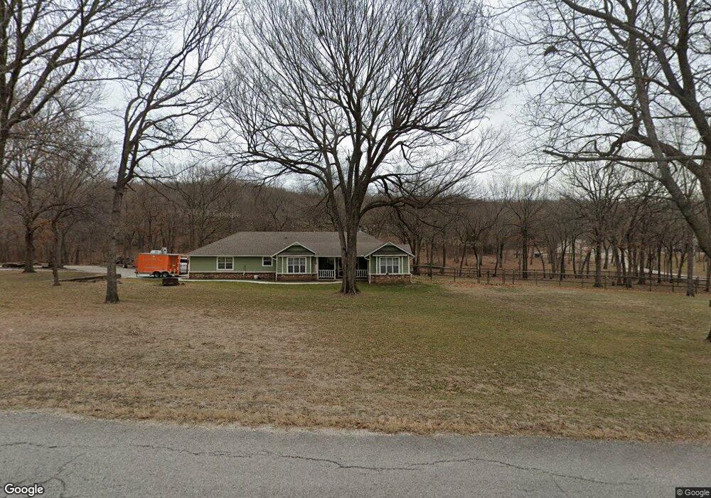
2115 N 55th West Ave Skiatook, OK 74070
Estimated Value: $282,454 - $351,000
3
Beds
2
Baths
1,905
Sq Ft
$165/Sq Ft
Est. Value
About This Home
This home is located at 2115 N 55th West Ave, Skiatook, OK 74070 and is currently estimated at $313,864, approximately $164 per square foot. 2115 N 55th West Ave is a home located in Osage County with nearby schools including Marrs Elementary School, Newman Middle School, and Skiatook High School.
Ownership History
Date
Name
Owned For
Owner Type
Purchase Details
Closed on
Mar 21, 2017
Sold by
Margaret E Loveall
Bought by
Pattillo Nathan
Current Estimated Value
Home Financials for this Owner
Home Financials are based on the most recent Mortgage that was taken out on this home.
Original Mortgage
$166,250
Outstanding Balance
$137,704
Interest Rate
4.3%
Estimated Equity
$176,160
Purchase Details
Closed on
Apr 28, 2003
Sold by
Brodie John B and Brodie Terrie L
Bought by
Loveall Margaret E
Create a Home Valuation Report for This Property
The Home Valuation Report is an in-depth analysis detailing your home's value as well as a comparison with similar homes in the area
Home Values in the Area
Average Home Value in this Area
Purchase History
| Date | Buyer | Sale Price | Title Company |
|---|---|---|---|
| Pattillo Nathan | -- | -- | |
| Loveall Margaret E | $165,000 | -- |
Source: Public Records
Mortgage History
| Date | Status | Borrower | Loan Amount |
|---|---|---|---|
| Open | Pattillo Nathan | $166,250 | |
| Closed | Pattillo Nathan | -- |
Source: Public Records
Tax History Compared to Growth
Tax History
| Year | Tax Paid | Tax Assessment Tax Assessment Total Assessment is a certain percentage of the fair market value that is determined by local assessors to be the total taxable value of land and additions on the property. | Land | Improvement |
|---|---|---|---|---|
| 2025 | $2,617 | $26,294 | $3,781 | $22,513 |
| 2024 | $2,500 | $25,042 | $3,601 | $21,441 |
| 2023 | $2,500 | $24,317 | $3,601 | $20,716 |
| 2022 | $2,294 | $22,056 | $3,601 | $18,455 |
| 2021 | $2,192 | $22,056 | $3,601 | $18,455 |
| 2020 | $2,100 | $21,006 | $3,601 | $17,405 |
| 2019 | $2,126 | $21,006 | $3,601 | $17,405 |
| 2018 | $2,118 | $21,006 | $3,601 | $17,405 |
| 2017 | $2,091 | $21,438 | $3,601 | $17,837 |
| 2016 | $2,056 | $21,023 | $3,601 | $17,422 |
| 2015 | $2,040 | $21,023 | $3,601 | $17,422 |
| 2014 | $1,939 | $21,023 | $3,601 | $17,422 |
| 2013 | $2,036 | $21,022 | $3,601 | $17,421 |
Source: Public Records
Map
Nearby Homes
- 5694 W 161st St N
- 15524 N 55th West Ave
- 5117 Woodland Dr
- 15439 N 55th West Ave
- 15823 Colonial Ln
- 15971 Munson Ct
- 16561 N 56th West Ave
- 5854 W 168th St N
- 101 N Castle St
- 103 N Phillips St
- 4 N 52nd West Ave
- 8 N 52nd West Ave
- 3 N 52nd West Ave
- 5 N 52nd West Ave
- 2 N 52nd West Ave
- 2 N Phillips St
- 1 N Phillips St
- 3 N Phillips St
- 0 W Rogers Blvd Unit 2543424
- 501 Maplewood Ln
- 15827 N 55th West Ave
- 1755 55th W
- 1895 55th W
- 15860 N Javine Hill Rd
- 15850 N Javine Hill Rd
- 15900 N 55th West Ave
- 15777 N 55th West Ave
- 15645 N 55th West Ave
- 15822 N 55th West Ave
- 15976 N Javine Hill Rd
- 15776 N 55th West Ave
- 15715 N 55th West Ave
- 15926 N 55th West Ave
- 15926 N 55th West Ave
- 15726 N 55th West Ave
- 15973 N Javine Hill Rd
- 5746 W 161st St N
- 2 Horizon Dr
- 5746 W 161st St N
- 15727 N 55th West Ave