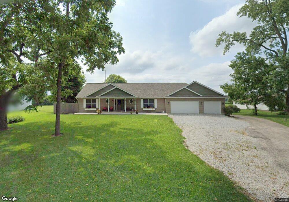
2115 S Union Rd Medway, OH 45341
Estimated Value: $136,000 - $431,317
3
Beds
3
Baths
1,976
Sq Ft
$161/Sq Ft
Est. Value
About This Home
This home is located at 2115 S Union Rd, Medway, OH 45341 and is currently estimated at $318,329, approximately $161 per square foot. 2115 S Union Rd is a home located in Clark County with nearby schools including Donnelsville Elementary School, Park Layne Elementary School, and New Carlisle Elementary School.
Ownership History
Date
Name
Owned For
Owner Type
Purchase Details
Closed on
Jul 22, 1997
Sold by
Measer Malinda
Bought by
Measel Shawn E and Measel Nicholette R
Current Estimated Value
Home Financials for this Owner
Home Financials are based on the most recent Mortgage that was taken out on this home.
Original Mortgage
$49,500
Interest Rate
7.94%
Mortgage Type
New Conventional
Create a Home Valuation Report for This Property
The Home Valuation Report is an in-depth analysis detailing your home's value as well as a comparison with similar homes in the area
Home Values in the Area
Average Home Value in this Area
Purchase History
| Date | Buyer | Sale Price | Title Company |
|---|---|---|---|
| Measel Shawn E | $63,000 | -- |
Source: Public Records
Mortgage History
| Date | Status | Borrower | Loan Amount |
|---|---|---|---|
| Closed | Measel Shawn E | $49,500 |
Source: Public Records
Tax History Compared to Growth
Tax History
| Year | Tax Paid | Tax Assessment Tax Assessment Total Assessment is a certain percentage of the fair market value that is determined by local assessors to be the total taxable value of land and additions on the property. | Land | Improvement |
|---|---|---|---|---|
| 2024 | $5,008 | $104,200 | $10,910 | $93,290 |
| 2023 | $5,008 | $104,200 | $10,910 | $93,290 |
| 2022 | $7,777 | $104,200 | $10,910 | $93,290 |
| 2021 | $4,255 | $80,800 | $8,330 | $72,470 |
| 2020 | $4,266 | $80,800 | $8,330 | $72,470 |
| 2019 | $4,384 | $80,800 | $8,330 | $72,470 |
| 2018 | $3,820 | $66,540 | $8,330 | $58,210 |
| 2017 | $3,796 | $66,536 | $8,327 | $58,209 |
| 2016 | $3,641 | $66,536 | $8,327 | $58,209 |
| 2015 | $463 | $14,844 | $8,327 | $6,517 |
| 2014 | $2,648 | $46,981 | $8,327 | $38,654 |
| 2013 | $1,393 | $46,981 | $8,327 | $38,654 |
Source: Public Records
Map
Nearby Homes
- 1225 Whaley Rd
- 10265 W Union Rd
- 18 Sunset Dr
- 14 Sunset Dr
- 204 E Main St
- 113 W Main St
- 738 S Medway Carlisle Rd
- 15 Tulip Rd
- 518 Beach Dr
- 2960 Lake Rd
- 326 Kennedy Dr
- 423 Sycamore Rd
- 429 Tulip Rd
- 522 Caldwell Cir
- 956 Styer Dr
- 851 Corvette Ave
- 870 Corvette Ave
- 1124 Burket Dr
- 11315 W National Rd
- 1115 Frayne Dr
- 2095 S Union Rd
- 2147 S Union Rd
- 2053 S Union Rd
- 2118 S Union Rd
- 2090 S Union Rd
- 9680 Willis Way
- 2066 S Union Rd
- 9690 Willis Way
- 2025 S Union Rd
- 9612 Lower Valley Pike
- 9504 Lower Valley Pike
- 9571 Lower Valley Pike
- 9470 Lower Valley Pike
- 9538 Lower Valley Pike
- 9558 Lower Valley Pike
- 9578 Lower Valley Pike
- 9517 Lower Valley Pike
- 9541 Lower Valley Pike
- 9439 Lower Valley Pike
- 9440 Lower Valley Pike