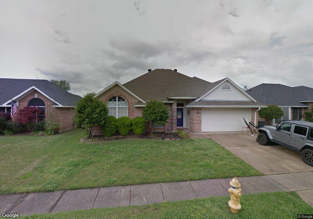
2115 Starling Dr Bossier City, LA 71111
Estimated Value: $236,000 - $250,000
3
Beds
2
Baths
1,625
Sq Ft
$150/Sq Ft
Est. Value
About This Home
This home is located at 2115 Starling Dr, Bossier City, LA 71111 and is currently estimated at $243,382, approximately $149 per square foot. 2115 Starling Dr is a home located in Bossier Parish with nearby schools including Stockwell Place Elementary School, Cope Middle School, and Airline High School.
Ownership History
Date
Name
Owned For
Owner Type
Purchase Details
Closed on
Dec 6, 2006
Sold by
Malcolm David Cameron
Bought by
Morgan David Wayne and Morgan Jana Jere
Current Estimated Value
Home Financials for this Owner
Home Financials are based on the most recent Mortgage that was taken out on this home.
Original Mortgage
$162,000
Outstanding Balance
$109,947
Interest Rate
8.9%
Mortgage Type
Adjustable Rate Mortgage/ARM
Estimated Equity
$133,435
Create a Home Valuation Report for This Property
The Home Valuation Report is an in-depth analysis detailing your home's value as well as a comparison with similar homes in the area
Home Values in the Area
Average Home Value in this Area
Purchase History
| Date | Buyer | Sale Price | Title Company |
|---|---|---|---|
| Morgan David Wayne | $162,000 | None Available |
Source: Public Records
Mortgage History
| Date | Status | Borrower | Loan Amount |
|---|---|---|---|
| Open | Morgan David Wayne | $162,000 |
Source: Public Records
Tax History Compared to Growth
Tax History
| Year | Tax Paid | Tax Assessment Tax Assessment Total Assessment is a certain percentage of the fair market value that is determined by local assessors to be the total taxable value of land and additions on the property. | Land | Improvement |
|---|---|---|---|---|
| 2024 | $1,621 | $19,520 | $3,000 | $16,520 |
| 2023 | $1,288 | $16,081 | $2,450 | $13,631 |
| 2022 | $920 | $16,081 | $2,450 | $13,631 |
| 2021 | $363 | $16,081 | $2,450 | $13,631 |
| 2020 | $919 | $16,081 | $2,450 | $13,631 |
| 2019 | $940 | $16,150 | $2,320 | $13,830 |
| 2018 | $940 | $16,150 | $2,320 | $13,830 |
| 2017 | $1,296 | $16,150 | $2,320 | $13,830 |
| 2016 | $1,296 | $16,150 | $2,320 | $13,830 |
| 2015 | $369 | $16,210 | $2,320 | $13,890 |
| 2014 | $369 | $16,210 | $2,320 | $13,890 |
Source: Public Records
Map
Nearby Homes
- 2050 Stockwell Rd Unit 4
- 2111 Middle Creek Blvd
- 2112 Sandhurst St
- 2212 Middle Creek Blvd
- 5908 Stockwood St
- 5900 Stockwood St
- 2198 Stockwell Rd
- 5909 Clearview Cir
- 6010 Inglewood Ct
- 5524 Hickory Ridge Dr
- 537 Dogwood Ln S
- 6019 Ellington Way
- 5900 Applegate Cir
- 6020 Braeburn Ct
- 524 Dogwood Ln S
- 5526 Lake Side Dr
- 5505 Hickory Ridge Dr
- 2320 Windsor Ct
- 2319 Windsor Ct
- 6001 Pepperwood Cir
- 2113 Starling Dr
- 2117 Starling Dr
- 2112 Mockingbird Ln
- 2111 Starling Dr
- 2110 Mockingbird Ln
- 2114 Mockingbird Ln
- 2108 Mockingbird Ln
- 2118 Starling Dr
- 2116 Starling Dr
- 2109 Starling Dr
- 2114 Starling Dr
- 2120 Starling Dr
- 2106 Mockingbird Ln
- 6009 Cardinal Ln
- 6007 Cardinal Ln
- 2112 Starling Dr
- 6003 Cardinal Ln
- 2107 Starling Dr
- 6011 Cardinal Ln
- 6005 Cardinal Ln