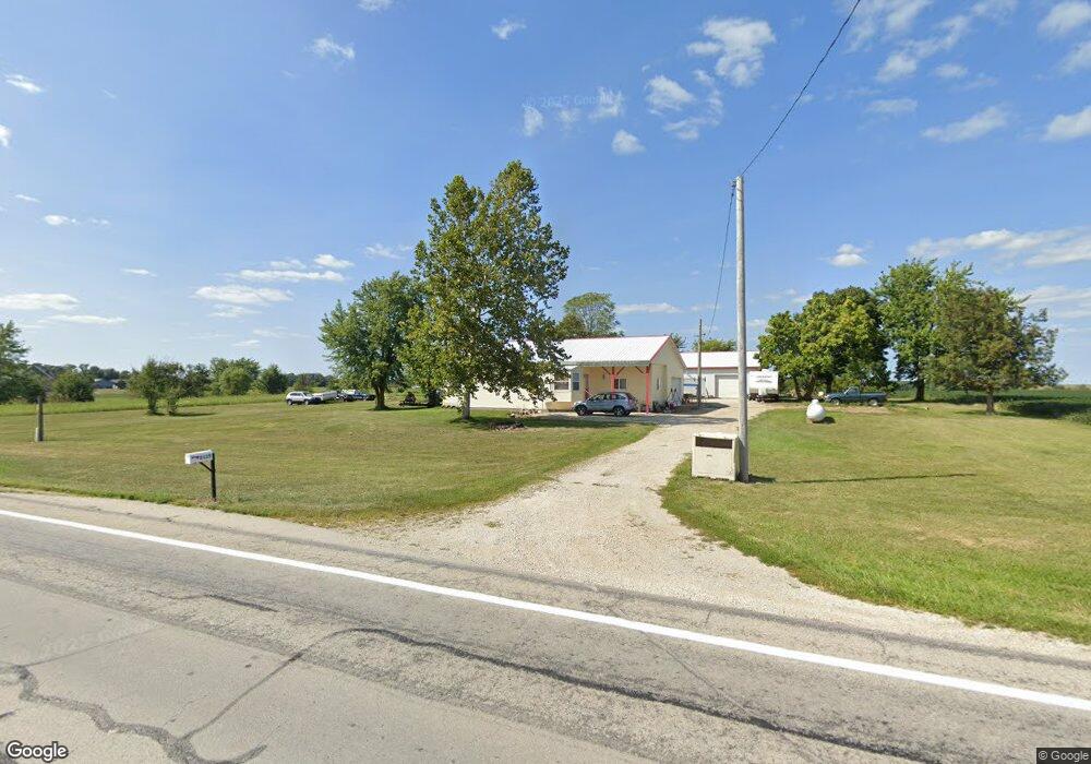
2115 State Route 29 Celina, OH 45822
Estimated Value: $88,000 - $254,000
3
Beds
2
Baths
1,531
Sq Ft
$122/Sq Ft
Est. Value
About This Home
This home is located at 2115 State Route 29, Celina, OH 45822 and is currently estimated at $187,478, approximately $122 per square foot. 2115 State Route 29 is a home located in Mercer County with nearby schools including Celina Middle School and Celina High School.
Ownership History
Date
Name
Owned For
Owner Type
Purchase Details
Closed on
Feb 25, 2025
Sold by
Feierstein Rosemary D
Bought by
Anderson Micheal G and Anderson Danielle L
Current Estimated Value
Purchase Details
Closed on
Nov 15, 2013
Sold by
Feierstein Ricky L and Feierstein Rosemary D
Bought by
Feierstein Ricky L and Feierstein Rosemary D
Purchase Details
Closed on
Sep 11, 1995
Bought by
Feierstein Ricky and Feierstein Rosemary
Create a Home Valuation Report for This Property
The Home Valuation Report is an in-depth analysis detailing your home's value as well as a comparison with similar homes in the area
Home Values in the Area
Average Home Value in this Area
Purchase History
| Date | Buyer | Sale Price | Title Company |
|---|---|---|---|
| Anderson Micheal G | $99,166 | None Listed On Document | |
| Feierstein Ricky L | -- | Attorney | |
| Feierstein Ricky | $46,500 | -- |
Source: Public Records
Tax History Compared to Growth
Tax History
| Year | Tax Paid | Tax Assessment Tax Assessment Total Assessment is a certain percentage of the fair market value that is determined by local assessors to be the total taxable value of land and additions on the property. | Land | Improvement |
|---|---|---|---|---|
| 2024 | $2,192 | $54,220 | $10,750 | $43,470 |
| 2023 | $2,192 | $54,220 | $10,750 | $43,470 |
| 2022 | $1,776 | $37,840 | $9,070 | $28,770 |
| 2021 | $1,781 | $37,840 | $9,070 | $28,770 |
| 2020 | $1,505 | $37,840 | $9,070 | $28,770 |
| 2019 | $1,415 | $33,330 | $8,160 | $25,170 |
| 2018 | $1,381 | $31,260 | $8,160 | $23,100 |
| 2017 | $1,411 | $32,000 | $8,160 | $23,840 |
| 2016 | $1,310 | $30,070 | $6,510 | $23,560 |
| 2015 | $1,274 | $30,070 | $6,510 | $23,560 |
| 2014 | $1,571 | $37,030 | $6,510 | $30,520 |
| 2013 | $928 | $19,850 | $7,630 | $12,220 |
Source: Public Records
Map
Nearby Homes
- 2332 State Route 29
- 6699 Gause Rd
- 6799 Debra Ave
- 0 Anderson 13&14 & Roadway 12&13 Unit 1037886
- 1291 State Route 219
- 0 Anderson Lots 10 11 & 12 Ln Unit 1037885
- 0 Springer 1-6 & Roadway 14-16 Unit 1037883
- 4640 Sierra Dr
- 6764 Silver Lakes Dr
- 912 Emerald Ave
- 821 Butler St
- 820 Mary Ln
- 401 N Cedar St
- 501 N 2nd St
- 721 Lilac Dr
- 314 E North St
- 402 E Elizabeth St
- 420 S 1st St
- 1101 Timothy Ln
- 426 E Walnut St
- 2077 State Route 29
- 2189 State Route 29
- 6790 Burrville Rd
- 6808 Burrville Rd
- 6860 Burrville Rd
- 1901 State Route 29
- 2341 State Route 29
- 6957 Burrville Rd
- 1871 State Route 29
- 7019 Burrville Rd
- 2404 State Route 29
- 1890 Schroeder Rd
- 1874 Schroeder Rd
- 2492 State Route 29
- 2492 Ohio 29
- 1729 State Route 29
- 6659 Erastus Durbin Rd
- 6623 Erastus Durbin Rd
- 1703 State Route 29