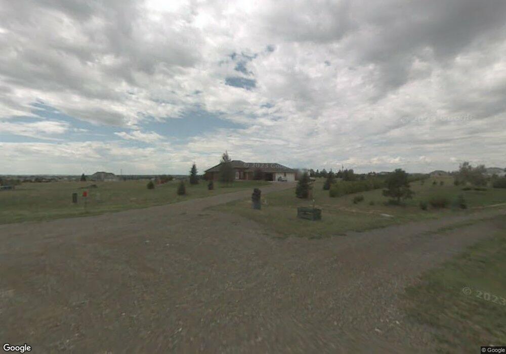
2115 Summerhill Ct Cheyenne, WY 82009
Ranchettes NeighborhoodEstimated Value: $597,000 - $779,000
Studio
--
Bath
2,384
Sq Ft
$290/Sq Ft
Est. Value
About This Home
This home is located at 2115 Summerhill Ct, Cheyenne, WY 82009 and is currently estimated at $691,187, approximately $289 per square foot. 2115 Summerhill Ct is a home located in Laramie County with nearby schools including Prairie Wind Elementary School, McCormick Junior High School, and Central High School.
Ownership History
Date
Name
Owned For
Owner Type
Purchase Details
Closed on
May 9, 2025
Sold by
Stephens James A and Stephens Laura A
Bought by
Jas Revocable Trust and Stephens
Current Estimated Value
Purchase Details
Closed on
Jul 13, 1998
Sold by
Hayes Construction Inc
Bought by
Stephens James A and Stephens Laura A
Home Financials for this Owner
Home Financials are based on the most recent Mortgage that was taken out on this home.
Original Mortgage
$130,000
Interest Rate
7.08%
Create a Home Valuation Report for This Property
The Home Valuation Report is an in-depth analysis detailing your home's value as well as a comparison with similar homes in the area
Home Values in the Area
Average Home Value in this Area
Purchase History
| Date | Buyer | Sale Price | Title Company |
|---|---|---|---|
| Jas Revocable Trust | -- | None Listed On Document | |
| Jas Revocable Trust | -- | None Listed On Document | |
| Stephens James A | -- | -- |
Source: Public Records
Mortgage History
| Date | Status | Borrower | Loan Amount |
|---|---|---|---|
| Previous Owner | Stephens James A | $130,000 |
Source: Public Records
Tax History
| Year | Tax Paid | Tax Assessment Tax Assessment Total Assessment is a certain percentage of the fair market value that is determined by local assessors to be the total taxable value of land and additions on the property. | Land | Improvement |
|---|---|---|---|---|
| 2025 | $4,305 | $34,572 | $5,932 | $28,640 |
| 2024 | $4,305 | $64,053 | $11,865 | $52,188 |
| 2023 | $3,748 | $57,043 | $11,865 | $45,178 |
| 2022 | $3,389 | $50,444 | $11,865 | $38,579 |
| 2021 | $3,076 | $45,675 | $9,719 | $35,956 |
| 2020 | $3,041 | $45,291 | $9,719 | $35,572 |
| 2019 | $2,891 | $43,026 | $9,719 | $33,307 |
| 2018 | $2,605 | $39,163 | $7,068 | $32,095 |
| 2017 | $2,577 | $38,359 | $6,835 | $31,524 |
| 2016 | $2,562 | $38,122 | $6,603 | $31,519 |
| 2015 | $2,486 | $36,980 | $6,603 | $30,377 |
| 2014 | $2,485 | $36,714 | $6,603 | $30,111 |
Source: Public Records
Map
Nearby Homes
- 1685 Moriah Ln
- 8917 Powderhouse Rd
- 9317 Kersey Dr
- 1711 Concha Loop
- 10718 W Polo Place
- 600 E Mustang Rd
- 714 E Ole Maverick Rd
- 5124 Sullivan St
- 252 E Idaho St
- 8322 Stoneridge Dr
- 1226 Wendy Ln
- 1214 Alyssa Way
- Lot 7 W Ole Maverick Rd
- Lot 6 W Ole Maverick Rd
- Lot 3 W Ole Maverick Rd
- 2593 Mccrae Rd
- Lot 15 Buckskin Trail
- 713 Gabriel Ct
- 6712 Big Sky Trail
- 7308 Legacy Pkwy
- 2223 Summerhill Ct
- 2120 Summerhill Ct
- 10110 Branding Iron Dr
- 2226 Summerhill Ct
- 10115 Branding Iron Dr
- 10121 Branding Iron Dr
- 2139 Iron Mountain Rd
- 10102 Branding Iron Dr
- 10115 Branding Iron D
- 10205 Powderhouse Rd
- 10319 Powderhouse Rd
- 10510 Powderhouse Rd
- 10107 Branding Iron Dr
- 10115 Powderhouse Rd
- 10413 Powderhouse Rd
- 10105 Carbine Trail
- 10513 Powderhouse Rd
- 10056 Branding Iron Dr
- 10003 Carbine Trail
- 10019 Branding Iron Dr
Your Personal Tour Guide
Ask me questions while you tour the home.