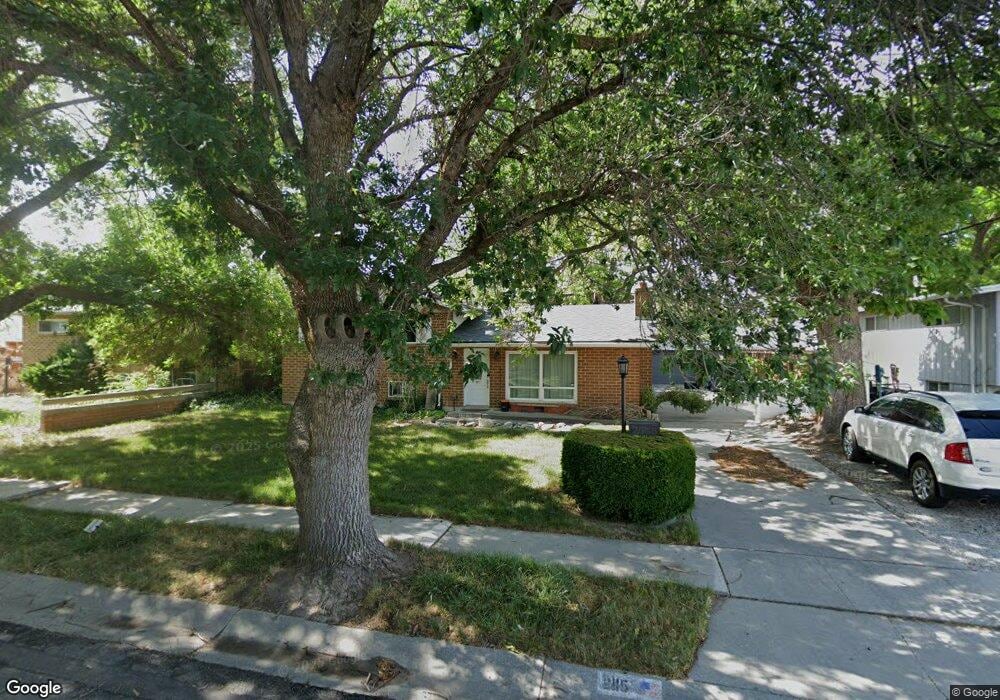
2115 Theckston Rd Salt Lake City, UT 84129
Estimated Value: $421,000 - $468,000
4
Beds
2
Baths
1,125
Sq Ft
$402/Sq Ft
Est. Value
About This Home
This home is located at 2115 Theckston Rd, Salt Lake City, UT 84129 and is currently estimated at $451,972, approximately $401 per square foot. 2115 Theckston Rd is a home located in Salt Lake County with nearby schools including Taylorsville Elementary School, Eisenhower Jr High School, and Taylorsville High School.
Ownership History
Date
Name
Owned For
Owner Type
Purchase Details
Closed on
Aug 9, 2017
Sold by
Munro Carol A
Bought by
Munro J Chris
Current Estimated Value
Purchase Details
Closed on
Sep 15, 2006
Sold by
Rogerson Christopher L and Rogerson Monica Gomez
Bought by
Munro J Chris and Munro Carol A
Purchase Details
Closed on
Jan 11, 1996
Sold by
Shosted Sterling K and Shosted Tessie Marie
Bought by
Rogerson Christopher L and Rogerson Monica Gomez
Home Financials for this Owner
Home Financials are based on the most recent Mortgage that was taken out on this home.
Original Mortgage
$103,425
Interest Rate
7.38%
Mortgage Type
FHA
Create a Home Valuation Report for This Property
The Home Valuation Report is an in-depth analysis detailing your home's value as well as a comparison with similar homes in the area
Home Values in the Area
Average Home Value in this Area
Purchase History
| Date | Buyer | Sale Price | Title Company |
|---|---|---|---|
| Munro J Chris | -- | None Available | |
| Munro J Chris | -- | Title One | |
| Rogerson Christopher L | -- | -- |
Source: Public Records
Mortgage History
| Date | Status | Borrower | Loan Amount |
|---|---|---|---|
| Previous Owner | Rogerson Christopher L | $103,425 |
Source: Public Records
Tax History Compared to Growth
Tax History
| Year | Tax Paid | Tax Assessment Tax Assessment Total Assessment is a certain percentage of the fair market value that is determined by local assessors to be the total taxable value of land and additions on the property. | Land | Improvement |
|---|---|---|---|---|
| 2025 | $2,434 | $415,200 | $100,500 | $314,700 |
| 2024 | $2,434 | $399,200 | $96,200 | $303,000 |
| 2023 | $2,258 | $363,200 | $92,500 | $270,700 |
| 2022 | $2,209 | $358,500 | $90,700 | $267,800 |
| 2021 | $2,070 | $292,500 | $69,800 | $222,700 |
| 2020 | $1,933 | $258,600 | $62,000 | $196,600 |
| 2019 | $1,915 | $250,100 | $62,000 | $188,100 |
| 2018 | $1,744 | $219,600 | $62,000 | $157,600 |
| 2017 | $1,458 | $193,000 | $59,000 | $134,000 |
| 2016 | $1,395 | $178,400 | $59,000 | $119,400 |
| 2015 | $1,349 | $166,700 | $74,400 | $92,300 |
| 2014 | $1,288 | $156,400 | $70,500 | $85,900 |
Source: Public Records
Map
Nearby Homes
- 1998 Theckston Rd
- 2267 W 4240 S
- 2258 W 4185 S
- 2221 W Davenshire Ln
- 2218 W Mackay Ln
- 2318 W 4220 S
- 4257 S Morris St
- 1901 Kirkham Way
- 1762 Mantle Ave
- 2409 W Hardrock Dr
- 2451 Hard Rock Cir S
- 1854 W 4100 S
- 4497 S Edgeware Ln
- 4255 S Redwood Rd W
- 4533 S Knightsbridge Rd
- 4111 S Greyhackle Ln
- 4107 S Greyhackle Ln
- 4188 S Oak Meadows Dr Unit 21
- 4077 Tralee Cir
- 4153 S 2700 W Unit 1G
- 2115 W Theckston Rd
- 2097 Theckston Rd
- 2131 Theckston Rd
- 2116 Condie Dr
- 4281 Mackay Dr
- 2100 W Condie Dr
- 2100 Condie Dr
- 2081 Theckston Rd
- 2116 W Theckston Rd
- 2116 Theckston Rd
- 4253 Mackay Dr
- 2100 Theckston Rd
- 2100 W Theckston Rd
- 2084 Condie Dr
- 2084 W Condie Dr
- 4278 Mackay Dr
- 4268 Mackay Dr
- 2084 Theckston Rd
- 4278 S Mackay Dr
- 2063 Theckston Rd