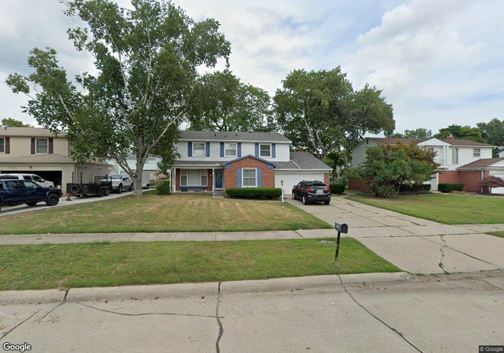
21150 Independence Dr Southfield, MI 48076
Estimated Value: $354,000 - $438,000
4
Beds
4
Baths
2,778
Sq Ft
$144/Sq Ft
Est. Value
About This Home
This home is located at 21150 Independence Dr, Southfield, MI 48076 and is currently estimated at $399,265, approximately $143 per square foot. 21150 Independence Dr is a home located in Oakland County with nearby schools including Alice M. Birney K-8 School, Southfield Christian School, and Yeshivas Darchei Torah.
Ownership History
Date
Name
Owned For
Owner Type
Purchase Details
Closed on
Oct 17, 2022
Sold by
Ligon Kenneth S and Ligon Patricia R
Bought by
Ligon Patricia R and Ligon Kenneth S
Current Estimated Value
Purchase Details
Closed on
Dec 7, 1999
Sold by
Thomas Raymond
Bought by
Ligon Kenneth S
Purchase Details
Closed on
Jan 29, 1997
Sold by
Battle Gerald
Bought by
Thomas Raymond G
Home Financials for this Owner
Home Financials are based on the most recent Mortgage that was taken out on this home.
Original Mortgage
$153,000
Interest Rate
7.73%
Mortgage Type
Purchase Money Mortgage
Create a Home Valuation Report for This Property
The Home Valuation Report is an in-depth analysis detailing your home's value as well as a comparison with similar homes in the area
Home Values in the Area
Average Home Value in this Area
Purchase History
| Date | Buyer | Sale Price | Title Company |
|---|---|---|---|
| Ligon Patricia R | -- | -- | |
| Ligon Kenneth S | $225,000 | -- | |
| Thomas Raymond G | $170,000 | -- |
Source: Public Records
Mortgage History
| Date | Status | Borrower | Loan Amount |
|---|---|---|---|
| Previous Owner | Thomas Raymond G | $153,000 | |
| Closed | Ligon Kenneth S | -- |
Source: Public Records
Tax History Compared to Growth
Tax History
| Year | Tax Paid | Tax Assessment Tax Assessment Total Assessment is a certain percentage of the fair market value that is determined by local assessors to be the total taxable value of land and additions on the property. | Land | Improvement |
|---|---|---|---|---|
| 2022 | $4,224 | $149,750 | $28,190 | $121,560 |
| 2021 | $4,373 | $137,500 | $22,940 | $114,560 |
| 2020 | $3,803 | $129,450 | $19,610 | $109,840 |
| 2018 | $4,503 | $106,700 | $19,610 | $87,090 |
| 2015 | -- | $81,690 | $0 | $0 |
| 2014 | -- | $66,690 | $0 | $0 |
| 2011 | -- | $66,990 | $0 | $0 |
Source: Public Records
Map
Nearby Homes
- 21140 Winchester St
- 21330 Winchester St
- 21440 Constitution St
- 20780 Wayland St
- 27925 Arlington Dr
- 21361 Andover Rd
- 28330 Lahser Rd
- 27249 Nantucket Dr
- 20351 Lacrosse Ave
- 21731 Concord St
- 28450 Tapert Dr
- 20345 Harbor Ln
- 000 Pontiac Trail
- 20120 Covington Pkwy
- 21901 Concord St
- 20141 Lacrosse Ave
- 22300 Ivanhoe Ln
- 27430 Evergreen Rd Unit 36
- 22465 Kenwyck Dr
- 29140 Briarbank Ct
- 21120 Independence Dr
- 21180 Independence Dr
- 20990 Independence Dr
- 21145 Glenmorra St
- 21115 Glenmorra St
- 21175 Glenmorra St
- 21210 Independence Dr
- 20985 Glenmorra St
- 21115 Independence Dr
- 21145 Independence Dr
- 20980 Independence Dr
- 21175 Independence Dr
- 21205 Glenmorra St
- 20975 Glenmorra St
- 20985 Independence Dr
- 21205 Independence Dr
- 20975 Independence Dr
- 20965 Glenmorra St
- 21150 Constitution St
- 20970 Independence Dr