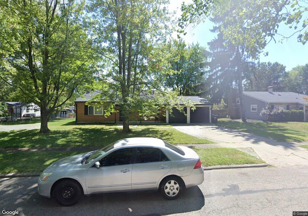
2116 Carol Pkwy Dayton, OH 45440
Estimated Value: $253,000 - $267,000
4
Beds
2
Baths
1,794
Sq Ft
$144/Sq Ft
Est. Value
About This Home
This home is located at 2116 Carol Pkwy, Dayton, OH 45440 and is currently estimated at $259,162, approximately $144 per square foot. 2116 Carol Pkwy is a home located in Montgomery County with nearby schools including John F. Kennedy Elementary School, Kettering Middle School, and Kettering Fairmont High School.
Ownership History
Date
Name
Owned For
Owner Type
Purchase Details
Closed on
Jan 31, 2008
Sold by
Katzenbach Karen S
Bought by
Montemore Sarah M
Current Estimated Value
Home Financials for this Owner
Home Financials are based on the most recent Mortgage that was taken out on this home.
Original Mortgage
$128,976
Interest Rate
5.93%
Mortgage Type
FHA
Purchase Details
Closed on
Jun 30, 2003
Sold by
Holloway Christopher J and Ramnath Urmila
Bought by
Katzenbach Karen S
Home Financials for this Owner
Home Financials are based on the most recent Mortgage that was taken out on this home.
Original Mortgage
$108,700
Interest Rate
5.36%
Mortgage Type
Purchase Money Mortgage
Purchase Details
Closed on
Dec 15, 1998
Sold by
Freida Osman
Bought by
Holloway Christopher J
Create a Home Valuation Report for This Property
The Home Valuation Report is an in-depth analysis detailing your home's value as well as a comparison with similar homes in the area
Home Values in the Area
Average Home Value in this Area
Purchase History
| Date | Buyer | Sale Price | Title Company |
|---|---|---|---|
| Montemore Sarah M | $131,000 | Evans Title Agency Inc | |
| Katzenbach Karen S | $135,900 | -- | |
| Holloway Christopher J | $109,900 | -- | |
| Holloway Christopher J | $109,900 | -- |
Source: Public Records
Mortgage History
| Date | Status | Borrower | Loan Amount |
|---|---|---|---|
| Previous Owner | Montemore Sarah M | $128,976 | |
| Previous Owner | Katzenbach Karen S | $108,700 |
Source: Public Records
Tax History Compared to Growth
Tax History
| Year | Tax Paid | Tax Assessment Tax Assessment Total Assessment is a certain percentage of the fair market value that is determined by local assessors to be the total taxable value of land and additions on the property. | Land | Improvement |
|---|---|---|---|---|
| 2024 | $4,205 | $67,820 | $16,580 | $51,240 |
| 2023 | $4,205 | $67,820 | $16,580 | $51,240 |
| 2022 | $3,960 | $50,490 | $12,370 | $38,120 |
| 2021 | $3,662 | $50,490 | $12,370 | $38,120 |
| 2020 | $3,675 | $50,490 | $12,370 | $38,120 |
| 2019 | $3,540 | $43,020 | $11,260 | $31,760 |
| 2018 | $3,559 | $43,020 | $11,260 | $31,760 |
| 2017 | $3,278 | $43,020 | $11,260 | $31,760 |
| 2016 | $3,072 | $37,870 | $11,260 | $26,610 |
| 2015 | $2,935 | $37,870 | $11,260 | $26,610 |
| 2014 | $2,935 | $37,870 | $11,260 | $26,610 |
| 2012 | -- | $43,000 | $11,350 | $31,650 |
Source: Public Records
Map
Nearby Homes
- 2217 Westlawn Dr
- 1968 Carol Pkwy
- 2169 Broadbent Way
- 2184 Broadbent Way
- 4508 Rean Meadow Dr
- 5195 Bigger Rd
- 2405 Westlawn Dr
- 2313 Glenheath Dr
- 2386 E Rahn Rd
- 2360 E Rahn Rd
- 2318 E Rahn Rd
- 4824 Rean Meadow Dr
- 4533 Drayton Ct
- 4464 Woodner Dr
- 2648 Parklawn Dr
- 4370 Wilmington Pike
- 5267 Newell Cir
- 5335 Glendon Ln
- 5274 Millcreek Rd
- 5052 Dobbs Dr
- 2108 Carol Pkwy
- 4851 Bigger Rd
- 2117 Westlawn Dr
- 2109 Westlawn Dr
- 2115 Carol Pkwy
- 4889 Bigger Rd
- 4825 Bigger Rd
- 2100 Carol Pkwy
- 2100 Carol Pkwy
- 2101 Carol Pkwy
- 2101 Westlawn Dr
- 4809 Bigger Rd
- 2089 Westlawn Dr
- 1992 Carol Pkwy
- 2209 Westlawn Dr
- 2116 Westlawn Dr
- 1984 Carol Pkwy
- 2108 Westlawn Dr
- 4801 Bigger Rd
- 4901 Bigger Rd