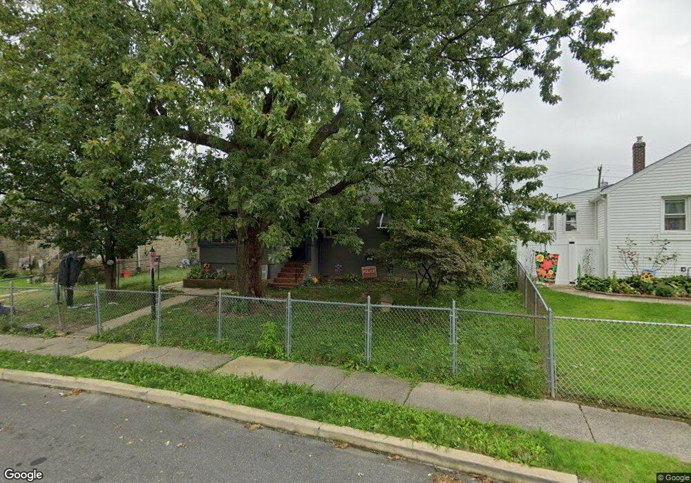
2116 Forrester Ave Holmes, PA 19043
Estimated Value: $248,000 - $312,000
3
Beds
1
Bath
1,152
Sq Ft
$246/Sq Ft
Est. Value
About This Home
This home is located at 2116 Forrester Ave, Holmes, PA 19043 and is currently estimated at $283,813, approximately $246 per square foot. 2116 Forrester Ave is a home located in Delaware County with nearby schools including Amosland El School, Ridley Middle School, and Ridley High School.
Ownership History
Date
Name
Owned For
Owner Type
Purchase Details
Closed on
Oct 12, 2015
Sold by
Lazaro Johnetta F
Bought by
Murray Francis C and Murray Joyce M
Current Estimated Value
Home Financials for this Owner
Home Financials are based on the most recent Mortgage that was taken out on this home.
Original Mortgage
$40,049
Outstanding Balance
$402
Interest Rate
3.9%
Mortgage Type
Seller Take Back
Estimated Equity
$283,411
Purchase Details
Closed on
Mar 18, 2004
Sold by
Bonner Johnetta F
Bought by
Bonner Johnetta F and Lazaro Johnetta F
Create a Home Valuation Report for This Property
The Home Valuation Report is an in-depth analysis detailing your home's value as well as a comparison with similar homes in the area
Home Values in the Area
Average Home Value in this Area
Purchase History
| Date | Buyer | Sale Price | Title Company |
|---|---|---|---|
| Murray Francis C | $60,000 | None Available | |
| Bonner Johnetta F | -- | -- |
Source: Public Records
Mortgage History
| Date | Status | Borrower | Loan Amount |
|---|---|---|---|
| Open | Murray Francis C | $40,049 |
Source: Public Records
Tax History Compared to Growth
Tax History
| Year | Tax Paid | Tax Assessment Tax Assessment Total Assessment is a certain percentage of the fair market value that is determined by local assessors to be the total taxable value of land and additions on the property. | Land | Improvement |
|---|---|---|---|---|
| 2025 | $5,029 | $144,840 | $48,190 | $96,650 |
| 2024 | $5,029 | $144,840 | $48,190 | $96,650 |
| 2023 | $4,810 | $144,840 | $48,190 | $96,650 |
| 2022 | $4,656 | $144,840 | $48,190 | $96,650 |
| 2021 | $7,208 | $144,840 | $48,190 | $96,650 |
| 2020 | $4,734 | $83,800 | $37,870 | $45,930 |
| 2019 | $4,647 | $83,800 | $37,870 | $45,930 |
| 2018 | $4,589 | $83,800 | $0 | $0 |
| 2017 | $4,589 | $83,800 | $0 | $0 |
| 2016 | $469 | $83,800 | $0 | $0 |
| 2015 | $469 | $83,800 | $0 | $0 |
| 2014 | $469 | $83,800 | $0 | $0 |
Source: Public Records
Map
Nearby Homes
- 209 Amosland Rd
- 211 Cedar Ave
- 219 Cedar Ave
- 2329 E Macdade Blvd
- 1618 Pennsylvania Ave
- 357 Cedar Ave
- 361 Amosland Rd
- 370 Amosland Rd
- 363 Holmes Rd
- 311 Urban Ave
- 740 16th Ave
- 510 Amosland Rd
- 2202 Clayton Rd
- 813 14th Ave
- 339 Sutton Ave
- 110 Lakeview Dr
- 618 W South Ave
- 730 Maryland Ave
- 5 Sparks Cir
- 2608 Grand Ave
- 2112 Forrester Ave
- 2120 Forrester Ave
- 2108 Forrester Ave
- 2124 Forrester Ave
- 201 Norwood Ave
- 101 Amosland Rd
- 200 Stanbridge Rd
- 2104 Forrester Ave
- 205 Norwood Ave
- 206 Stanbridge Rd
- 2100 Forrester Ave
- 2132 Forrester Ave
- 209 Norwood Ave
- 2141 Forrester Ave Unit b
- 201 Stanbridge Rd
- 122 Norwood Ave
- 210 Stanbridge Rd
- 120 Norwood Ave
- 118 Norwood Ave
- 2200 Amosland Rd