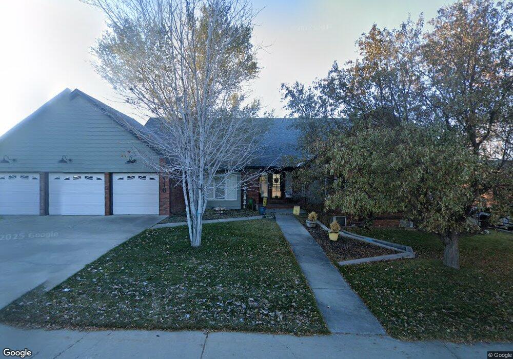
2116 Hillcrest Dr Rock Springs, WY 82901
Estimated Value: $274,000 - $677,000
6
Beds
4
Baths
2,805
Sq Ft
$184/Sq Ft
Est. Value
About This Home
This home is located at 2116 Hillcrest Dr, Rock Springs, WY 82901 and is currently estimated at $515,189, approximately $183 per square foot. 2116 Hillcrest Dr is a home located in Sweetwater County with nearby schools including Rock Springs Junior High School, Rock Springs High School, and Holy Spirit Catholic School.
Ownership History
Date
Name
Owned For
Owner Type
Purchase Details
Closed on
May 30, 2018
Sold by
Wall and Shelly
Bought by
Pond Mark D and Justice Jayme L
Current Estimated Value
Purchase Details
Closed on
Jun 7, 2013
Sold by
Laws Bypass Trust
Bought by
Wall Gary and Wall Shelly
Home Financials for this Owner
Home Financials are based on the most recent Mortgage that was taken out on this home.
Original Mortgage
$342,000
Interest Rate
3.41%
Mortgage Type
New Conventional
Create a Home Valuation Report for This Property
The Home Valuation Report is an in-depth analysis detailing your home's value as well as a comparison with similar homes in the area
Home Values in the Area
Average Home Value in this Area
Purchase History
| Date | Buyer | Sale Price | Title Company |
|---|---|---|---|
| Pond Mark D | $433,125 | First American Title | |
| Wall Gary | $427,500 | -- |
Source: Public Records
Mortgage History
| Date | Status | Borrower | Loan Amount |
|---|---|---|---|
| Previous Owner | Wall Gary | $342,000 | |
| Closed | Pond Mark D | $346,500 |
Source: Public Records
Tax History Compared to Growth
Tax History
| Year | Tax Paid | Tax Assessment Tax Assessment Total Assessment is a certain percentage of the fair market value that is determined by local assessors to be the total taxable value of land and additions on the property. | Land | Improvement |
|---|---|---|---|---|
| 2025 | $3,347 | $35,304 | $4,446 | $30,858 |
| 2024 | $3,347 | $45,261 | $5,700 | $39,561 |
| 2023 | $3,167 | $43,740 | $5,700 | $38,040 |
| 2022 | $2,994 | $40,972 | $5,700 | $35,272 |
| 2021 | $3,078 | $42,022 | $5,700 | $36,322 |
| 2020 | $3,056 | $41,764 | $5,700 | $36,064 |
| 2019 | $2,985 | $41,103 | $5,700 | $35,403 |
| 2018 | $3,243 | $44,565 | $5,700 | $38,865 |
| 2017 | $3,158 | $43,199 | $5,700 | $37,499 |
| 2015 | -- | $41,441 | $0 | $0 |
| 2014 | -- | $40,231 | $0 | $0 |
Source: Public Records
Map
Nearby Homes
- 2058 Skyview St
- 2030 Carson St
- South Belt Loop N Belt Loop
- South Belt Loop S Belt Loop
- 230 Jade St
- 1820 Collins St
- 1805 Carson St
- 413 Hay St
- 1545 Edgar St
- 1525 Edgar St
- 1408 Collins St
- 506 R St
- 416 R St
- 206 R St
- 1300 New Hampshire St
- 1500 James Dr
- 1210 Mccabe St
- 220 Liberty St
- 920 Adams Ave
- 1201 Cottonwood Dr
- 2116 Hillcrest Dr Unit Skyview
- 2112 Hillcrest Dr
- 2120 Hillcrest Dr
- 2108 Hillcrest Dr
- 2121 Hillcrest Dr
- 2046 Skyview St
- 2052 Skyview St
- 2040 Skyview St
- 2040 Skyview St Unit Hillcrest
- 2104 Hillcrest Dr
- 2125 Westview Ave
- 2125 Westview Ave Unit Prairie Ave
- 2128 Westview Ave
- 2064 Skyview St
- 2064 Skyview St Unit Westview
- 2204 Westview Ave
- 2204 Westview Ave Unit 25th Street
- 2045 Skyview St
- 2106 Prairie Ave
- 2039 Skyview St