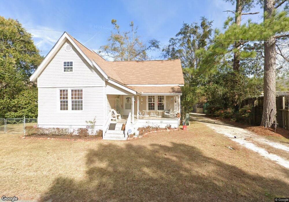
2116 Stephens St Ochlocknee, GA 31773
Estimated Value: $94,000 - $159,000
3
Beds
2
Baths
1,376
Sq Ft
$90/Sq Ft
Est. Value
About This Home
This home is located at 2116 Stephens St, Ochlocknee, GA 31773 and is currently estimated at $123,935, approximately $90 per square foot. 2116 Stephens St is a home located in Thomas County with nearby schools including Hand in Hand Primary School, Cross Creek Elementary School, and Garrison-Pilcher Elementary School.
Ownership History
Date
Name
Owned For
Owner Type
Purchase Details
Closed on
May 31, 2002
Sold by
Frist Union National Bank Of D
Bought by
Duffell Betty J
Current Estimated Value
Purchase Details
Closed on
Jun 5, 2001
Sold by
Bryant Charles and Bryant Dorothy
Bought by
Frist Union National Bank Of Delaware
Purchase Details
Closed on
Apr 23, 1999
Sold by
Powell Len and Powell Sharon
Bought by
Bryant Charles and Bryant Dorothy
Create a Home Valuation Report for This Property
The Home Valuation Report is an in-depth analysis detailing your home's value as well as a comparison with similar homes in the area
Purchase History
| Date | Buyer | Sale Price | Title Company |
|---|---|---|---|
| Duffell Betty J | $11,500 | -- | |
| Frist Union National Bank Of Delaware | -- | -- | |
| Bryant Charles | $37,500 | -- |
Source: Public Records
Tax History
| Year | Tax Paid | Tax Assessment Tax Assessment Total Assessment is a certain percentage of the fair market value that is determined by local assessors to be the total taxable value of land and additions on the property. | Land | Improvement |
|---|---|---|---|---|
| 2025 | $661 | $29,620 | $3,336 | $26,284 |
| 2024 | $678 | $28,708 | $3,336 | $25,372 |
| 2023 | $650 | $27,850 | $3,336 | $24,514 |
| 2022 | $419 | $23,993 | $2,780 | $21,213 |
| 2021 | $515 | $21,220 | $2,780 | $18,440 |
| 2020 | $523 | $21,071 | $2,780 | $18,291 |
| 2019 | $526 | $21,071 | $2,780 | $18,291 |
| 2018 | $494 | $19,741 | $2,780 | $16,961 |
| 2017 | $505 | $19,864 | $2,474 | $17,390 |
| 2016 | $542 | $19,452 | $2,474 | $16,978 |
| 2015 | $627 | $22,310 | $2,308 | $20,002 |
| 2014 | $570 | $21,837 | $2,308 | $19,529 |
| 2013 | -- | $21,836 | $2,307 | $19,529 |
Source: Public Records
Map
Nearby Homes
- 3021 Church St
- 27286 U S Highway 19
- 27286 U S 19
- 5801 State Route 188
- 116 Yellow Pine Ln
- 00 Rupp Rd
- 23481 N Us 19 (7 46 Ac) Hwy
- 23481 N Us Hwy 19 (7 46 Ac)
- 23481 N Us Hwy 19 (7 46 Acres)
- 415 Jane's Ln
- 2542 Maddox Rd
- 108 Quail Ridge St
- 127 Quail Ridge
- 124 Quail Ridge
- 107 Mossy Creek Way
- 5488 Bulloch Rd
- 105 Mossy Creek Way
- 210 Egg and Butter Rd N
- 210 Egg & Butter Rd
- 755 Dixie Chastain Rd
- 2094 Stephens St
- 2028 Leon Hurst St
- 2068 Stephens St
- 2089 Stephens St
- 2057 Stephens St
- 2044 Stephens St
- 2090 E Railroad St
- 2047 Stephens St
- 3013 Leon Hurst St
- 2064 E Railroad St Unit CK
- 2042 E Railroad St Unit CK
- 2019 Stephens St
- 3050 E Railroad St
- 2025 Brayton St
- 2022 E Railroad St
- 2060 Brayton St
- 2056 Leon Hurst St
- 2019 Brayton St
- 3065 Wurst St
- 400 Wurst St
Your Personal Tour Guide
Ask me questions while you tour the home.