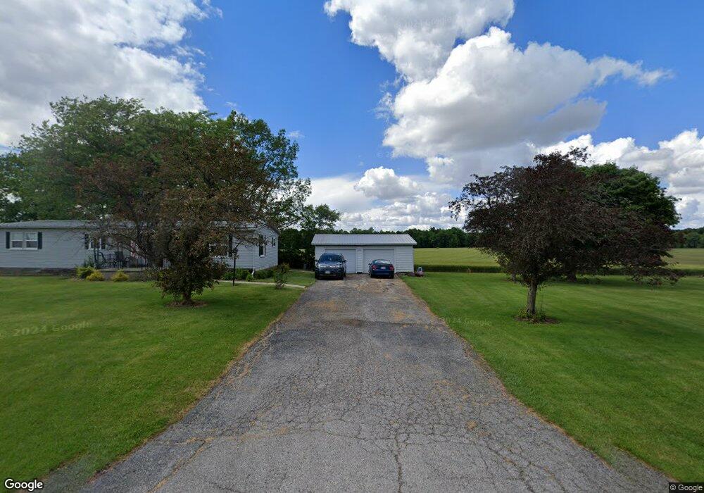
2116 Wyandot Rd Bucyrus, OH 44820
Estimated Value: $125,483 - $239,000
2
Beds
2
Baths
1,248
Sq Ft
$150/Sq Ft
Est. Value
About This Home
This home is located at 2116 Wyandot Rd, Bucyrus, OH 44820 and is currently estimated at $186,621, approximately $149 per square foot. 2116 Wyandot Rd is a home located in Crawford County with nearby schools including Wynford Elementary School, Wynford High School, and Wayside Christian School.
Ownership History
Date
Name
Owned For
Owner Type
Purchase Details
Closed on
Jun 27, 2024
Sold by
Smith Earl E and Smith Joan C
Bought by
Smith Principal Protection Trust and Smith
Current Estimated Value
Purchase Details
Closed on
Feb 3, 2012
Sold by
Leonhardt Tami L and Poole Michelle D
Bought by
Smith Earl E and Smith Joan C
Purchase Details
Closed on
Aug 12, 2002
Bought by
Smith Earl E and Smith Joan C
Create a Home Valuation Report for This Property
The Home Valuation Report is an in-depth analysis detailing your home's value as well as a comparison with similar homes in the area
Home Values in the Area
Average Home Value in this Area
Purchase History
| Date | Buyer | Sale Price | Title Company |
|---|---|---|---|
| Smith Principal Protection Trust | -- | None Listed On Document | |
| Smith Earl E | $18,000 | None Available | |
| Smith Earl E | $18,000 | -- |
Source: Public Records
Tax History Compared to Growth
Tax History
| Year | Tax Paid | Tax Assessment Tax Assessment Total Assessment is a certain percentage of the fair market value that is determined by local assessors to be the total taxable value of land and additions on the property. | Land | Improvement |
|---|---|---|---|---|
| 2024 | $926 | $24,450 | $4,230 | $20,220 |
| 2023 | $926 | $20,670 | $3,470 | $17,200 |
| 2022 | $942 | $20,670 | $3,470 | $17,200 |
| 2021 | $1,010 | $20,670 | $3,470 | $17,200 |
| 2020 | $733 | $16,190 | $3,470 | $12,720 |
| 2019 | $754 | $16,190 | $3,470 | $12,720 |
| 2018 | $771 | $16,190 | $3,470 | $12,720 |
| 2017 | $696 | $14,850 | $3,470 | $11,380 |
| 2016 | $582 | $14,850 | $3,470 | $11,380 |
| 2015 | $591 | $14,850 | $3,470 | $11,380 |
| 2014 | $681 | $15,700 | $3,470 | $12,230 |
| 2013 | $681 | $15,700 | $3,470 | $12,230 |
Source: Public Records
Map
Nearby Homes
- 2440 Wyandot Rd
- 275 Brentwood St
- 2273 Kerstetter Rd
- 1123 Hillcrest Dr
- 130 Brentwood St
- 1112 Hillcrest Dr
- 1149 Farmview Dr
- 1315 Lynne Ave
- 1145 Lynne Ave
- 0 Lynne Ave
- 1555 Rosedale Ave
- 452 Pleasant Ln
- 3056 Mccracken Rd
- 1211 S Sandusky Ave
- 900 S Spring St
- 1021 S Sandusky Ave
- 325 W Liberty St
- 885 W Perry St
- 317 S Spring St
- 316 W Warren St
- 2104 Wyandot Rd
- 2082 Wyandot Rd
- 2082 Wyandot Rd
- 2186 Wyandot Rd
- 2186 Wyandot Rd
- 2055 Wyandot Rd
- 2201 Wyandot Rd
- 2012 Wyandot Rd
- 1986 Wyandot Rd
- 1990 Wyandot Rd
- 2304 Wyandot Rd
- 2343 Kerstetter Rd
- 2339 Kerstetter Rd
- 2347 Kerstetter Rd
- 2001 River Rd
- 2404 Krauter Rd
- 2325 Denzer Rd
- 2335 Kerstetter Rd
- 2333 Kerstetter Rd
- 2492 Krauter Rd