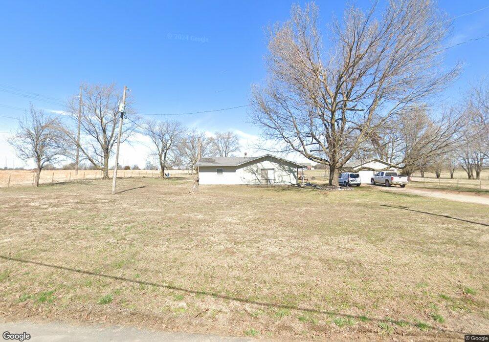
21168 Chesney Rd Siloam Springs, AR 72761
Estimated Value: $224,000 - $249,000
--
Bed
2
Baths
1,380
Sq Ft
$170/Sq Ft
Est. Value
About This Home
This home is located at 21168 Chesney Rd, Siloam Springs, AR 72761 and is currently estimated at $234,913, approximately $170 per square foot. 21168 Chesney Rd is a home located in Benton County with nearby schools including Northside Elementary School, Delbert Pete & Pat Allen Elementary School, and Southside Elementary School.
Ownership History
Date
Name
Owned For
Owner Type
Purchase Details
Closed on
Jan 10, 2014
Sold by
Caulkins Jason M
Bought by
Kendrick Laura
Current Estimated Value
Purchase Details
Closed on
Sep 18, 2000
Bought by
Caulkins
Purchase Details
Closed on
Sep 15, 1995
Bought by
Gargrave
Purchase Details
Closed on
Aug 11, 1993
Bought by
Cantorna
Purchase Details
Closed on
Nov 9, 1983
Bought by
Eslick
Create a Home Valuation Report for This Property
The Home Valuation Report is an in-depth analysis detailing your home's value as well as a comparison with similar homes in the area
Home Values in the Area
Average Home Value in this Area
Purchase History
| Date | Buyer | Sale Price | Title Company |
|---|---|---|---|
| Kendrick Laura | $43,199 | None Available | |
| Caulkins | $68,000 | -- | |
| Gargrave | $59,000 | -- | |
| Cantorna | $62,000 | -- | |
| Eslick | $40,000 | -- |
Source: Public Records
Tax History Compared to Growth
Tax History
| Year | Tax Paid | Tax Assessment Tax Assessment Total Assessment is a certain percentage of the fair market value that is determined by local assessors to be the total taxable value of land and additions on the property. | Land | Improvement |
|---|---|---|---|---|
| 2025 | $1,193 | $33,483 | $8,648 | $24,835 |
| 2024 | $1,119 | $33,483 | $8,648 | $24,835 |
| 2023 | $1,018 | $21,750 | $4,890 | $16,860 |
| 2022 | $939 | $21,750 | $4,890 | $16,860 |
| 2021 | $859 | $21,750 | $4,890 | $16,860 |
| 2020 | $783 | $15,030 | $2,630 | $12,400 |
| 2019 | $783 | $15,030 | $2,630 | $12,400 |
| 2018 | $783 | $15,030 | $2,630 | $12,400 |
| 2017 | $673 | $15,030 | $2,630 | $12,400 |
| 2016 | $673 | $15,030 | $2,630 | $12,400 |
| 2015 | $607 | $11,650 | $2,260 | $9,390 |
| 2014 | $257 | $11,650 | $2,260 | $9,390 |
Source: Public Records
Map
Nearby Homes
- 14987 S Highway 59
- 0 Tbd Davidson Rd
- 3604 N Wiley Dr
- 3503 N Wiley Dr
- 3607 N Wiley Dr
- 3603 N Wiley Dr
- 3507 N Wiley Dr
- 3501 N Wiley Dr
- 3506 N Wiley Dr
- 3606 N Wiley Dr
- 3508 N Wiley Dr
- 3602 N Wiley Dr
- 3605 N Wiley Dr
- 3700 N Wiley Dr
- 3610 N Wiley Dr
- 3608 N Wiley Dr
- 3609 N Jr Martin Dr
- 2002 E Hudson Dr
- 21036 Richard Ct
- 21173 Chesney Rd
- 0 Chesney Rd
- 21170 Chesney Rd
- 21078 Chesney Rd
- 21193 Chesney Rd
- 21149 Davidson Rd
- 21023 Chesney Rd
- 21348 Chesney Rd
- 20973 Chesney Rd
- 0 Cheri Whitlock Stephens Rd Unit 1264147
- 21085 Davidson Rd
- 45.11 Acres Stephens Rd
- 20898 Chesney Rd
- 20898 Chesney Rd
- 20927 Chesney Rd
- 20856 Chesney Rd
- 20856 Chesney Rd Unit 20898
- 27.57 Acres Stephens Rd
- 14973 S Highway 59
- 14853 S Highway 59