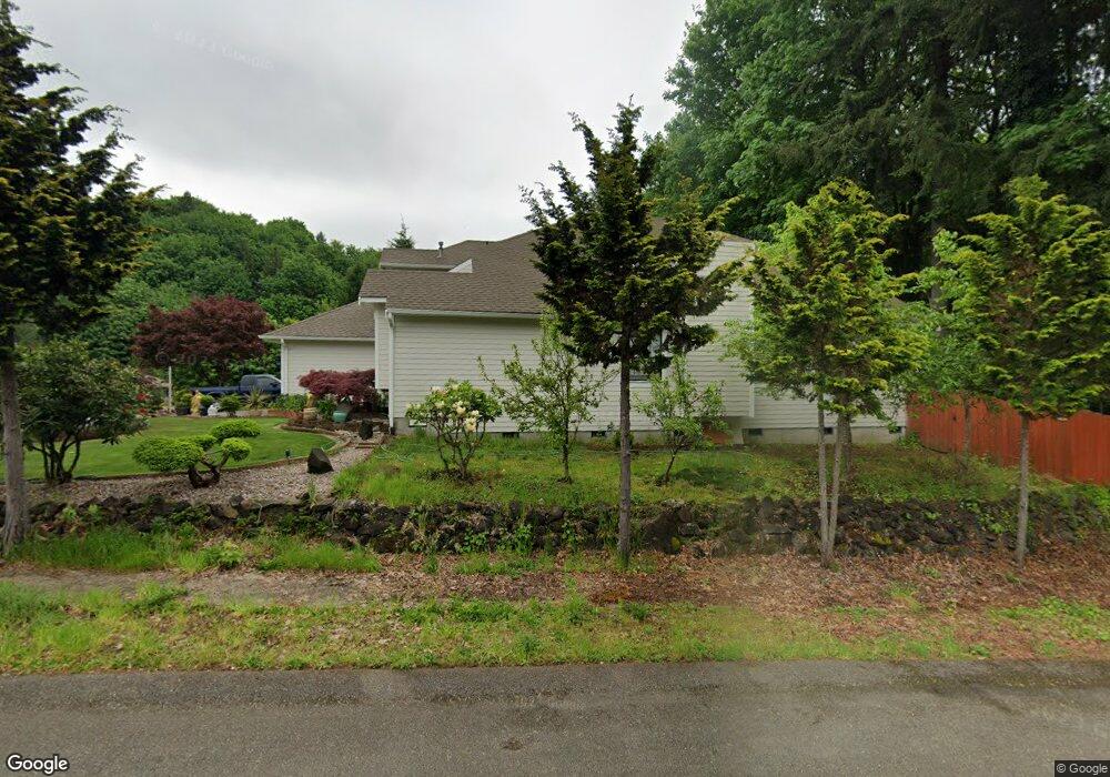
2117 Brookside Rd SW Tumwater, WA 98512
Tumwater Hill NeighborhoodEstimated Value: $580,811 - $644,000
4
Beds
3
Baths
2,642
Sq Ft
$231/Sq Ft
Est. Value
About This Home
This home is located at 2117 Brookside Rd SW, Tumwater, WA 98512 and is currently estimated at $609,703, approximately $230 per square foot. 2117 Brookside Rd SW is a home located in Thurston County with nearby schools including Tumwater Hill Elementary School, Tumwater Middle School, and A.G. West Black Hills High School.
Ownership History
Date
Name
Owned For
Owner Type
Purchase Details
Closed on
Jun 24, 2019
Sold by
Tu Nhan T and Trac Jeanette N
Bought by
Tu Nhan T
Current Estimated Value
Home Financials for this Owner
Home Financials are based on the most recent Mortgage that was taken out on this home.
Original Mortgage
$223,600
Outstanding Balance
$196,200
Interest Rate
4%
Mortgage Type
New Conventional
Estimated Equity
$413,503
Purchase Details
Closed on
Sep 21, 2015
Sold by
Tu Nhan Thi
Bought by
Tu Nhan T and Trac Jeanette N
Home Financials for this Owner
Home Financials are based on the most recent Mortgage that was taken out on this home.
Original Mortgage
$230,000
Interest Rate
3.9%
Mortgage Type
New Conventional
Purchase Details
Closed on
Oct 8, 2004
Sold by
Wormcke Richard A and Willis Kathryn M
Bought by
Trac De C and Tu Nhan
Home Financials for this Owner
Home Financials are based on the most recent Mortgage that was taken out on this home.
Original Mortgage
$235,200
Interest Rate
5.72%
Mortgage Type
New Conventional
Purchase Details
Closed on
Jun 7, 2002
Sold by
Lee Curtis A and Lee Stephanie L
Bought by
Wormcke Richard A and Willis Kathryn M
Home Financials for this Owner
Home Financials are based on the most recent Mortgage that was taken out on this home.
Original Mortgage
$100,000
Interest Rate
6.74%
Purchase Details
Closed on
Jun 12, 1998
Sold by
Hill Danial D
Bought by
Lee Curtis A and Lee Stephanie L
Home Financials for this Owner
Home Financials are based on the most recent Mortgage that was taken out on this home.
Original Mortgage
$193,500
Interest Rate
7.17%
Purchase Details
Closed on
Nov 20, 1995
Sold by
Regmund Thomas R and Regmund William Charles
Bought by
Hill Danial D
Home Financials for this Owner
Home Financials are based on the most recent Mortgage that was taken out on this home.
Original Mortgage
$115,000
Interest Rate
7.51%
Mortgage Type
Balloon
Create a Home Valuation Report for This Property
The Home Valuation Report is an in-depth analysis detailing your home's value as well as a comparison with similar homes in the area
Home Values in the Area
Average Home Value in this Area
Purchase History
| Date | Buyer | Sale Price | Title Company |
|---|---|---|---|
| Tu Nhan T | -- | None Available | |
| Tu Nhan T | $94,212 | Chicago Title Company | |
| Tu Nhan T | -- | Chicago Title Company | |
| Trac De C | $294,000 | Stewart Title Of Western | |
| Wormcke Richard A | $245,000 | Thurston County Title | |
| Lee Curtis A | $215,000 | Thurston County Title Co | |
| Hill Danial D | $190,000 | Transamerica Title Ins Compa |
Source: Public Records
Mortgage History
| Date | Status | Borrower | Loan Amount |
|---|---|---|---|
| Open | Tu Nhan T | $223,600 | |
| Closed | Tu Nhan T | $230,000 | |
| Previous Owner | Trac De C | $235,200 | |
| Previous Owner | Wormcke Richard A | $100,000 | |
| Previous Owner | Lee Curtis A | $193,500 | |
| Previous Owner | Hill Danial D | $115,000 | |
| Closed | Trac De C | $29,400 |
Source: Public Records
Tax History Compared to Growth
Tax History
| Year | Tax Paid | Tax Assessment Tax Assessment Total Assessment is a certain percentage of the fair market value that is determined by local assessors to be the total taxable value of land and additions on the property. | Land | Improvement |
|---|---|---|---|---|
| 2024 | $4,654 | $492,300 | $144,100 | $348,200 |
| 2023 | $4,654 | $464,900 | $120,600 | $344,300 |
| 2022 | $4,716 | $462,600 | $91,600 | $371,000 |
| 2021 | $4,409 | $400,700 | $81,000 | $319,700 |
| 2020 | $4,205 | $343,600 | $86,700 | $256,900 |
| 2019 | $4,332 | $317,700 | $70,800 | $246,900 |
| 2018 | $4,242 | $328,700 | $65,300 | $263,400 |
| 2017 | $3,510 | $267,500 | $69,400 | $198,100 |
| 2016 | $3,530 | $265,050 | $69,450 | $195,600 |
| 2014 | -- | $259,150 | $66,950 | $192,200 |
Source: Public Records
Map
Nearby Homes
- 3571 Cassie Dr SW
- 2092 Blackstone Ct SW
- 3827 Crosby Blvd SW
- 1748 View Point Ct SW
- 3151 Vista Verde Ln SW
- 3038 Banks Ln SW
- 3184 Vista Verde Ln SW
- 3037 Hampton Dr SW
- 2263 43rd Ln SW
- 1271 Bay Loop SW
- 1025 Ebbets Dr SW
- 3568 Simmons Mill Ct SW Unit B
- 990 Ebbets Dr
- 3694 Simmons Mill Ct SW Unit B
- 3467 Simmons Mill Ct SW Unit B
- 3627 Simmons Mill Ct SW Unit A
- 942 G St SW
- 2486 Breen Ln SW
- 782 Fenway Ln SW
- 217 N 7th Ave SW
- 2113 Brookside Rd SW
- 2109 Brookside Rd SW
- 3215 Woodland Dr SW
- 3213 Woodland Dr SW
- 2110 Brookside Rd SW
- 3211 Woodland Dr SW
- 2105 Brookside Rd SW
- 2106 Brookside Rd SW
- 3209 Woodland Dr SW
- 2111 Shadycrest Ct SW
- 2107 Shadycrest Ct SW
- 2101 Brookside Rd SW
- 2102 Brookside Rd SW
- 3216 Crosby Blvd SW
- 3207 Woodland Dr SW
- 3220 Crosby Blvd SW
- 3510 Antsen St SW
- 3740 Antsen Rd SW
- 3203 Woodland Dr SW