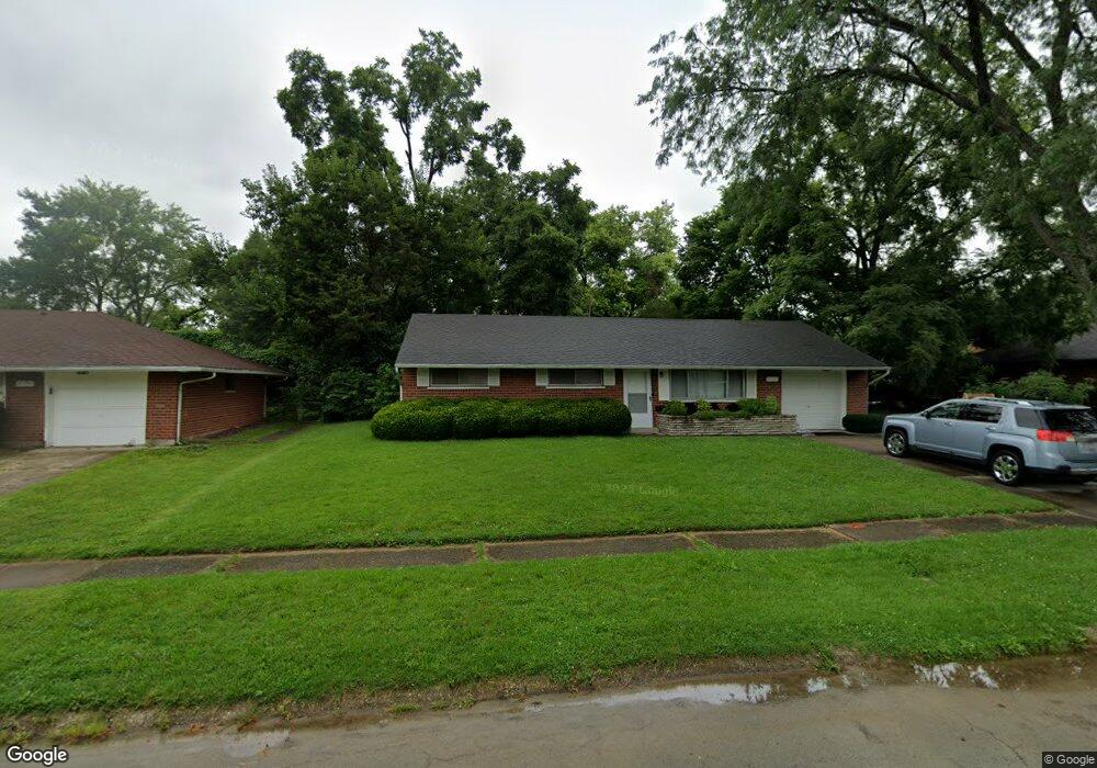
2117 Burnside Dr Dayton, OH 45439
Woodbourne-Hyde Park NeighborhoodEstimated Value: $151,578 - $188,000
3
Beds
1
Bath
1,080
Sq Ft
$160/Sq Ft
Est. Value
About This Home
This home is located at 2117 Burnside Dr, Dayton, OH 45439 and is currently estimated at $173,145, approximately $160 per square foot. 2117 Burnside Dr is a home located in Montgomery County with nearby schools including West Carrollton High School, Miami Valley Academies, and St. Albert the Great School.
Ownership History
Date
Name
Owned For
Owner Type
Purchase Details
Closed on
Nov 17, 1999
Sold by
Kelly Patrick J
Bought by
Maximum Investment Group Inc
Current Estimated Value
Home Financials for this Owner
Home Financials are based on the most recent Mortgage that was taken out on this home.
Original Mortgage
$32,650
Interest Rate
7.88%
Create a Home Valuation Report for This Property
The Home Valuation Report is an in-depth analysis detailing your home's value as well as a comparison with similar homes in the area
Home Values in the Area
Average Home Value in this Area
Purchase History
| Date | Buyer | Sale Price | Title Company |
|---|---|---|---|
| Maximum Investment Group Inc | -- | Midwest Abstract Company |
Source: Public Records
Mortgage History
| Date | Status | Borrower | Loan Amount |
|---|---|---|---|
| Closed | Maximum Investment Group Inc | $32,650 |
Source: Public Records
Tax History
| Year | Tax Paid | Tax Assessment Tax Assessment Total Assessment is a certain percentage of the fair market value that is determined by local assessors to be the total taxable value of land and additions on the property. | Land | Improvement |
|---|---|---|---|---|
| 2025 | $66 | $30,820 | $7,820 | $23,000 |
| 2024 | $66 | $30,820 | $7,820 | $23,000 |
| 2023 | $66 | $30,820 | $7,820 | $23,000 |
| 2022 | $1,952 | $20,690 | $5,250 | $15,440 |
| 2021 | $1,786 | $20,690 | $5,250 | $15,440 |
| 2020 | $2,530 | $29,370 | $5,250 | $24,120 |
| 2019 | $2,036 | $20,560 | $5,250 | $15,310 |
| 2018 | $1,908 | $20,560 | $5,250 | $15,310 |
| 2017 | $1,898 | $20,560 | $5,250 | $15,310 |
| 2016 | $1,961 | $20,560 | $5,250 | $15,310 |
| 2015 | $1,829 | $20,560 | $5,250 | $15,310 |
| 2014 | $1,829 | $20,560 | $5,250 | $15,310 |
| 2012 | -- | $27,670 | $7,000 | $20,670 |
Source: Public Records
Map
Nearby Homes
- 1952 Tait Circle Rd
- 2090 Mattis Dr
- 4445 Moraine Ridge Ln
- 4304 Harbison St
- 4301 Tait Rd
- 4518 Harbison St
- 1764 Lanbury Dr
- 3865 Endover Rd
- 5100 Oak Ave
- 4792 Loxley Dr
- 4207 S Dixie Dr
- 3929 Fulton Ave
- 4935 Cordell Dr
- 2369 Polo Park Dr
- 4400 Royal Ridge Way
- 5048 Oak Manor Ct
- 5117 Pensacola Blvd
- 713 Murrell Dr
- 3464 Westbury Rd
- 3401 Dryden Rd
- 2131 Burnside Dr
- 2103 Burnside Dr
- 4333 Cordell Dr
- 2128 Burnside Dr
- 2102 Finland Dr
- 2114 Finland Dr
- 2145 Burnside Dr
- 2088 Finland Dr
- 2122 Burnside Dr
- 2130 Finland Dr
- 2138 Burnside Dr
- 4373 Cordell Dr
- 2157 Burnside Dr
- 2150 Burnside Dr
- 2142 Finland Dr
- 4344 Cordell Dr
- 2131 Kajean Ave
- 4391 Cordell Dr
- 2103 Finland Dr
- 2115 Finland Dr