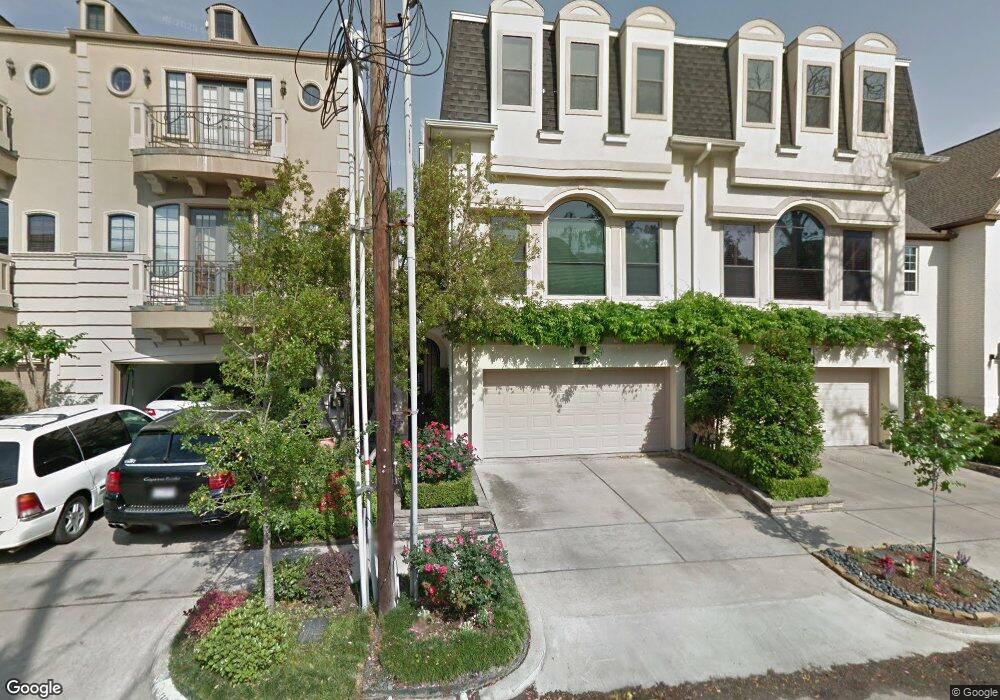
2117 Mcduffie St Houston, TX 77019
Montrose NeighborhoodEstimated Value: $750,772 - $895,000
3
Beds
4
Baths
3,312
Sq Ft
$247/Sq Ft
Est. Value
About This Home
This home is located at 2117 Mcduffie St, Houston, TX 77019 and is currently estimated at $817,193, approximately $246 per square foot. 2117 Mcduffie St is a home located in Harris County with nearby schools including Baker Montessori, Lanier Middle School, and Lamar High School.
Ownership History
Date
Name
Owned For
Owner Type
Purchase Details
Closed on
Dec 12, 2013
Sold by
Mccardell Michael Shane
Bought by
Hogan Ronnie E and Hogan Sandra K
Current Estimated Value
Purchase Details
Closed on
Aug 21, 2006
Sold by
Estate Of Michael Gilford Hagey
Bought by
Mccardell Michael Shane
Purchase Details
Closed on
Nov 30, 1999
Sold by
Town West Development Ii Llc
Bought by
Hagey Michael Gilford and Mccardell Michael Shane
Home Financials for this Owner
Home Financials are based on the most recent Mortgage that was taken out on this home.
Original Mortgage
$130,000
Interest Rate
7.93%
Create a Home Valuation Report for This Property
The Home Valuation Report is an in-depth analysis detailing your home's value as well as a comparison with similar homes in the area
Home Values in the Area
Average Home Value in this Area
Purchase History
| Date | Buyer | Sale Price | Title Company |
|---|---|---|---|
| Hogan Ronnie E | -- | Charter Title Co | |
| Mccardell Michael Shane | -- | None Available | |
| Hagey Michael Gilford | -- | Stewart Title Company |
Source: Public Records
Mortgage History
| Date | Status | Borrower | Loan Amount |
|---|---|---|---|
| Previous Owner | Hagey Michael Gilford | $130,000 |
Source: Public Records
Tax History Compared to Growth
Tax History
| Year | Tax Paid | Tax Assessment Tax Assessment Total Assessment is a certain percentage of the fair market value that is determined by local assessors to be the total taxable value of land and additions on the property. | Land | Improvement |
|---|---|---|---|---|
| 2025 | $5,867 | $722,995 | $275,000 | $447,995 |
| 2024 | $5,867 | $679,411 | $275,000 | $404,411 |
| 2023 | $5,867 | $684,963 | $275,000 | $409,963 |
| 2022 | $13,740 | $624,023 | $275,000 | $349,023 |
| 2021 | $13,775 | $591,013 | $262,500 | $328,513 |
| 2020 | $14,312 | $591,013 | $262,500 | $328,513 |
| 2019 | $14,332 | $566,377 | $150,000 | $416,377 |
| 2018 | $9,074 | $599,829 | $150,000 | $449,829 |
| 2017 | $15,917 | $599,829 | $150,000 | $449,829 |
| 2016 | $15,917 | $599,829 | $150,000 | $449,829 |
| 2015 | $9,290 | $599,829 | $150,000 | $449,829 |
| 2014 | $9,290 | $545,074 | $131,250 | $413,824 |
Source: Public Records
Map
Nearby Homes
- 2112 Mcduffie St
- 2117 Huldy St
- 2119 Huldy St
- 2113 Huldy St
- 2115 Huldy St
- 2103 Hazard St
- 2315 Huldy St
- 2027 Huldy St
- 2221 Driscoll St
- 2309 Driscoll St
- 2008 Hazard St
- 2026 Morse St
- 2410 Huldy St
- 2505 Mcduffie St Unit B
- 2026 Welch St
- 2508 Brun St
- 1909 Brun St Unit 17
- 1909 Brun St Unit 16
- 1904 Hazard St
- 1910 Huldy St Unit A
- 2119 Mcduffie St
- 2119 Mcduffie St
- 2119 Mcduffie St
- 2115 Mcduffie St Unit B
- 2115 Mcduffie St Unit A
- 2201 Mcduffie St
- 2205 Mcduffie St
- 2118 Hazard St
- 2111 Mcduffie St Unit A
- 2111 Mcduffie St Unit B
- 2116 Hazard St
- 2114 Hazard St
- 2114 Hazard St
- 2120 Hazard St
- 2207 Mcduffie St
- 2112 Hazard St
- 2112 Hazard St
- 2103 Mcduffie St
- 2105 Mcduffie St
- 2110 Hazard St