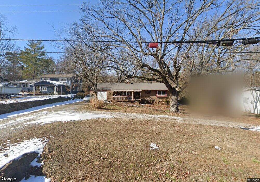
2117 N Old Wire Rd Fayetteville, AR 72703
Downtown Fayetteville NeighborhoodEstimated Value: $329,000 - $349,000
--
Bed
2
Baths
1,386
Sq Ft
$243/Sq Ft
Est. Value
About This Home
This home is located at 2117 N Old Wire Rd, Fayetteville, AR 72703 and is currently estimated at $336,989, approximately $243 per square foot. 2117 N Old Wire Rd is a home located in Washington County with nearby schools including Root Elementary School, Woodland Junior High School, and McNair Middle School.
Ownership History
Date
Name
Owned For
Owner Type
Purchase Details
Closed on
Sep 30, 2004
Sold by
Berry Jennifer L Wall
Bought by
Mcclelland Gretha Karin
Current Estimated Value
Home Financials for this Owner
Home Financials are based on the most recent Mortgage that was taken out on this home.
Original Mortgage
$106,331
Outstanding Balance
$52,397
Interest Rate
5.8%
Mortgage Type
Purchase Money Mortgage
Estimated Equity
$284,592
Purchase Details
Closed on
Nov 11, 1992
Bought by
Douthit Harold D
Purchase Details
Closed on
Sep 13, 1990
Bought by
Wainwright Wayne D
Purchase Details
Closed on
Nov 15, 1989
Bought by
Crotzer Margaret Joan
Purchase Details
Closed on
Dec 1, 1988
Bought by
Walch Joseph and Walch Joann
Purchase Details
Closed on
Jan 1, 1985
Bought by
Arnold Thomas Vance and Arnold Jane C
Create a Home Valuation Report for This Property
The Home Valuation Report is an in-depth analysis detailing your home's value as well as a comparison with similar homes in the area
Home Values in the Area
Average Home Value in this Area
Purchase History
| Date | Buyer | Sale Price | Title Company |
|---|---|---|---|
| Mcclelland Gretha Karin | $108,000 | Lenders | |
| Douthit Harold D | -- | -- | |
| Wainwright Wayne D | $50,000 | -- | |
| Crotzer Margaret Joan | $54,000 | -- | |
| Walch Joseph | $54,000 | -- | |
| Arnold Thomas Vance | -- | -- |
Source: Public Records
Mortgage History
| Date | Status | Borrower | Loan Amount |
|---|---|---|---|
| Open | Mcclelland Gretha Karin | $106,331 |
Source: Public Records
Tax History Compared to Growth
Tax History
| Year | Tax Paid | Tax Assessment Tax Assessment Total Assessment is a certain percentage of the fair market value that is determined by local assessors to be the total taxable value of land and additions on the property. | Land | Improvement |
|---|---|---|---|---|
| 2025 | $1,131 | $55,640 | $29,700 | $25,940 |
| 2024 | $1,153 | $55,640 | $29,700 | $25,940 |
| 2023 | $1,179 | $55,640 | $29,700 | $25,940 |
| 2022 | $1,152 | $34,310 | $18,000 | $16,310 |
| 2021 | $1,086 | $34,310 | $18,000 | $16,310 |
| 2020 | $1,020 | $34,310 | $18,000 | $16,310 |
| 2019 | $953 | $22,920 | $8,100 | $14,820 |
| 2018 | $978 | $22,920 | $8,100 | $14,820 |
| 2017 | $967 | $22,920 | $8,100 | $14,820 |
| 2016 | $967 | $22,920 | $8,100 | $14,820 |
| 2015 | $905 | $22,920 | $8,100 | $14,820 |
| 2014 | $951 | $24,210 | $8,100 | $16,110 |
Source: Public Records
Map
Nearby Homes
- 1417 E Elmwood Dr
- 945 E Elm St
- 1125 E Township St
- 1640 N Boston Place
- 1000 E Township St
- 1911 N Austin Dr
- 1534 E Century Dr
- 576 E Champion Dr
- 2125 N Libby Ln
- 488 E Ozark View Dr
- 2351 N Windswept Ln
- 1835 E Mission Blvd
- 942 E Township St
- 2383 N Yorkwood Dr
- 1645 N Rhonda Dr
- 2416 N Brophy Cir
- 2507 N Jimmie Ave
- 2420 N Brophy Cir Unit 1
- 0 N Brophy Cir
- Lot 19 Karyn Ave
- 2103 N Old Wire Rd
- 1241 E Elm St
- 1233 E Elm St
- 1267 E Elm St
- 2057 N Old Wire Rd
- 1207 E Elm St
- 1404 E Elmwood Dr
- 1275 E Elm St
- 0 E Elmwood Dr
- 1931 N Old Wire Rd
- 2121 Old Wire Rd
- 1203 E Elm St
- 2020 N Old Wire Rd
- 1283 E Elm St
- 1165 E Overcrest St
- 1236 E Elm St
- 1375 E Overcrest St
- 1408 E Elmwood Dr
- 1218 E Elm St
- 1199 E Elm St