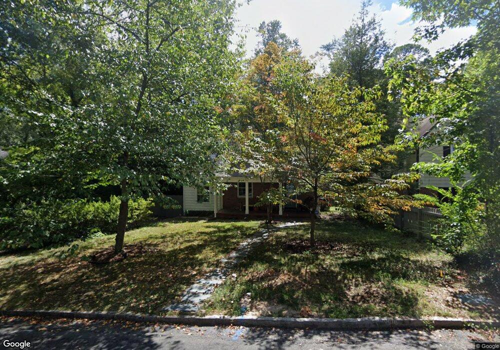
2117 Pershing St Durham, NC 27705
Watts Hospital-Hillandale NeighborhoodEstimated Value: $490,000 - $609,000
3
Beds
2
Baths
1,406
Sq Ft
$403/Sq Ft
Est. Value
About This Home
This home is located at 2117 Pershing St, Durham, NC 27705 and is currently estimated at $566,731, approximately $403 per square foot. 2117 Pershing St is a home located in Durham County with nearby schools including E K Powe Elementary, W.G. Pearson Elementary School, and Brogden Middle.
Ownership History
Date
Name
Owned For
Owner Type
Purchase Details
Closed on
Apr 21, 2017
Sold by
Bolt Brian Lee
Bought by
Trask Merrill K and Price Trevor Thomas
Current Estimated Value
Home Financials for this Owner
Home Financials are based on the most recent Mortgage that was taken out on this home.
Original Mortgage
$232,000
Outstanding Balance
$192,688
Interest Rate
4.14%
Mortgage Type
New Conventional
Estimated Equity
$374,043
Purchase Details
Closed on
Dec 19, 1997
Sold by
Joyner Catherine M
Bought by
Bolt Brian Lee and Bolt Suzanne Shrell
Home Financials for this Owner
Home Financials are based on the most recent Mortgage that was taken out on this home.
Original Mortgage
$108,000
Interest Rate
7.26%
Create a Home Valuation Report for This Property
The Home Valuation Report is an in-depth analysis detailing your home's value as well as a comparison with similar homes in the area
Home Values in the Area
Average Home Value in this Area
Purchase History
| Date | Buyer | Sale Price | Title Company |
|---|---|---|---|
| Trask Merrill K | $290,000 | -- | |
| Bolt Brian Lee | $120,000 | -- |
Source: Public Records
Mortgage History
| Date | Status | Borrower | Loan Amount |
|---|---|---|---|
| Open | Trask Merrill K | $232,000 | |
| Previous Owner | Bolt Brian Lee | $108,000 |
Source: Public Records
Tax History
| Year | Tax Paid | Tax Assessment Tax Assessment Total Assessment is a certain percentage of the fair market value that is determined by local assessors to be the total taxable value of land and additions on the property. | Land | Improvement |
|---|---|---|---|---|
| 2025 | $5,389 | $543,670 | $330,750 | $212,920 |
| 2024 | $3,980 | $285,301 | $113,220 | $172,081 |
| 2023 | $3,737 | $285,301 | $113,220 | $172,081 |
| 2022 | $3,652 | $285,301 | $113,220 | $172,081 |
| 2021 | $3,634 | $285,301 | $113,220 | $172,081 |
| 2020 | $3,549 | $285,301 | $113,220 | $172,081 |
| 2019 | $3,549 | $285,301 | $113,220 | $172,081 |
| 2018 | $2,966 | $218,637 | $56,610 | $162,027 |
| 2017 | $2,944 | $218,637 | $56,610 | $162,027 |
| 2016 | $2,845 | $218,637 | $56,610 | $162,027 |
| 2015 | $2,851 | $157,289 | $50,127 | $107,162 |
| 2014 | $2,177 | $157,289 | $50,127 | $107,162 |
Source: Public Records
Map
Nearby Homes
- 1505 Virginia Ave
- 2305 Sprunt Ave
- 2305 Woodrow St
- 1608 Maryland Ave
- 1612 Maryland Ave
- 2207 Edwin Ave
- 2217 Stroller Ave
- 2205 Tampa Ave
- 2532 W Wilson St
- 2530 W Wilson St
- 2534 W Wilson St
- 2536 W Wilson St
- 2538 W Wilson St
- 914 Rosehill Ave
- 2518 Indian Trail
- 927 Alabama Ave
- 2524 Indian Trail
- 1409 Sedgefield St
- 1811 Forest Rd
- 1801 Forest Rd
- 2119 Pershing St
- 2115 Pershing St
- 2121 Pershing St
- 2113 Pershing St
- 2116 Wilson St
- 2118 Wilson St
- 2114 Wilson St
- 2111 Pershing St
- 2118 Pershing St
- 2112 Wilson St
- 2116 Pershing St
- 2120 Pershing St
- 1406 Oakland Ave
- 2122 Pershing St
- 1408 Oakland Ave
- 1404 Oakland Ave
- 2109 Pershing St
- 2110 Wilson St
- 2108 Pershing St
- 1402 Oakland Ave
Your Personal Tour Guide
Ask me questions while you tour the home.