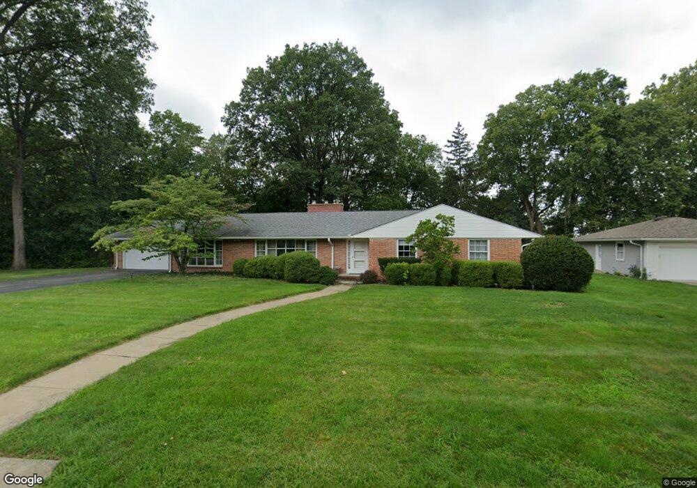
2118 Birch Ln Lafayette, IN 47905
Bennett NeighborhoodEstimated Value: $355,000 - $460,028
4
Beds
4
Baths
2,648
Sq Ft
$159/Sq Ft
Est. Value
About This Home
This home is located at 2118 Birch Ln, Lafayette, IN 47905 and is currently estimated at $420,507, approximately $158 per square foot. 2118 Birch Ln is a home located in Tippecanoe County with nearby schools including Thomas Miller Elementary School, Lafayette Tecumseh Junior High School, and Sunnyside Intermediate School.
Ownership History
Date
Name
Owned For
Owner Type
Purchase Details
Closed on
Oct 11, 2021
Sold by
Otto Thomas N and Otto Bonnie L
Bought by
Thomas N Otto And Bonnie L Otto Living Trust and Ott Bonnie
Current Estimated Value
Purchase Details
Closed on
Oct 1, 2003
Sold by
Oconnor Frances A
Bought by
Otto Thomas N and Otto Bonnie L
Home Financials for this Owner
Home Financials are based on the most recent Mortgage that was taken out on this home.
Original Mortgage
$124,000
Interest Rate
6.4%
Mortgage Type
Purchase Money Mortgage
Create a Home Valuation Report for This Property
The Home Valuation Report is an in-depth analysis detailing your home's value as well as a comparison with similar homes in the area
Home Values in the Area
Average Home Value in this Area
Purchase History
| Date | Buyer | Sale Price | Title Company |
|---|---|---|---|
| Thomas N Otto And Bonnie L Otto Living Trust | -- | Vogler Laura M | |
| Otto Thomas N | -- | -- |
Source: Public Records
Mortgage History
| Date | Status | Borrower | Loan Amount |
|---|---|---|---|
| Previous Owner | Otto Thomas N | $124,000 |
Source: Public Records
Tax History Compared to Growth
Tax History
| Year | Tax Paid | Tax Assessment Tax Assessment Total Assessment is a certain percentage of the fair market value that is determined by local assessors to be the total taxable value of land and additions on the property. | Land | Improvement |
|---|---|---|---|---|
| 2024 | $3,769 | $375,500 | $95,200 | $280,300 |
| 2023 | $3,550 | $350,500 | $95,200 | $255,300 |
| 2022 | $3,187 | $313,700 | $95,200 | $218,500 |
| 2021 | $2,951 | $289,800 | $95,200 | $194,600 |
| 2020 | $2,876 | $282,300 | $95,200 | $187,100 |
| 2019 | $2,336 | $230,500 | $49,200 | $181,300 |
| 2018 | $2,262 | $223,000 | $49,200 | $173,800 |
| 2017 | $2,291 | $225,900 | $49,200 | $176,700 |
| 2016 | $2,244 | $221,300 | $49,200 | $172,100 |
| 2014 | $2,169 | $214,000 | $49,200 | $164,800 |
| 2013 | $2,002 | $197,200 | $49,200 | $148,000 |
Source: Public Records
Map
Nearby Homes
- 2514 Eckman Dr
- 1802 Skyline Rd
- 1842 Mill Pond Ln
- 2060 Crestview Ct
- 912 Crestview Place
- 1005 Sarasota Dr
- 2561 S 231 Hwy
- 1017 Sarasota Dr
- 602 Cherokee Ave
- 1108 Potomac Ave
- 2501 Crestview Ct
- 1118 S 2nd St
- 2830 Duroc Dr Unit A
- 1017 S 4th St
- 900 King St
- 2508 Oxford St
- 2516 Oxford St
- 2820 Limestone Ln
- 235 Kimmel St
- 2605 Oxford St