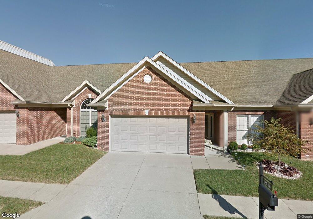
2118 Pickwick Dr New Albany, IN 47150
Estimated Value: $254,000 - $286,940
2
Beds
2
Baths
1,520
Sq Ft
$181/Sq Ft
Est. Value
About This Home
This home is located at 2118 Pickwick Dr, New Albany, IN 47150 and is currently estimated at $274,735, approximately $180 per square foot. 2118 Pickwick Dr is a home located in Floyd County with nearby schools including Slate Run Elementary School, Hazelwood Middle School, and New Albany Senior High School.
Ownership History
Date
Name
Owned For
Owner Type
Purchase Details
Closed on
Aug 6, 2019
Sold by
Mcgee Mary
Bought by
Farmer Debra B
Current Estimated Value
Purchase Details
Closed on
Jan 25, 2012
Sold by
Mcgee Mary C
Bought by
Mcgee Charles A and Mcgee Kenneth J
Purchase Details
Closed on
Dec 30, 2011
Sold by
Mcgee Mary C
Bought by
Mcgee Mary C and Mc Gee Sr Charles A
Purchase Details
Closed on
Dec 28, 2009
Sold by
Mcgee Mary
Bought by
Mcgee Mary and Mcgee Kenneth J
Purchase Details
Closed on
Nov 4, 2009
Sold by
Estate Of Margaret M Marguet
Bought by
Mcgee Mary
Purchase Details
Closed on
Aug 31, 2006
Sold by
Pickwick Partners Llc
Bought by
Marguet Margaret
Create a Home Valuation Report for This Property
The Home Valuation Report is an in-depth analysis detailing your home's value as well as a comparison with similar homes in the area
Home Values in the Area
Average Home Value in this Area
Purchase History
| Date | Buyer | Sale Price | Title Company |
|---|---|---|---|
| Farmer Debra B | -- | Agency Title | |
| Mcgee Charles A | -- | None Available | |
| Mcgee Charles A | -- | None Available | |
| Mcgee Charles A | -- | None Available | |
| Mcgee Mary C | -- | None Available | |
| Mcgee Mary | -- | None Available | |
| Mcgee Mary | -- | Agency Title | |
| Marguet Margaret | -- | None Available |
Source: Public Records
Tax History Compared to Growth
Tax History
| Year | Tax Paid | Tax Assessment Tax Assessment Total Assessment is a certain percentage of the fair market value that is determined by local assessors to be the total taxable value of land and additions on the property. | Land | Improvement |
|---|---|---|---|---|
| 2024 | $2,079 | $196,400 | $24,000 | $172,400 |
| 2023 | $2,202 | $202,400 | $24,000 | $178,400 |
| 2022 | $2,142 | $200,500 | $24,000 | $176,500 |
| 2021 | $3,578 | $182,400 | $24,000 | $158,400 |
| 2020 | $2,166 | $200,800 | $24,000 | $176,800 |
| 2019 | $3,336 | $171,300 | $24,000 | $147,300 |
| 2018 | $3,948 | $181,900 | $24,000 | $157,900 |
| 2017 | $4,011 | $181,600 | $24,000 | $157,600 |
| 2016 | $2,948 | $141,800 | $0 | $141,800 |
| 2014 | $2,944 | $147,200 | $24,000 | $123,200 |
| 2013 | -- | $144,400 | $24,000 | $120,400 |
Source: Public Records
Map
Nearby Homes
- 1672 Garretson Ln
- 2705 Charlestown Rd
- 1709 Millerwood Dr
- 1352 Miller Ln
- 1435 Bellemeade Dr
- 1749 McDonald Ln
- 1655 Harriett Ct
- 1651 Summit Ave
- 13 Bellewood Ct
- 1413 Silver Slate Dr
- 1578 Clifton Ave
- 1710 Creekside Dr
- 303 Colonial Club Dr
- 213 Colonial Club Dr
- 1652 Hedden Park
- 2550 Broadway St
- 2548 Broadway St
- 8 Robin Ct
- 3105 Murr Ln
- 1408 Gutford Rd
- 2116 Pickwick Dr
- 2120 Pickwick Dr
- 2114 Pickwick Dr
- 2122 Pickwick Dr
- 2124 Pickwick Dr
- 2112 Pickwick Dr
- 2110 Pickwick Dr
- 2126 Pickwick Dr
- 0 Pickwick Commons Unit 200906176
- 0 Pickwick Commons Unit 201002345
- 2108 Pickwick Dr
- 2117 Pickwick Dr
- 2119 Pickwick Dr
- 2115 Pickwick Dr
- 2128 Pickwick Dr
- 2121 Pickwick Dr
- 2113 Pickwick Dr
- 2123 Pickwick Dr
- 2106 Pickwick Dr
- 2111 Pickwick Dr