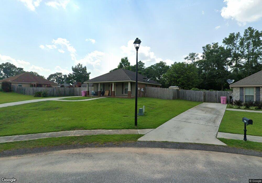
2118 Wolf Branch Dr N Unit 74 Mobile, AL 36608
Outer West Mobile NeighborhoodEstimated Value: $210,000 - $248,000
--
Bed
--
Bath
1,218
Sq Ft
$186/Sq Ft
Est. Value
About This Home
This home is located at 2118 Wolf Branch Dr N Unit 74, Mobile, AL 36608 and is currently estimated at $226,036, approximately $185 per square foot. 2118 Wolf Branch Dr N Unit 74 is a home located in Mobile County with nearby schools including Taylor White Elementary School, Bernice J Causey Middle School, and Baker High School.
Ownership History
Date
Name
Owned For
Owner Type
Purchase Details
Closed on
Apr 29, 2015
Sold by
Mark Swanson Builders Inc
Bought by
Mcdevitt Nicholas and Mcdevitt Whitney
Current Estimated Value
Home Financials for this Owner
Home Financials are based on the most recent Mortgage that was taken out on this home.
Original Mortgage
$131,122
Outstanding Balance
$101,703
Interest Rate
3.87%
Mortgage Type
New Conventional
Estimated Equity
$124,333
Purchase Details
Closed on
Apr 23, 2015
Sold by
Mp Properties L L C
Bought by
Mark Swanson Builders Inc
Home Financials for this Owner
Home Financials are based on the most recent Mortgage that was taken out on this home.
Original Mortgage
$131,122
Outstanding Balance
$101,703
Interest Rate
3.87%
Mortgage Type
New Conventional
Estimated Equity
$124,333
Create a Home Valuation Report for This Property
The Home Valuation Report is an in-depth analysis detailing your home's value as well as a comparison with similar homes in the area
Home Values in the Area
Average Home Value in this Area
Purchase History
| Date | Buyer | Sale Price | Title Company |
|---|---|---|---|
| Mcdevitt Nicholas | $128,500 | Surety Land Title | |
| Mark Swanson Builders Inc | $128,500 | Surety Land Title |
Source: Public Records
Mortgage History
| Date | Status | Borrower | Loan Amount |
|---|---|---|---|
| Open | Mcdevitt Nicholas | $131,122 |
Source: Public Records
Tax History Compared to Growth
Tax History
| Year | Tax Paid | Tax Assessment Tax Assessment Total Assessment is a certain percentage of the fair market value that is determined by local assessors to be the total taxable value of land and additions on the property. | Land | Improvement |
|---|---|---|---|---|
| 2024 | $839 | $17,230 | $4,000 | $13,230 |
| 2023 | $839 | $15,400 | $3,600 | $11,800 |
| 2022 | $670 | $13,810 | $2,990 | $10,820 |
| 2021 | $1,185 | $12,220 | $2,600 | $9,620 |
| 2020 | $531 | $12,320 | $2,600 | $9,720 |
| 2019 | $516 | $12,020 | $0 | $0 |
| 2018 | $467 | $11,000 | $0 | $0 |
| 2017 | $544 | $11,160 | $0 | $0 |
| 2016 | $479 | $11,260 | $0 | $0 |
| 2013 | $150 | $3,100 | $0 | $0 |
Source: Public Records
Map
Nearby Homes
- 11920 Ives Ln
- 12171 Yancey Glen Dr
- 2760 Wildflower Dr W
- 0 Busby Rd
- The Kingston Plan at Coxwell Crossing
- 2814 Plan at Highland Pointe
- 2508 Plan at Highland Pointe
- 3000 Plan at Highland Pointe
- 2831 Plan at Highland Pointe
- 2300 Plan at Highland Pointe
- 2557 Plan at Highland Pointe
- 2320 Plan at Highland Pointe
- 1930 Plan at Highland Pointe
- 2202-0 Plan at Highland Pointe
- 1825 Plan at Highland Pointe
- The Avery Plan at Coxwell Crossing
- The Mckenzie Plan at Coxwell Crossing
- 2029 Plan at Pines of Dawes
- 1425 Plan at Pines of Dawes
- 1525 Plan at Pines of Dawes
- 2118 Wolf Branch Dr N
- 2104 Wolf Branch Dr N Unit 75
- 2104 Wolf Branch Dr N
- 2143 Lumpkin Grove Ln
- 2127 Lumpkin Grove Ln
- 2090 Wolf Branch Dr N
- 2115 Wolf Branch Dr N Unit 80
- 2115 Wolf Branch Dr N
- 2123 Wolf Branch Dr N
- 2091 Wolf Branch Dr N
- 2099 Wolf Branch Dr N
- 2131 Wolf Branch Dr N Unit 82
- 2131 Wolf Branch Dr N
- 2144 Wolf Branch Dr N
- 2144 Lumpkin Grove Ln
- 2119 Lumpkin Grove Ln Unit 2
- 2144 Wolf Branch Dr N
- 2137 Wolf Branch Dr N Unit 83
- 2137 Wolf Branch Dr N
- 2120 Lumpkin Grove Ln