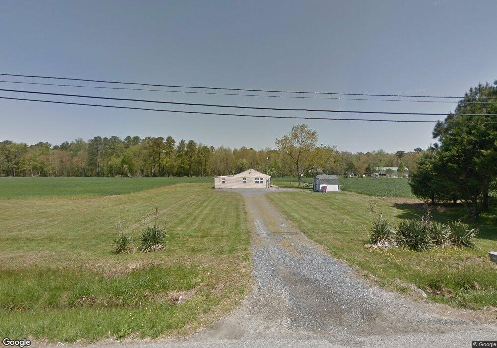
21180 Dover Bridge Rd Preston, MD 21655
Estimated Value: $162,000 - $237,185
3
Beds
1
Bath
1,560
Sq Ft
$129/Sq Ft
Est. Value
About This Home
This home is located at 21180 Dover Bridge Rd, Preston, MD 21655 and is currently estimated at $201,546, approximately $129 per square foot. 21180 Dover Bridge Rd is a home located in Caroline County with nearby schools including Preston Elementary School, Colonel Richardson Middle School, and Colonel Richardson High School.
Ownership History
Date
Name
Owned For
Owner Type
Purchase Details
Closed on
Sep 30, 2008
Sold by
Deutsche Bank National Trust Co
Bought by
Brown Ronald W and Brown Mary E
Current Estimated Value
Purchase Details
Closed on
Jul 30, 2008
Sold by
Mason Jerry L and Mason Michele L
Bought by
Deutsche Bank National Trust Co
Purchase Details
Closed on
Jul 16, 2008
Sold by
Deutsche Bank National Trust Co
Bought by
Brown Ronald W and Brown Mary E
Purchase Details
Closed on
Oct 29, 2002
Sold by
Bridges Clara O
Bought by
Mason Jerry L and Mason Michele L
Create a Home Valuation Report for This Property
The Home Valuation Report is an in-depth analysis detailing your home's value as well as a comparison with similar homes in the area
Home Values in the Area
Average Home Value in this Area
Purchase History
| Date | Buyer | Sale Price | Title Company |
|---|---|---|---|
| Brown Ronald W | $78,000 | -- | |
| Deutsche Bank National Trust Co | $133,000 | -- | |
| Deutsche Bank National Trust Co | $133,000 | -- | |
| Brown Ronald W | $78,000 | -- | |
| Mason Jerry L | $65,000 | -- |
Source: Public Records
Mortgage History
| Date | Status | Borrower | Loan Amount |
|---|---|---|---|
| Closed | Mason Jerry L | -- |
Source: Public Records
Tax History Compared to Growth
Tax History
| Year | Tax Paid | Tax Assessment Tax Assessment Total Assessment is a certain percentage of the fair market value that is determined by local assessors to be the total taxable value of land and additions on the property. | Land | Improvement |
|---|---|---|---|---|
| 2025 | $1,487 | $138,900 | $0 | $0 |
| 2024 | $1,487 | $130,700 | $0 | $0 |
| 2023 | $1,398 | $122,500 | $57,400 | $65,100 |
| 2022 | $1,338 | $117,067 | $0 | $0 |
| 2021 | $1,220 | $111,633 | $0 | $0 |
| 2020 | $1,220 | $106,200 | $57,400 | $48,800 |
| 2019 | $1,200 | $104,367 | $0 | $0 |
| 2018 | $1,180 | $102,533 | $0 | $0 |
| 2017 | $1,160 | $100,700 | $0 | $0 |
| 2016 | -- | $100,700 | $0 | $0 |
| 2015 | $1,059 | $100,700 | $0 | $0 |
| 2014 | $1,059 | $113,200 | $0 | $0 |
Source: Public Records
Map
Nearby Homes
- 0 Dover Bridge Rd Unit MDCM2005586
- 21245 Tanyard Rd
- 21090 Marsh Creek Rd
- 21084 Marsh Creek Rd
- 21682 Dover Bridge Rd
- Parcel 210 Dover Bridge Rd
- 4631 Everlea Ct
- 22109 Tanyard Rd
- 6074 Newton Rd
- 22408 Hog Creek Rd
- 22490 Ash Blvd
- lot 6 Harmony Woods Dr
- 22403 Marsh Creek Rd
- 7371 Michael Ave
- 29865 Hillary Ave
- 7400 Michael Ave
- 29830 Hillary Ave
- LOT #6 High Banks Dr
- 0 High Banks Dr
- 29782 Hillary Ave
- 21145 Dover Bridge Rd
- 0 Dover Bridge Rd Unit 1007196136
- 0 Dover Bridge Rd Unit MDCM2003102
- 0 Dover Bridge Rd Unit MDCM2002482
- 0 Dover Bridge Rd Unit MDCM2001294
- 0 Dover Bridge Rd Unit MDCM123500
- 0 Dover Bridge Rd Unit 1001566562
- 0 Dover Bridge Rd Unit 1000438405
- 0 Dover Bridge Rd Unit MDCM122522
- 21134 Dover Bridge Rd
- 21210 Dover Bridge Rd
- 21197 Dover Bridge Rd
- 21125 Dover Bridge Rd
- 21240 Dover Bridge Rd
- 21120 Dover Bridge Rd
- 21250 Dover Bridge Rd
- 21110 Dover Bridge Rd
- 21260 Dover Bridge Rd
- 21117 Dover Bridge Rd