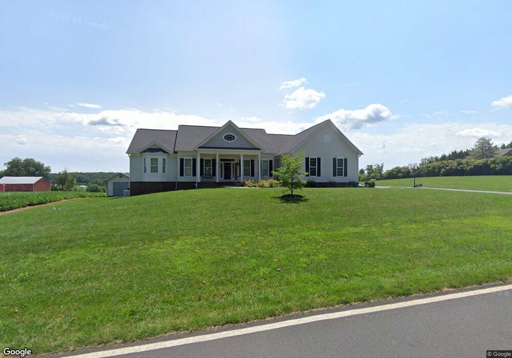
2119 Dennings Rd New Windsor, MD 21776
Estimated Value: $619,000 - $698,000
--
Bed
1
Bath
2,417
Sq Ft
$268/Sq Ft
Est. Value
About This Home
This home is located at 2119 Dennings Rd, New Windsor, MD 21776 and is currently estimated at $648,780, approximately $268 per square foot. 2119 Dennings Rd is a home located in Carroll County with nearby schools including Winfield Elementary School, Mount Airy Middle School, and South Carroll High School.
Ownership History
Date
Name
Owned For
Owner Type
Purchase Details
Closed on
Jun 7, 2018
Sold by
Hoff Matthew M and Hoff Debra L
Bought by
Trigger James P and Trigger Darla Lynn
Current Estimated Value
Home Financials for this Owner
Home Financials are based on the most recent Mortgage that was taken out on this home.
Original Mortgage
$91,200
Outstanding Balance
$29,382
Interest Rate
4.6%
Mortgage Type
New Conventional
Estimated Equity
$619,398
Purchase Details
Closed on
May 1, 2009
Sold by
Hoff Matthew M
Bought by
Hoff Matthew M and Hoff Debra L
Create a Home Valuation Report for This Property
The Home Valuation Report is an in-depth analysis detailing your home's value as well as a comparison with similar homes in the area
Home Values in the Area
Average Home Value in this Area
Purchase History
| Date | Buyer | Sale Price | Title Company |
|---|---|---|---|
| Trigger James P | $114,000 | First Amer Title Ins Co | |
| Hoff Matthew M | -- | -- |
Source: Public Records
Mortgage History
| Date | Status | Borrower | Loan Amount |
|---|---|---|---|
| Open | Trigger James P | $91,200 |
Source: Public Records
Tax History Compared to Growth
Tax History
| Year | Tax Paid | Tax Assessment Tax Assessment Total Assessment is a certain percentage of the fair market value that is determined by local assessors to be the total taxable value of land and additions on the property. | Land | Improvement |
|---|---|---|---|---|
| 2025 | $5,487 | $518,600 | $0 | $0 |
| 2024 | $5,487 | $490,000 | $135,100 | $354,900 |
| 2023 | $5,272 | $465,433 | $0 | $0 |
| 2022 | $4,997 | $440,867 | $0 | $0 |
| 2021 | $9,648 | $416,300 | $135,100 | $281,200 |
| 2020 | $4,609 | $406,233 | $0 | $0 |
| 2019 | $4,033 | $396,167 | $0 | $0 |
| 2018 | $1,301 | $115,100 | $115,100 | $0 |
| 2017 | $1,289 | $115,100 | $0 | $0 |
| 2016 | -- | $115,100 | $0 | $0 |
| 2015 | -- | $400 | $0 | $0 |
| 2014 | -- | $400 | $0 | $0 |
Source: Public Records
Map
Nearby Homes
- PARCEL 198 Dennings Rd
- 2900 Marston Rd
- 2636 Marston Rd
- 2208 Bluebird Dr
- 3319 Mail Rd
- Lot 15 Westview Dr
- 3174 Cardinal Dr
- 2995 Sams Creek Rd
- 2322 Nicodemus Rd
- 3204 Hooper Rd
- 3526 Ellen Dr
- 3536 Hooper Rd
- 1530 Bowersox Rd
- 3400 Chula Dr
- 3489 Salem Bottom Rd
- 1802 Ridge Rd
- 2262 Cherokee Dr
- 1110 Algernon Dr
- 3501 Sams Creek Rd
- 15602 Wildrose Ct
- 2112 Dennings Rd
- 2125 Dennings Rd
- 2082 Dennings Rd
- 2078 Dennings Rd
- 2133 Dennings Rd
- 2063 Dennings Rd
- 2072 Dennings Rd
- 2076 Dennings Rd
- 2030 Dennings Rd
- 2176 Dennings Rd
- 2022 Dennings Rd
- 2184 Dennings Rd
- 2174 Dennings Rd
- 2202 Dennings Rd
- 2017 Dennings Rd
- 2074 Dennings Rd
- 2014 Dennings Rd
- 2175 Dennings Rd
- 2206 Dennings Rd
- 2210 Dennings Rd