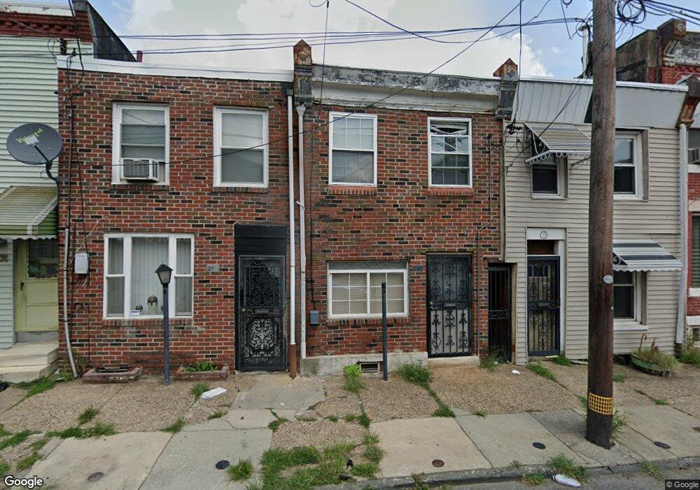
2119 E Auburn St Philadelphia, PA 19134
Port Richmond NeighborhoodEstimated Value: $120,000 - $166,000
2
Beds
1
Bath
680
Sq Ft
$201/Sq Ft
Est. Value
About This Home
This home is located at 2119 E Auburn St, Philadelphia, PA 19134 and is currently estimated at $136,925, approximately $201 per square foot. 2119 E Auburn St is a home located in Philadelphia County with nearby schools including Frances E. Willard Elementary School, Kensington High School, and Kensington Health Sciences Academy.
Ownership History
Date
Name
Owned For
Owner Type
Purchase Details
Closed on
Sep 9, 2009
Sold by
Household Finance Consumer Discount Comp
Bought by
Turbs Joseph
Current Estimated Value
Purchase Details
Closed on
Sep 29, 2008
Sold by
Johnson Edward R
Bought by
Household Finance Consumer Discount Co
Purchase Details
Closed on
Nov 23, 1998
Sold by
Johnson Dorothy
Bought by
Johnson Edward R
Create a Home Valuation Report for This Property
The Home Valuation Report is an in-depth analysis detailing your home's value as well as a comparison with similar homes in the area
Home Values in the Area
Average Home Value in this Area
Purchase History
| Date | Buyer | Sale Price | Title Company |
|---|---|---|---|
| Turbs Joseph | $8,900 | None Available | |
| Household Finance Consumer Discount Co | $20,000 | None Available | |
| Johnson Edward R | $1,000 | -- |
Source: Public Records
Tax History Compared to Growth
Tax History
| Year | Tax Paid | Tax Assessment Tax Assessment Total Assessment is a certain percentage of the fair market value that is determined by local assessors to be the total taxable value of land and additions on the property. | Land | Improvement |
|---|---|---|---|---|
| 2025 | $1,145 | $106,800 | $21,360 | $85,440 |
| 2024 | $1,145 | $106,800 | $21,360 | $85,440 |
| 2023 | $1,145 | $81,800 | $16,360 | $65,440 |
| 2022 | $231 | $36,800 | $16,360 | $20,440 |
| 2021 | $861 | $0 | $0 | $0 |
| 2020 | $861 | $0 | $0 | $0 |
| 2019 | $799 | $0 | $0 | $0 |
| 2018 | $794 | $0 | $0 | $0 |
| 2017 | $794 | $0 | $0 | $0 |
| 2016 | $794 | $0 | $0 | $0 |
| 2015 | $422 | $0 | $0 | $0 |
| 2014 | -- | $31,500 | $7,981 | $23,519 |
| 2012 | -- | $2,816 | $293 | $2,523 |
Source: Public Records
Map
Nearby Homes
- 2116 E Cambria St
- 2108 E Cambria St
- 2136 E Cambria St
- 324 E Cambria St
- 2137 E William St
- 2139 E William St
- 2106 E William St
- 2143 E William St
- 2141 E William St
- 2849 Amber St
- 2124 E Birch St
- 2163 E William St
- 2122 E Birch St
- 2136 E Birch St
- 2068 E William St
- 2162 E Monmouth St
- 2074 E Birch St
- 2050 E Cambria St
- 2155 E Birch St
- 2154 E Orleans St
- 2121 E Auburn St
- 2117 E Auburn St
- 2123 E Auburn St
- 2115 E Auburn St
- 2125 E Auburn St
- 2113 E Auburn St
- 2111 E Auburn St
- 2127 E Auburn St
- 2109 E Auburn St
- 2116 E William St
- 2129 E Auburn St
- 2120 E William St
- 2107 E Auburn St
- 2131 E Auburn St
- 2118 E William St
- 2124 E William St
- 2108 E William St
- 2133 E Auburn St
- 2126 E William St
- 2843 Amber St