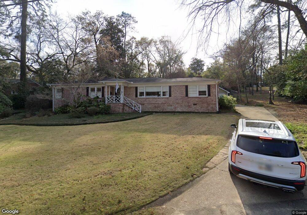
2119 Preston Dr Columbus, GA 31906
Wynnton Grove NeighborhoodEstimated Value: $270,831 - $324,000
3
Beds
3
Baths
1,664
Sq Ft
$180/Sq Ft
Est. Value
About This Home
This home is located at 2119 Preston Dr, Columbus, GA 31906 and is currently estimated at $299,958, approximately $180 per square foot. 2119 Preston Dr is a home located in Muscogee County with nearby schools including Wilkinson Elementary School, Clubview Elementary School, and Richards Middle School.
Ownership History
Date
Name
Owned For
Owner Type
Purchase Details
Closed on
Jul 28, 2010
Sold by
Ellis Robert W and Ellis Karen A
Bought by
Carver John C and Carver Sara C
Current Estimated Value
Home Financials for this Owner
Home Financials are based on the most recent Mortgage that was taken out on this home.
Original Mortgage
$216,090
Outstanding Balance
$140,746
Interest Rate
4.25%
Mortgage Type
FHA
Estimated Equity
$159,212
Create a Home Valuation Report for This Property
The Home Valuation Report is an in-depth analysis detailing your home's value as well as a comparison with similar homes in the area
Home Values in the Area
Average Home Value in this Area
Purchase History
| Date | Buyer | Sale Price | Title Company |
|---|---|---|---|
| Carver John C | $219,000 | None Available |
Source: Public Records
Mortgage History
| Date | Status | Borrower | Loan Amount |
|---|---|---|---|
| Open | Carver John C | $216,090 |
Source: Public Records
Tax History Compared to Growth
Tax History
| Year | Tax Paid | Tax Assessment Tax Assessment Total Assessment is a certain percentage of the fair market value that is determined by local assessors to be the total taxable value of land and additions on the property. | Land | Improvement |
|---|---|---|---|---|
| 2025 | $290 | $99,908 | $19,512 | $80,396 |
| 2024 | $2,902 | $99,908 | $19,512 | $80,396 |
| 2023 | $2,227 | $99,908 | $19,512 | $80,396 |
| 2022 | $3,027 | $80,852 | $19,512 | $61,340 |
| 2021 | $3,020 | $80,372 | $19,512 | $60,860 |
| 2020 | $3,021 | $80,372 | $19,512 | $60,860 |
| 2019 | $3,033 | $80,372 | $19,512 | $60,860 |
| 2018 | $3,033 | $80,372 | $19,512 | $60,860 |
| 2017 | $3,044 | $80,372 | $19,512 | $60,860 |
| 2016 | $3,056 | $87,361 | $11,259 | $76,102 |
| 2015 | $3,060 | $87,361 | $11,259 | $76,102 |
| 2014 | $3,065 | $87,361 | $11,259 | $76,102 |
| 2013 | -- | $87,361 | $11,259 | $76,102 |
Source: Public Records
Map
Nearby Homes
- 2010 Wells Dr
- 2604 Sue MacK Dr
- 2637 Sue MacK Dr
- 1712 Marilon Dr
- 1706 Stark Ave
- 1700 Stark Ave
- 1717 Stark Ave
- 2609 Hilton Ave
- 1500 Preston Dr
- 2220 Country Club Rd
- 1809 Carter Ave
- 1513 Wells Dr
- 2911 Gardenia St
- 2820 Nancy St
- 2916 Gardenia St
- 2533 15th St
- 1310 S Dixon Dr
- 1319 Hilton Ave
- 2707 Lookout Dr
- 2930 Sue MacK Dr
- 2117 Preston Dr
- 2124 Wells Dr
- 2116 Wells Dr
- 2131 Preston Dr
- 2130 Preston Dr
- 2107 Preston Dr
- 2132 Wells Dr
- 2106 Wells Dr
- 2704 Fleetwood Dr
- 2105 Wells Dr
- 2120 Preston Dr
- 2820 Wingfield Dr
- 2832 Wingfield Dr
- 2027 Preston Dr
- 2612 Averett Dr
- 2714 Fleetwood Dr
- 2016 Wells Dr
- 2026 Preston Dr
- 2021 Wells Dr
- 2424 Averett Dr