Estimated Value: $180,000 - $276,927
3
Beds
1
Bath
2,060
Sq Ft
$120/Sq Ft
Est. Value
About This Home
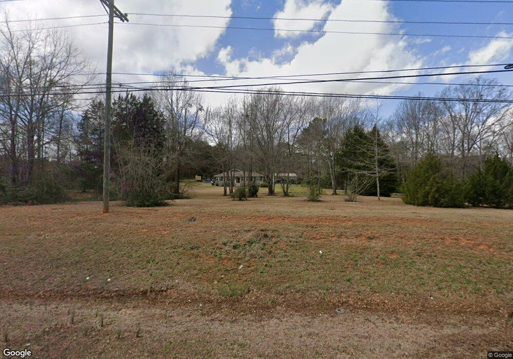
This home is located at 2119 Us Highway 41 N, Perry, GA 31069 and is currently estimated at $246,982, approximately $119 per square foot. 2119 Us Highway 41 N is a home located in Houston County with nearby schools including Langston Road Elementary School, Perry Middle School, and Perry High School.
Ownership History
Date
Name
Owned For
Owner Type
Purchase Details
Closed on
Mar 6, 2015
Sold by
Branning Ralph E
Bought by
Lemley Paul Steve
Current Estimated Value
Purchase Details
Closed on
Sep 27, 2014
Sold by
Branning Janice J Estate
Bought by
Branning Ralph E
Purchase Details
Closed on
Aug 27, 1993
Sold by
Herigstad Kathleen
Bought by
Branning Ralph E and Branning Janice J
Purchase Details
Closed on
Jan 1, 1993
Sold by
Herigstad Reginals Estate
Bought by
Herigstad Kathleen
Purchase Details
Closed on
Apr 23, 1984
Sold by
Leverette Gladys Sewell
Bought by
Herigstad Reginald and Herigstad Kathleen
Create a Home Valuation Report for This Property
The Home Valuation Report is an in-depth analysis detailing your home's value as well as a comparison with similar homes in the area
Home Values in the Area
Average Home Value in this Area
Purchase History
| Date | Buyer | Sale Price | Title Company |
|---|---|---|---|
| Lemley Paul Steve | $75,000 | -- | |
| Branning Ralph E | -- | -- | |
| Branning Ralph E | $53,000 | -- | |
| Herigstad Kathleen | -- | -- | |
| Herigstad Reginald | -- | -- |
Source: Public Records
Tax History Compared to Growth
Tax History
| Year | Tax Paid | Tax Assessment Tax Assessment Total Assessment is a certain percentage of the fair market value that is determined by local assessors to be the total taxable value of land and additions on the property. | Land | Improvement |
|---|---|---|---|---|
| 2024 | $1,587 | $66,360 | $24,960 | $41,400 |
| 2023 | $1,437 | $59,440 | $24,960 | $34,480 |
| 2022 | $1,393 | $57,640 | $24,960 | $32,680 |
| 2021 | $1,310 | $53,920 | $24,960 | $28,960 |
| 2020 | $1,324 | $54,240 | $24,960 | $29,280 |
| 2019 | $1,324 | $54,240 | $24,960 | $29,280 |
| 2018 | $1,324 | $54,240 | $24,960 | $29,280 |
| 2017 | $1,325 | $54,240 | $24,960 | $29,280 |
| 2016 | $734 | $46,160 | $24,960 | $21,200 |
| 2015 | $907 | $46,160 | $24,960 | $21,200 |
| 2014 | -- | $46,160 | $24,960 | $21,200 |
| 2013 | -- | $46,160 | $24,960 | $21,200 |
Source: Public Records
Map
Nearby Homes
- 2111 N Us Hwy 41
- 0 Langston Rd Unit 16828609
- 0 Hwy 41 & Langston Rd Unit M170042
- 149 MacK Thompson Road Common
- 0 MacK Thompson Rd Unit 253661
- 150 MacK Thompson Rd
- 107 Lighterknot Trail
- 106 Raspberry Trail
- 118 Bramblewood Way
- 128 Bramblewood Ln
- 124 Bramblewood Ln
- 302 Brampton Way
- 309 E River Cane Run
- 114 Sutton Dr
- 206 Sutton Dr
- 204 Sutton Dr
- 210 Overton Dr
- 103 Breakwater Way
- 107 Breakwater Way
- 111 Breakwater Way
- 2129 Us Highway 41 N
- 2111 U S 41
- 0 C Hodge Rd
- 2107 Us Highway 41 N
- 2136 Us Highway 41 N
- 121 MacK Thompson Rd
- 2100 Us Highway 41 N
- 2104 Us Highway 41 N
- 0 Hwy 41 & Langston Road Hwy Unit 141391
- 0 Langston Rd Unit 51946
- 0 Langston Rd Unit 98024
- 0 Langston Rd Unit M141357
- 0 Langston Rd Unit M144254
- 0 Langston Rd Unit M141296
- 0 Langston Rd Unit 119021
- 0 Langston Rd
- 303 Macon Rd
- 2001 Macon Rd
- 2140 N Hwy
- 155 MacK Thompson Rd