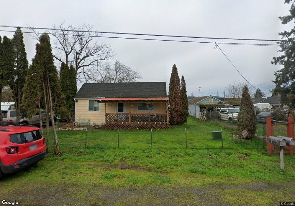
212 Alder St Lebanon, OR 97355
Estimated Value: $303,000 - $327,909
3
Beds
1
Bath
1,573
Sq Ft
$201/Sq Ft
Est. Value
About This Home
This home is located at 212 Alder St, Lebanon, OR 97355 and is currently estimated at $315,455, approximately $200 per square foot. 212 Alder St is a home located in Linn County with nearby schools including Riverview School, Seven Oak Middle School, and Lebanon High School.
Ownership History
Date
Name
Owned For
Owner Type
Purchase Details
Closed on
Jun 9, 2016
Sold by
Arthur Norma J
Bought by
Lebanon Alder Street Llc
Current Estimated Value
Purchase Details
Closed on
Mar 14, 2012
Sold by
Arthur Norma Jean
Bought by
Norma Jean Arthur Revocable Living Trust
Purchase Details
Closed on
Feb 23, 2012
Sold by
Deutsche Bank National Trust Company
Bought by
Arthur Norma Jean
Purchase Details
Closed on
Jun 30, 2011
Sold by
Garcia Israel J and Garcia Theresa Ann
Bought by
Deutsche Bank National Trust Company
Create a Home Valuation Report for This Property
The Home Valuation Report is an in-depth analysis detailing your home's value as well as a comparison with similar homes in the area
Home Values in the Area
Average Home Value in this Area
Purchase History
| Date | Buyer | Sale Price | Title Company |
|---|---|---|---|
| Lebanon Alder Street Llc | -- | None Available | |
| Norma Jean Arthur Revocable Living Trust | -- | None Available | |
| Arthur Norma Jean | $29,500 | Fidelity Natl Title Co Of Or | |
| Deutsche Bank National Trust Company | $55,930 | None Available |
Source: Public Records
Tax History Compared to Growth
Tax History
| Year | Tax Paid | Tax Assessment Tax Assessment Total Assessment is a certain percentage of the fair market value that is determined by local assessors to be the total taxable value of land and additions on the property. | Land | Improvement |
|---|---|---|---|---|
| 2024 | $1,754 | $119,150 | -- | -- |
| 2023 | $1,702 | $115,680 | $0 | $0 |
| 2022 | $1,667 | $112,320 | $0 | $0 |
| 2021 | $1,596 | $109,050 | $0 | $0 |
| 2020 | $1,563 | $105,880 | $0 | $0 |
| 2019 | $1,523 | $102,800 | $0 | $0 |
| 2018 | $1,485 | $99,810 | $0 | $0 |
| 2017 | $1,437 | $96,910 | $0 | $0 |
| 2016 | $1,375 | $94,090 | $0 | $0 |
| 2015 | $1,307 | $91,350 | $0 | $0 |
| 2014 | $881 | $61,010 | $0 | $0 |
Source: Public Records
Map
Nearby Homes
- 2464 Primrose St
- 301 Russell St
- 2187 Mill St
- 2101 Primrose St
- 0 S Santiam (Lot Unit 102) Hwy
- 200 Market (#291) St Unit 291
- 200 Market (#289) St Unit 289
- 200 Market St Unit 221 St
- 200 Market St Unit 222 St
- 200 Market St Unit 218 St
- 200 Market St Unit 255
- 200 Market St Unit 291
- 2100 Park Dr
- 300 Water's Edge Ct
- 2796 S Main (#26) Rd Unit 26
- 270 Hobbs St
- 357 Water's Edge Ct
- 24 E Pine St
- 63 Sand Ridge Ct
- 0 S Santiam Hwy Unit 321692493