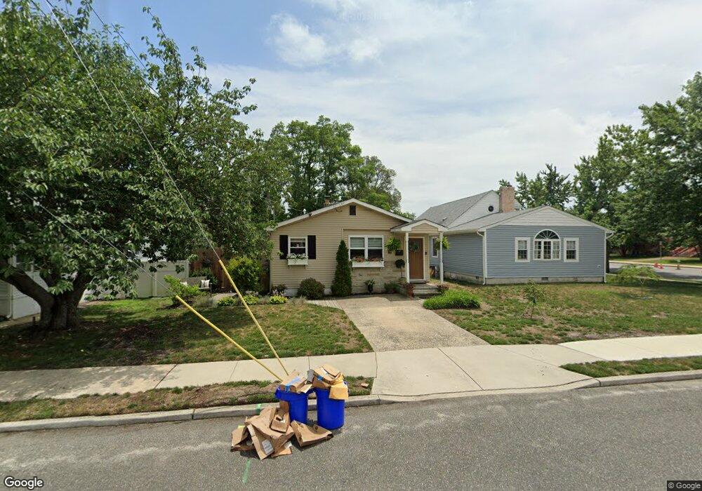
212 Atlantic Ave Somers Point, NJ 08244
Estimated Value: $371,173 - $436,000
3
Beds
1
Bath
1,100
Sq Ft
$371/Sq Ft
Est. Value
About This Home
This home is located at 212 Atlantic Ave, Somers Point, NJ 08244 and is currently estimated at $407,793, approximately $370 per square foot. 212 Atlantic Ave is a home located in Atlantic County with nearby schools including Mainland Regional High School, ChARTer TECH High School for the Performing Arts, and Saint Joseph Regional School.
Ownership History
Date
Name
Owned For
Owner Type
Purchase Details
Closed on
Oct 5, 2017
Sold by
Wagner Vincent C and Wagner Stacey C
Bought by
Oblen Karen
Current Estimated Value
Purchase Details
Closed on
Jan 31, 1991
Sold by
Mcgrath Lorraine F
Bought by
Wagner Vinent C
Create a Home Valuation Report for This Property
The Home Valuation Report is an in-depth analysis detailing your home's value as well as a comparison with similar homes in the area
Home Values in the Area
Average Home Value in this Area
Purchase History
| Date | Buyer | Sale Price | Title Company |
|---|---|---|---|
| Oblen Karen | $170,000 | Atlantic Shore Title Llc | |
| Wagner Vinent C | $85,000 | -- |
Source: Public Records
Tax History Compared to Growth
Tax History
| Year | Tax Paid | Tax Assessment Tax Assessment Total Assessment is a certain percentage of the fair market value that is determined by local assessors to be the total taxable value of land and additions on the property. | Land | Improvement |
|---|---|---|---|---|
| 2025 | $5,550 | $155,200 | $65,800 | $89,400 |
| 2024 | $5,550 | $155,200 | $65,800 | $89,400 |
| 2023 | $5,185 | $155,200 | $65,800 | $89,400 |
| 2022 | $5,185 | $155,200 | $65,800 | $89,400 |
| 2021 | $5,108 | $155,200 | $65,800 | $89,400 |
| 2020 | $5,004 | $155,200 | $65,800 | $89,400 |
| 2019 | $4,862 | $155,200 | $65,800 | $89,400 |
| 2018 | $4,760 | $155,200 | $65,800 | $89,400 |
| 2017 | $4,589 | $155,200 | $65,800 | $89,400 |
| 2016 | $4,381 | $155,200 | $65,800 | $89,400 |
| 2015 | $4,336 | $155,200 | $65,800 | $89,400 |
| 2014 | $4,190 | $155,200 | $65,800 | $89,400 |
Source: Public Records
Map
Nearby Homes
- 33 W Meyran Ave
- 25 W Pierson Ave
- 301 Bliss Ave
- 1102 Jesse Dr
- 2102 Angelina Ln
- 29 E Pierson Ave
- 206 Philadelphia Ave
- 25 Shore Rd
- 112 E Pierson Ave
- 116 W Ocean Ave
- 11 Shore Rd Unit 7D
- 114 E Pierson Ave
- 6 Abbey Rd
- 226 Bethel Rd
- 101 E Johnson Ave
- 118 E Wilmont Ave
- 421 Shore Rd
- 109 E Cedar Ave
- 2 Shore Rd
- 123 E Cedar Ave
- 49 W Dawes Ave
- 210 Atlantic Ave
- 32 W Meyran Ave
- 34 W Meyran Ave
- 15 W Dawes Ave
- 30 W Meyran Ave
- 28 W Meyran Ave
- 9 W Dawes Ave
- 26 W Meyran Ave
- 7 W Dawes Ave
- 35 W Meyran Ave
- 24 W Meyran Ave
- 31 W Meyran Ave
- 101 W Dawes Ave
- 207 Atlantic Ave
- 100 W Dawes Ave
- 102 W Meyran Ave
- 22 W Meyran Ave
- 29 W Meyran Ave
- 19 W Dawes Ave