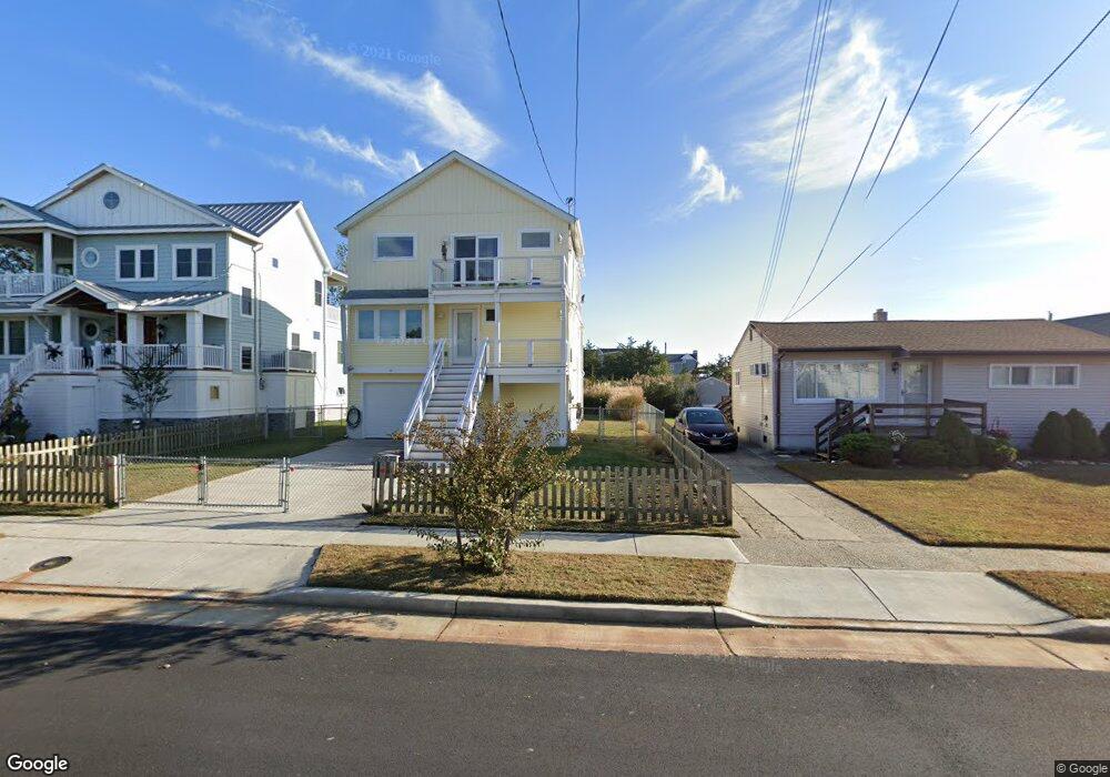
212 Bartram Ln Ocean City, NJ 08226
Estimated Value: $647,000 - $1,240,000
--
Bed
--
Bath
694
Sq Ft
$1,404/Sq Ft
Est. Value
About This Home
This home is located at 212 Bartram Ln, Ocean City, NJ 08226 and is currently estimated at $974,548, approximately $1,404 per square foot. 212 Bartram Ln is a home located in Cape May County with nearby schools including Ocean City Primary School, Ocean City Intermediate School, and Ocean City High School.
Ownership History
Date
Name
Owned For
Owner Type
Purchase Details
Closed on
Jan 9, 1998
Sold by
Whitman Luann
Bought by
Pinder Edward J and Pinder Naomi R
Current Estimated Value
Home Financials for this Owner
Home Financials are based on the most recent Mortgage that was taken out on this home.
Original Mortgage
$71,000
Outstanding Balance
$12,290
Interest Rate
7.11%
Estimated Equity
$962,258
Purchase Details
Closed on
Nov 30, 1988
Sold by
Magee John and Magee Joan
Bought by
Butler Emery and Butler Paula
Create a Home Valuation Report for This Property
The Home Valuation Report is an in-depth analysis detailing your home's value as well as a comparison with similar homes in the area
Home Values in the Area
Average Home Value in this Area
Purchase History
| Date | Buyer | Sale Price | Title Company |
|---|---|---|---|
| Pinder Edward J | $89,000 | -- | |
| Butler Emery | $93,000 | -- |
Source: Public Records
Mortgage History
| Date | Status | Borrower | Loan Amount |
|---|---|---|---|
| Open | Pinder Edward J | $71,000 |
Source: Public Records
Tax History Compared to Growth
Tax History
| Year | Tax Paid | Tax Assessment Tax Assessment Total Assessment is a certain percentage of the fair market value that is determined by local assessors to be the total taxable value of land and additions on the property. | Land | Improvement |
|---|---|---|---|---|
| 2025 | $6,431 | $573,200 | $220,000 | $353,200 |
| 2024 | $6,431 | $573,200 | $220,000 | $353,200 |
| 2023 | $6,139 | $573,200 | $220,000 | $353,200 |
| 2022 | $5,898 | $573,200 | $220,000 | $353,200 |
| 2021 | $5,606 | $573,200 | $220,000 | $353,200 |
| 2020 | $5,606 | $573,200 | $220,000 | $353,200 |
| 2019 | $5,543 | $573,200 | $220,000 | $353,200 |
| 2018 | $5,491 | $573,200 | $220,000 | $353,200 |
| 2017 | $5,405 | $573,200 | $220,000 | $353,200 |
| 2016 | $5,199 | $573,200 | $220,000 | $353,200 |
| 2015 | $5,130 | $573,200 | $220,000 | $353,200 |
| 2014 | $5,056 | $220,000 | $220,000 | $0 |
Source: Public Records
Map
Nearby Homes
- 3708 Westminster Ln
- 215 Limpet Dr Unit 215
- 515 Conch Dr Unit 515 Conch
- 507 Conch Dr
- 103 Somerset Ln
- 3700 Oxford Ln
- 3604 Oxford Ln
- 17 36th St Unit 111
- 3551 Bay Ave Unit 34
- 3716 18 West Ave
- 3815 West Ave Unit 2nd floor
- 3809 W #1 Ave Unit 1
- 3813-15 West
- 3649 West Ave Unit 1
- 3809 West Ave Unit 1
- 3813 West Ave Unit 1st floor
- 3432 Haven Ave Unit I
- 3313 Bay Ave
- 3827 Asbury Ave Unit 2
- 3332 Simpson Ave
- 214 Bartram Ln
- 210 Bartram Ln
- 216 Bartram Ln
- 4 Derby Place
- 208 Bartram Ln
- 3705 Waterview Blvd
- 2 Derby Place
- 218 Bartram Ln
- 6 Derby Place
- 213 Bartram Ln
- 215 Bartram Ln
- 206 Bartram Ln
- 217 Bartram Ln
- 209 Bartram Ln
- 219 Bartram Ln
- 8 Derby Place
- 204 Bartram Ln
- 207 Bartram Ln
- 214 Victoria Ln
- 212 Victoria Ln