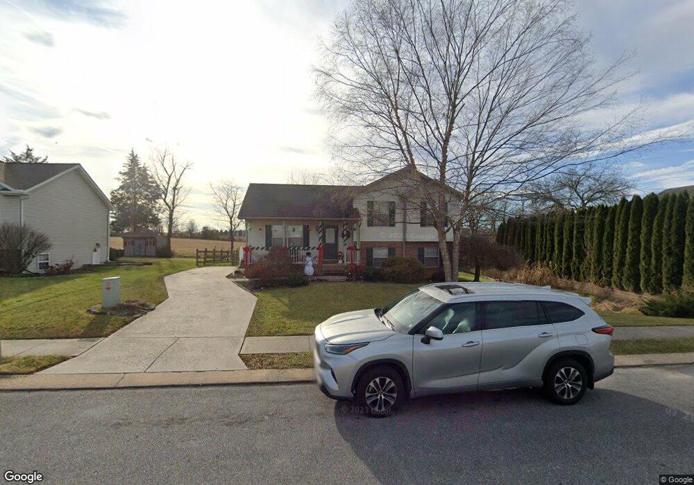
212 Branch Cir Unit 32 East Berlin, PA 17316
Estimated Value: $288,370 - $326,000
3
Beds
2
Baths
1,130
Sq Ft
$277/Sq Ft
Est. Value
About This Home
This home is located at 212 Branch Cir Unit 32, East Berlin, PA 17316 and is currently estimated at $313,343, approximately $277 per square foot. 212 Branch Cir Unit 32 is a home located in Adams County with nearby schools including Bermudian Springs Elementary School, Bermudian Springs Middle School, and Bermudian Springs High School.
Ownership History
Date
Name
Owned For
Owner Type
Purchase Details
Closed on
Jan 17, 2014
Sold by
Hayes Jason M and Hayes Lena J
Bought by
Hayes Jason M and Hayes Lena J
Current Estimated Value
Home Financials for this Owner
Home Financials are based on the most recent Mortgage that was taken out on this home.
Original Mortgage
$158,600
Outstanding Balance
$82,157
Interest Rate
4.14%
Mortgage Type
New Conventional
Estimated Equity
$231,186
Purchase Details
Closed on
Jan 31, 2007
Sold by
Strouse Jeanne V and Shoemaker Jeanne V
Bought by
Hayes Jason M and Wagaman Lena J
Home Financials for this Owner
Home Financials are based on the most recent Mortgage that was taken out on this home.
Original Mortgage
$31,485
Interest Rate
5.96%
Mortgage Type
Stand Alone Second
Create a Home Valuation Report for This Property
The Home Valuation Report is an in-depth analysis detailing your home's value as well as a comparison with similar homes in the area
Home Values in the Area
Average Home Value in this Area
Purchase History
| Date | Buyer | Sale Price | Title Company |
|---|---|---|---|
| Hayes Jason M | -- | None Available | |
| Hayes Jason M | $209,900 | -- |
Source: Public Records
Mortgage History
| Date | Status | Borrower | Loan Amount |
|---|---|---|---|
| Open | Hayes Jason M | $158,600 | |
| Closed | Hayes Jason M | $31,485 | |
| Closed | Hayes Jason M | $167,920 |
Source: Public Records
Tax History Compared to Growth
Tax History
| Year | Tax Paid | Tax Assessment Tax Assessment Total Assessment is a certain percentage of the fair market value that is determined by local assessors to be the total taxable value of land and additions on the property. | Land | Improvement |
|---|---|---|---|---|
| 2025 | $3,655 | $180,600 | $43,700 | $136,900 |
| 2024 | $3,446 | $180,600 | $43,700 | $136,900 |
| 2023 | $3,378 | $180,600 | $43,700 | $136,900 |
| 2022 | $3,378 | $180,600 | $43,700 | $136,900 |
| 2021 | $3,333 | $180,600 | $43,700 | $136,900 |
| 2020 | $3,255 | $180,600 | $43,700 | $136,900 |
| 2019 | $3,189 | $180,600 | $43,700 | $136,900 |
| 2018 | $3,122 | $180,600 | $43,700 | $136,900 |
| 2017 | $3,006 | $180,600 | $43,700 | $136,900 |
| 2016 | -- | $180,600 | $43,700 | $136,900 |
| 2015 | -- | $180,600 | $43,700 | $136,900 |
| 2014 | -- | $180,600 | $43,700 | $136,900 |
Source: Public Records
Map
Nearby Homes
- 508 Beaver St
- 0 Beaver St
- 134 Pleasant View Ct Unit 4
- 226 E King St
- 206 E King St
- 199 Kuhn Dr
- 702 Wind In the Willows
- 43 Conewago Park Dr
- 278 Runaway Rd
- 510 W King St
- 39 Kuhn Fording Rd
- 115 Creekland Dr Unit 4
- 5399 W Canal Rd
- 719 N Creek Rd
- 60 Hunters Cir Unit 19
- 7435 Saint Patrick Ct Unit 6
- 7461 Saint Patrick Ct
- 7463 Saint Patrick Ct
- 7459 Saint Patrick Ct
- 7457 Saint Patrick Ct
- 208 Branch Cir Unit 31
- 211 Branch Cir Unit 83
- 204 Branch Cir
- 154 Aspen Dr Unit 82
- 205 Branch Cir Unit 84
- 220 Branch Cir Unit 34
- 150 Aspen Dr Unit 81
- 200 Branch Cir Unit 29
- 195 Branch Cir Unit 85
- 153 Aspen Dr Unit 59
- 196 Branch Cir Unit 28
- 146 Aspen Dr Unit 80
- 129 Twig Terrace Unit 87
- 149 Aspen Dr Unit 60
- 192 Branch Cir Unit 27
- 225 Branch Cir Unit 58
- 145 Aspen Dr Unit 61
- 128 Twig Terrace Unit 98
- 138 Twig Terrace Unit 99
- 125 Twig Terrace Unit 88